Tag Archives: augmented reality

How We Made the CES 2024 AR Experience: Android Virtual Guide, powered by Geospatial Creator

Posted by Kira Rich – Senior Product Marketing Manager, AR and Bradford Lee – Product Marketing Manager, AR

Navigating a large-scale convention like CES can be overwhelming. To enhance the attendee experience, we've created a 360° event-scale augmented reality (AR) experience in our Google booth. Our friendly Android Bot served as a digital guide, providing:

  • Seamless wayfinding within our booth, letting you know about the must try demos
  • Delightful content, only possible with AR, like replacing the Las Vegas Convention Center facade with our Generative AI Wallpapers or designing an interactive version of Android on Sphere for those who missed it in real life
  • Helpful navigation tips and quick directions to transportation hubs (Monorail, shuttle buses)

In partnership with Left Field Labs and Adobe, we used Google’s latest AR technologies to inspire developers, creators, and brands on how to elevate the conference experience for attendees. Here’s a behind the scenes look at how we used Geospatial Creator, powered by ARCore and Photorealistic 3D Tiles from Google Maps Platform, to promote the power and usefulness of Google on Android.

Moving image showing end-to-end experience
Using Google’s Geospatial Creator, we helped attendees navigate CES with the Android Bot as a virtual guide, providing helpful and delightful immersive tips on what to experience in our Google Booth.


Tools We Used


Geospatial Creator in Adobe Aero Pre-Release

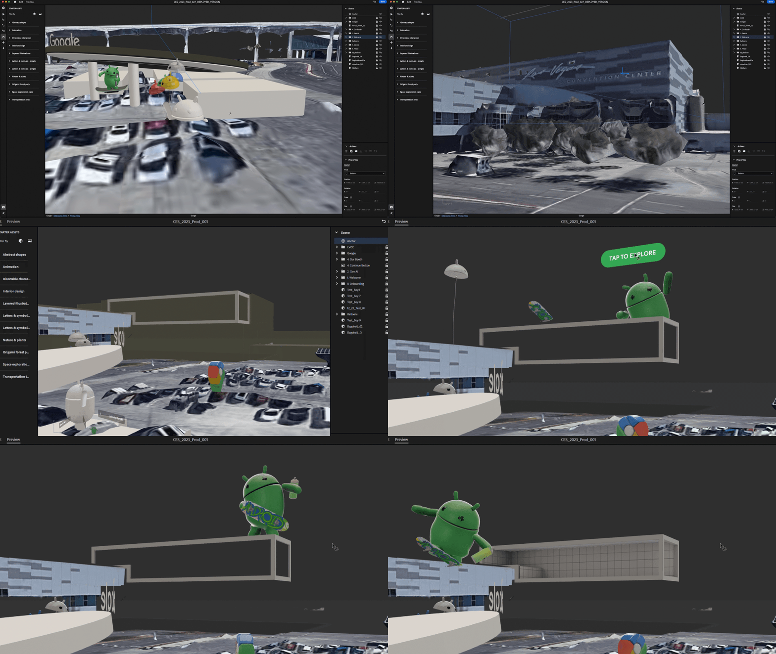
Geospatial Creator in Adobe Aero enables creators and developers to easily visualize where in the real-world they want to place their digital content, similar to how Google Earth visualizes the world. With Geospatial Creator, we were able to bring up Las Vegas Convention Center in Photorealistic 3D Tiles from Google Maps Platform and understand the surroundings of where the Google Booth would be placed. In this case, the booth did not exist in the Photorealistic 3D Tiles because it was a temporary build for the conference. However, by utilizing the 3D model of the booth and the coordinates of where it would be built, we were able to easily estimate and visualize the booth inside of Adobe Aero and build the experience around it seamlessly, including anchoring points for the digital content and the best attendee viewing points for the experience.


"At CES 2024, the Android AR experience, created in partnership with the Google AR, Android, and Adobe teams, brought smiles and excitement to attendees - ultimately that's what it's all about. The experience not only showcased the amazing potential of app-less AR with Geospatial Creator, but also demonstrated its practical applications in enhancing event navigation and engagement, all accessible with a simple QR scan." 
– Yann Caloghiris, Executive Creative Director at Left Field Labs
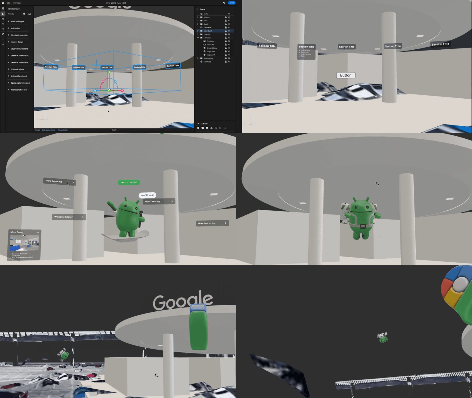
Moving image of developer timelapse
Adobe Aero provided us with an easy way to visualize and anchor the AR experience around the 3D model of the Google Booth at the Las Vegas Convention Center.

With Geospatial Creator, we had multiple advantages for designing the experience:

  • Rapid iteration with live previews of 3D assets and high fidelity visualization of the location with Photorealistic 3D Tiles from Google Maps Platform were crucial for building a location-based, AR experience without having to be there physically. 
  • Easy selection of the Las Vegas Convention Center and robust previews of the environment, as you would navigate in Google Earth, helped us visualize and develop the AR experience with precision and alignment to the real world location.

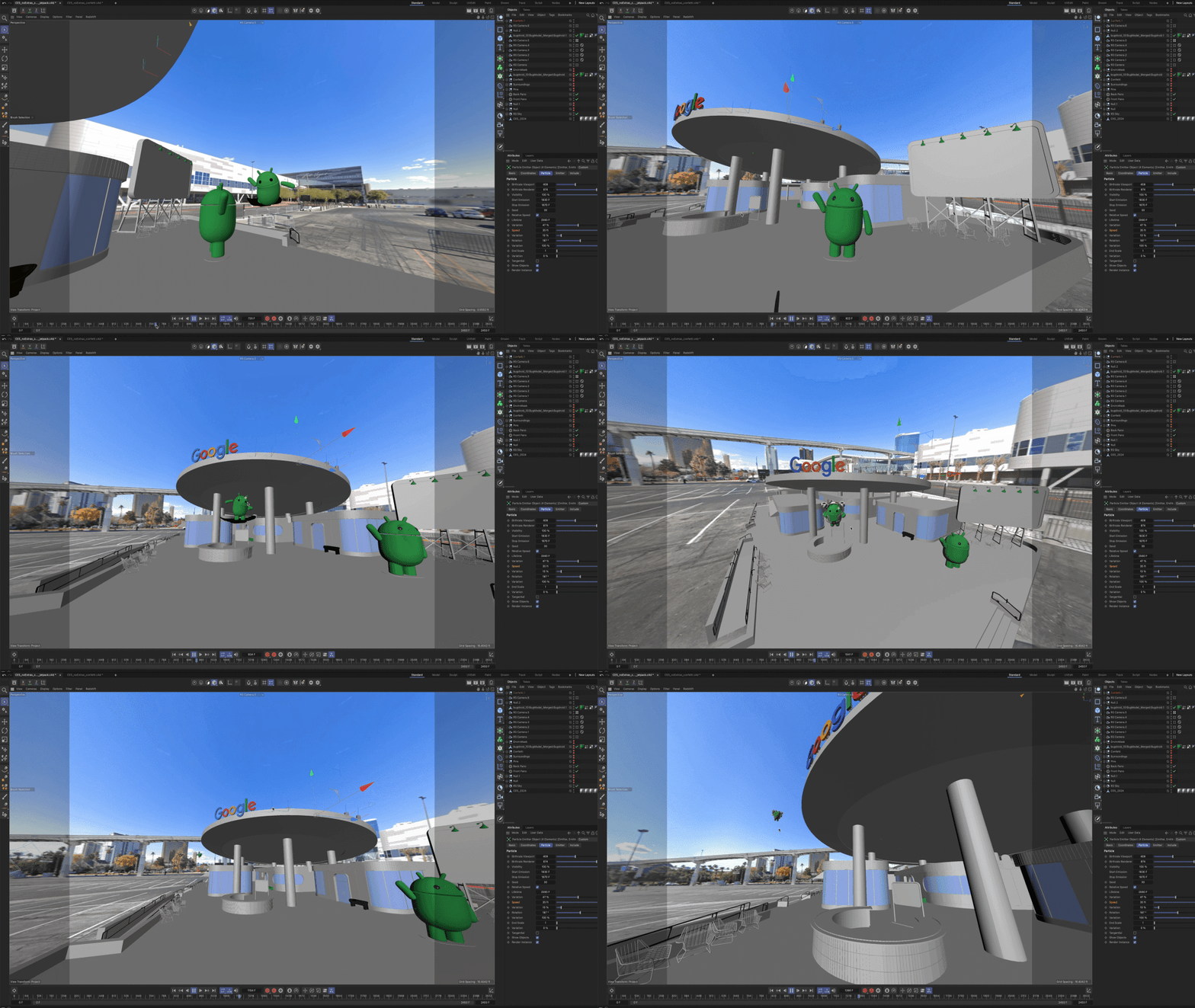
In addition, Google Street View imagery generated a panoramic skybox, which helped visualize the sight lines in Cinema 4D for storyboards. We also imported this and Photorealistic 3D Tiles from Google Maps Platform into Unreal Engine to visualize occlusion models at real world scale.

In Adobe Aero, we did the final assembly of all 3D assets and created all interactive behaviors in the experience. We also used it for animating simpler navigational elements, like the info panel assets in the booth.

AR development was primarily done with Geospatial Creator in Adobe Aero. Supplementary tools, including Unreal Engine and Autodesk Maya, were used to bring the experience to life.

Adobe Aero also supports Google Play Instant apps and App Clips1, which means attendees did not have to download an app to access the experience. They simply scanned a QR code at the booth and launched directly into the experience, which proved to be ideal for onboarding users and reducing friction especially at a busy event like CES.

Unreal Engine was used to bring in the Photorealistic 3D Tiles, allowing them to build the 3D animated Android Bot that really interacted closely with the surrounding environment. This approach was crucial for previews of the experience, allowing us to understand sight lines and where to best locate content for optimal viewing from the Google booth.

Autodesk Maya was used to create the Android Bot character, environmental masks, and additional 3D props for the different scenes in the experience. It was also used for authoring the final materials.

Babylon exporter was used for exporting from Autodesk Maya to glTF format for importing into Adobe Aero.

Figma was used for designing flat user interface elements that could be easily imported into Adobe Aero.

Cinema 4D was used for additional visualization and promotional shots, which helped with stakeholder alignment during the development of the experience.


Designing the experience

During the design phase, we envisioned the AR experience to have multiple interactions, so attendees could experience the delight of seeing precise and robust AR elements blended into the real world around them. In addition, they could experience the helpfulness of contextual information embedded into the real objects around them, providing the right information at the right time.

Image of Creative storyboard
To make the AR experience more engaging for attendees, we created several possibilities for people to interact with their environment (click to enlarge).

Creative storyboarding

Creating an effective storyboard for a Geospatial AR experience using Adobe Aero begins with a clear vision of how the digital overlays interact with the real-world locations.

Left Field Labs started by mapping out key geographical points at the Las Vegas Convention Center location where the Google booth was going to stand, integrating physical and digital elements along the way. Each scene sketched in the storyboard illustrated how virtual objects and real-world environments would interplay, ensuring that user interactions and movements felt natural and intuitive.


“Being able to pin content to a location that’s mapped by Google and use Photorealistic 3D Tiles in Google’s Geospatial Creator provided incredible freedom when choosing how the experience would move around the environment. It gave us the flexibility to create the best flow possible.” 
– Chris Wnuk, Technical Director at Left Field Labs

Early on in the storyboarding process, we decided that the virtual 3D Android Bot would act as the guide. Users could follow the Bot around the venue by turning around in 360°, but staying at the same vantage point. This allowed us to design the interactive experience and each element in it for the right perspective from where the user would be standing, and give them a full look around the Google Booth and surrounding Google experiences, like the Monorail or Sphere.

The storyboard not only depicted the AR elements but also considered user pathways, sightlines, and environmental factors like time of day, occlusion, and overall layout of the AR content around the Booth and surrounding environment.

We aimed to connect the attendees with engaging, helpful, and delightful content, helping them visually navigate Google Booth at CES.

User experience and interactivity

When designing for AR, we have learned that user interactivity and ensuring that the experience has both helpful and delightful elements are key. Across the experience, we added multiple interactions that allowed users to explore different demo stations in the Booth, get navigation via Google Maps for the Monorail and shuttles, and interact with the Android Bot directly.

The Android brand team and Left Field Labs created the Android character to be both simple and expressive, showing playfulness and contextual understanding of the environment to delight users while managing the strain on users’ devices. Taking an agile approach, the team iterated on a wide range of both Android and iOS mobile devices to ensure smooth performance across different smartphones, form factors such as foldables, as well as operating system versions, making the AR experience accessible and enjoyable to the widest audience.

testing content in Adobe Aero
With Geospatial Creator in Adobe Aero, we were able to ensure that 3D content would be accurate to specific locations throughout the development process.

Testing the experience

We consistently iterated on the interactive elements based on location testing. We performed two location tests: First, in the middle of the design phase, which helped us validate the performance of the Visual Positioning Service (VPS) at the Las Vegas Convention Center. Second, at the end of the design phase and a few days before CES, which further validated the placement of the 3D content and enabled us to refine any final adjustments once the Google booth structure was built on site.


“It was really nice to never worry about deploying. The tracking on physical objects and quickness of localization was some of the best I’ve seen!” 
– Devin Thompson, Associate Technical Director at Left Field Labs

Attendee Experience

When attendees came to the Google Booth, they saw a sign with the QR code to enter the AR experience. We positioned the sign at the best vantage point at the booth, ensuring that people had enough space around them to scan with their device and engage in the AR experience.

Sign with QR code to scan for entry at the Google Booth, Las Vegas Convention Center
By scanning a QR code, attendees entered directly into the experience and saw the virtual Android Bot pop up behind the Las Vegas Convention Center, guiding them through the full AR experience.

Attendees enjoyed seeing the Android Bot take over the Las Vegas Convention Center. Upon initializing the AR experience, the Bot revealed a Generative AI wallpaper scene right inside of a 3D view of the building, all while performing skateboarding tricks at the edge of the building’s facade.
Moving image of GenAI Wallpaper scene
With Geospatial Creator, it was possible for us to “replace” the facade of the Las Vegas Convention Center, revealing a playful scene where the Android Bot highlighted the depth and occlusion capabilities of the technology while showcasing a Generative AI Wallpaper demo.

Many people also called out the usefulness of seeing location-based, AR content with contextual information, like navigation through Google Maps, embedded into interesting locations around the Booth. Interactive panels overlaid around the Booth then introduced key physical demos located at each station around the Booth. Attendees could quickly scan the different themes and features demoed, orient themselves around the Booth, and decide which area they wanted to visit first.


“I loved the experience! Maps and AR make so much sense together. I found it super helpful seeing what demos are in each booth, right on top of the booth, as well as the links to navigation. I could see using this beyond CES as well!” 
– CES Attendee
Moving image Booth navigation
The Android Bot helped attendees visually understand the different areas and demos at the Google Booth, helping them decide what they wanted to go see first.

From the attendees we spoke to, over half of them engaged with the full experience. They were able to skip parts of the experience that felt less relevant to them and focus only on the interactions that added value. Overall, we’ve learned that most people liked seeing a mix of delightful and helpful content and they felt excited to explore the Booth further with other demos.
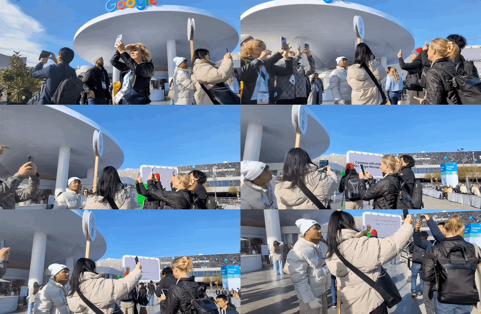
Moving image of people navigating augmented reality at CES
Many attendees engaged with the full AR experience to learn more about the Google Booth at CES.

Photo of Shahram Izadi watching a demonstration of the full Geospatial AR experience at CES.
Shahram Izadi, Google’s VP and GM, AR/XR, watching a demonstration of the full Geospatial AR experience at CES.

Location-based, AR experiences can transform event experiences for attendees who desire more ways to discover and engage with exhibitors at events. This trend underscores a broader shift in consumer expectations for a more immersive and interactive world around them and the blurring lines between online and offline experiences. At events like CES, AR content can offer a more immersive and personalized experience that not only entertains but also educates and connects attendees in meaningful ways.

To hear the latest updates about Google AR, Geospatial Creator, and more follow us on LinkedIn (@GoogleARVR) and X (@GoogleARVR). Plus, visit our ARCore and Geospatial Creator websites to learn how to get started building with Google’s AR technology.


1Available on select devices and may depend on regional availability and user settings.
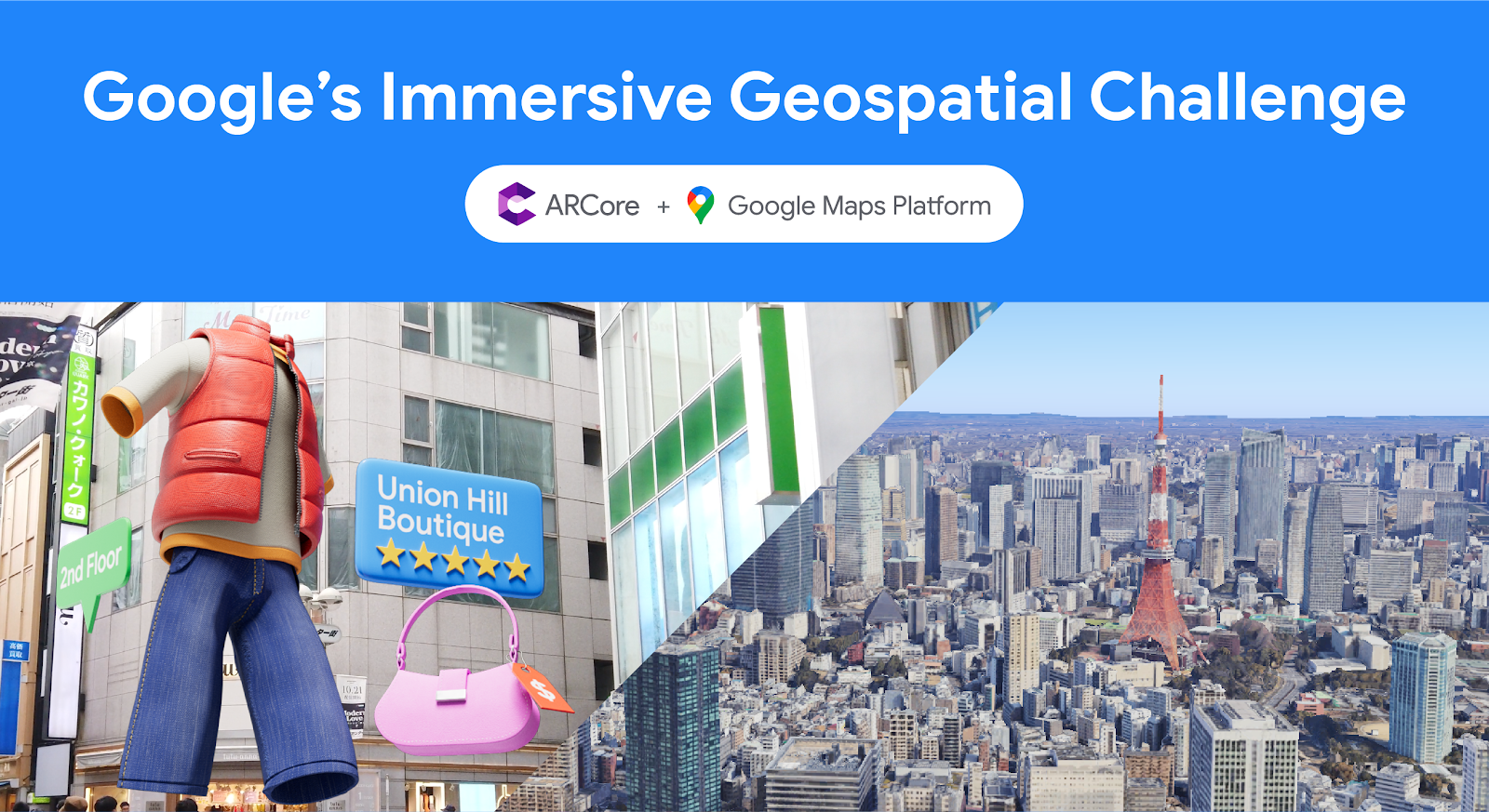
Congratulations to the winners of Google’s Immersive Geospatial Challenge

Posted by Bradford Lee – Product Marketing Manager, Augmented Reality, and Ahsan Ashraf – Product Marketing Manager, Google Maps Platform

In September, we launched Google's Immersive Geospatial Challenge on Devpost where we invited developers and creators from all over the world to create an AR experience with Geospatial Creator or a virtual 3D immersive experience with Photorealistic 3D Tiles.

"We were impressed by the innovation and creativity of the projects submitted. Over 2,700 participants across 100+ countries joined to build something they were truly passionate about and to push the boundaries of what is possible. Congratulations to all the winners!" 

 Shahram Izadi, VP of AR at Google

We judged all submissions on five key criteria:

  • Functionality - How are the APIs used in the application?
  • Purpose - What problem is the application solving?
  • Content - How creative is the application?
  • User Experience - How easy is the application to use?
  • Technical Execution - How well are you showcasing Geospatial Creator and/or Photorealistic 3D Tiles?

Many of the entries are working prototypes, with which our judges thoroughly enjoyed experiencing and interacting. Thank you to everyone who participated in this hackathon.


From our outstanding list of submissions, here are the winners of Google’s Immersive Geospatial Challenge:


Category: Best of Entertainment and Events

Winner, AR Experience: World Ensemble

Description: World Ensemble is an audio-visual app that positions sound objects in 3D, creating an immersive audio-visual experience.


Winner, Virtual 3D Experience: Realistic Event Showcaser

Description: Realistic Event Showcaser is a fully configurable and immersive platform to customize your event experience and showcase its unique location stories and charm.


Winner, Virtual 3D Experience: navigAtoR

Description: navigAtoR is an augmented reality app that is changing the way you navigate through cities by providing a 3 dimensional map of your surroundings.


Category: Best of Commerce

Winner, AR Experience: love ya

Description: love ya showcases three user scenarios for a special time of year that connect local businesses with users.


Category: Best of Travel and Local Discovery

Winner, AR Experience: Sutro Baths AR Tour

Description: This guided tour through the Sutro Baths historical landmark using an illuminated walking path, information panels with text and images, and a 3D rendering of how the Sutro Baths swimming pool complex would appear to those attending.


Winner, Virtual 3D Experience: Hyper Immersive Panorama

Description: Hyper Immersive Panorama uses real time facial detection to allow the user to look left, right, up or down, in the virtual 3D environment.


Winner, Virtual 3D Experience: The World is Flooding!

Description: The World is Flooding! allows you to visualize a 3D, realistic flooding view of your neighborhood.


Category: Best of Productivity and Business

Winner, AR Experience: GeoViz

Description: GeoViz revolutionizes architectural design, allowing users to create, modify, and visualize architectural designs in their intended context. The platform facilitates real-time collaboration, letting multiple users contribute to designs and view them in AR on location.


Category: Best of Sustainability

Winner, AR Experience: Geospatial Solar

Description: Geospatial Solar combines the Google Geospatial API with the Google Solar API for instant analysis of a building's solar potential by simply tapping it.


Winner, Virtual 3D Experience: EarthLink - Geospatial Social Media

Description: EarthLink is the first geospatial social media platform that uses 3D photorealistic tiles to enable users to create and share immersive experiences with their friends.


Honorable Mentions

In addition, we have five projects that earned honorable mentions:

  1. Simmy
  2. FrameView
  3. City Hopper
  4. GEOMAZE - The Urban Quest
  5. Geospatial Route Check

Congratulations to the winners and thank you to all the participants! Check out all the amazing projects submitted. We can't wait to see you at the next hackathon.

VALID: A perceptually validated virtual avatar library for inclusion and diversity

As virtual reality (VR) and augmented reality (AR) technologies continue to grow in popularity, virtual avatars are becoming an increasingly important part of our digital interactions. In particular, virtual avatars are at the center of many social VR and AR interactions, as they are key to representing remote participants and facilitating collaboration.

In the last decade, interdisciplinary scientists have dedicated a significant amount of effort to better understand the use of avatars, and have made many interesting observations, including the capacity of the users to embody their avatar (i.e., the illusion that the avatar body is their own) and the self-avatar follower effect, which creates a binding between the actions of the avatar and the user strong enough that the avatar can actually affect user behavior.

The use of avatars in experiments isn’t just about how users will interact and behave in VR spaces, but also about discovering the limits of human perception and neuroscience. In fact, some VR social experiments often rely on recreating scenarios that can’t be reproduced easily in the real world, such as bar crawls to explore ingroup vs. outgroup effects, or deception experiments, such as the Milgram obedience to authority inside virtual reality. Other studies try to explore deep neuroscientific phenomena, like the human mechanisms for motor control. This perhaps follows the trail of the rubber hand illusion on brain plasticity, where a person can start feeling as if they own a rubber hand while their real hand is hidden behind a curtain. There is also an increased number of possible therapies for psychiatric treatment using personalized avatars. In these cases, VR becomes an ecologically valid tool that allows scientists to explore or treat human behavior and perception.

None of these experiments and therapies could exist without good access to research tools and libraries that can enable easy experimentation. As such, multiple systems and open source tools have been released around avatar creation and animation over recent years. However, existing avatar libraries have not been validated systematically on the diversity spectrum. Societal bias and dynamics also transfer to VR/AR when interacting with avatars, which could lead to incomplete conclusions for studies on human behavior inside VR/AR.

To partially overcome this problem, we partnered with the University of Central Florida to create and release the open-source Virtual Avatar Library for Inclusion and Diversity (VALID). Described in our recent paper, published in Frontiers in Virtual Reality, this library of avatars is readily available for usage in VR/AR experiments and includes 210 avatars of seven different races and ethnicities recognized by the US Census Bureau. The avatars have been perceptually validated and designed to advance diversity and inclusion in virtual avatar research.

Headshots of all 42 base avatars available on the VALID library were created in extensive interaction with members of the 7 ethnic and racial groups from the Federal Register, which include (AIAN, Asian, Black, Hispanic, MENA, NHPI and White).

Creation and validation of the library

Our initial selection of races and ethnicities for the diverse avatar library follows the most recent guidelines of the US Census Bureau that as of 2023 recommended the use of 7 ethnic and racial groups representing a large demographic of the US society, which can also be extrapolated to the global population. These groups include Hispanic or Latino, American Indian or Alaska Native (AIAN), Asian, Black or African American, Native Hawaiian or Other Pacific Islander (NHPI), White, Middle East or North Africa (MENA). We envision the library will continue to evolve to bring even more diversity and representation with future additions of avatars.

The avatars were hand modeled and created using a process that combined average facial features with extensive collaboration with representative stakeholders from each racial group, where their feedback was used to artistically modify the facial mesh of the avatars. Then we conducted an online study with participants from 33 countries to determine whether the race and gender of each avatar in the library are recognizable. In addition to the avatars, we also provide labels statistically validated through observation of users for the race and gender of all 42 base avatars (see below).

Example of the headshots of a Black/African American avatar presented to participants during the validation of the library.

We found that all Asian, Black, and White avatars were universally identified as their modeled race by all participants, while our American Indian or Native Alaskan (AIAN), Hispanic, and Middle Eastern or North African (MENA) avatars were typically only identified by participants of the same race. This also indicates that participant race can improve identification of a virtual avatar of the same race. The paper accompanying the library release highlights how this ingroup familiarity should also be taken into account when studying avatar behavior in VR.

Confusion matrix heatmap of agreement rates for the 42 base avatars separated by other-race participants and same-race participants. One interesting aspect visible in this matrix, is that participants were significantly better at identifying the avatars of their own race than other races.

Dataset details

Our models are available in FBX format, are compatible with previous avatar libraries like the commonly used Rocketbox, and can be easily integrated into most game engines such as Unity and Unreal. Additionally, the avatars come with 69 bones and 65 facial blendshapes to enable researchers and developers to easily create and apply dynamic facial expressions and animations. The avatars were intentionally made to be partially cartoonish to avoid extreme look-a-like scenarios in which a person could be impersonated, but still representative enough to be able to run reliable user studies and social experiments.

Images of the skeleton rigging (bones that allow for animation) and some facial blend shapes included with the VALID avatars.

The avatars can be further combined with variations of casual attires and five professional attires, including medical, military, worker and business. This is an intentional improvement from prior libraries that in some cases reproduced stereotypical gender and racial bias into the avatar attires, and provided very limited diversity to certain professional avatars.

Images of some sample attire included with the VALID avatars.

Get started with VALID

We believe that the Virtual Avatar Library for Inclusion and Diversity (VALID) will be a valuable resource for researchers and developers working on VR/AR applications. We hope it will help to create more inclusive and equitable virtual experiences. To this end, we invite you to explore the avatar library, which we have released under the open source MIT license. You can download the avatars and use them in a variety of settings at no charge.


Acknowledgements

This library of avatars was born out of a collaboration with Tiffany D. Do, Steve Zelenty and Prof. Ryan P McMahan from the University of Central Florida.

Source: Google AI Blog


7 dos and don’ts of using ML on the web with MediaPipe

Posted by Jen Person, Developer Relations Engineer

If you're a web developer looking to bring the power of machine learning (ML) to your web apps, then check out MediaPipe Solutions! With MediaPipe Solutions, you can deploy custom tasks to solve common ML problems in just a few lines of code. View the guides in the docs and try out the web demos on Codepen to see how simple it is to get started. While MediaPipe Solutions handles a lot of the complexity of ML on the web, there are still a few things to keep in mind that go beyond the usual JavaScript best practices. I've compiled them here in this list of seven dos and don'ts. Do read on to get some good tips!


❌ DON'T bundle your model in your app

As a web developer, you're accustomed to making your apps as lightweight as possible to ensure the best user experience. When you have larger items to load, you already know that you want to download them in a thoughtful way that allows the user to interact with the content quickly rather than having to wait for a long download. Strategies like quantization have made ML models smaller and accessible to edge devices, but they're still large enough that you don't want to bundle them in your web app. Store your models in the cloud storage solution of your choice. Then, when you initialize your task, the model and WebAssembly binary will be downloaded and initialized. After the first page load, use local storage or IndexedDB to cache the model and binary so future page loads run even faster. You can see an example of this in this touchless ATM sample app on GitHub.


✅ DO initialize your task early

Task initialization can take a bit of time depending on model size, connection speed, and device type. Therefore, it's a good idea to initialize the solution before user interaction. In the majority of the code samples on Codepen, initialization takes place on page load. Keep in mind that these samples are meant to be as simple as possible so you can understand the code and apply it to your own use case. Initializing your model on page load might not make sense for you. Just focus on finding the right place to spin up the task so that processing is hidden from the user.

After initialization, you should warm up the task by passing a placeholder image through the model. This example shows a function for running a 1x1 pixel canvas through the Pose Landmarker task:

function dummyDetection(poseLandmarker: PoseLandmarker) { const width = 1; const height = 1; const canvas = document.createElement('canvas'); canvas.width = width; canvas.height = height; const ctx = canvas.getContext('2d'); ctx.fillStyle = 'rgba(0, 0, 0, 1)'; ctx.fillRect(0, 0, width, height); poseLandmarker.detect(canvas); }


✅ DO clean up resources

One of my favorite parts of JavaScript is automatic garbage collection. In fact, I can't remember the last time memory management crossed my mind. Hopefully you've cached a little information about memory in your own memory, as you'll need just a bit of it to make the most of your MediaPipe task. MediaPipe Solutions for web uses WebAssembly (WASM) to run C++ code in-browser. You don't need to know C++, but it helps to know that C++ makes you take out your own garbage. If you don't free up unused memory, you will find that your web page uses more and more memory over time. It can have performance issues or even crash.

When you're done with your solution, free up resources using the .close() method.

For example, I can create a gesture recognizer using the following code:

const createGestureRecognizer = async () => { const vision = await FilesetResolver.forVisionTasks( "https://cdn.jsdelivr.net/npm/@mediapipe/[email protected]/wasm" ); gestureRecognizer = await GestureRecognizer.createFromOptions(vision, { baseOptions: { modelAssetPath: "https://storage.googleapis.com/mediapipe-models/gesture_recognizer/gesture_recognizer/float16/1/gesture_recognizer.task", delegate: "GPU" }, }); }; createGestureRecognizer();

Once I'm done recognizing gestures, I dispose of the gesture recognizer using the close() method:

gestureRecognizer.close();

Each task has a close method, so be sure to use it where relevant! Some tasks have close() methods for the returned results, so refer to the API docs for details.


✅ DO try out tasks in MediaPipe Studio

When deciding on or customizing your solution, it's a good idea to try it out in MediaPipe Studio before writing your own code. MediaPipe Studio is a web-based application for evaluating and customizing on-device ML models and pipelines for your applications. The app lets you quickly test MediaPipe solutions in your browser with your own data, and your own customized ML models. Each solution demo also lets you experiment with model settings for the total number of results, minimum confidence threshold for reporting results, and more. You'll find this especially useful when customizing solutions so you can see how your model performs without needing to create a test web page.

Screenshot of Image Classification page in MediaPipe Studio


✅ DO test on different devices

It's always important to test your web apps on various devices and browsers to ensure they work as expected, but I think it's worth adding a reminder here to test early and often on a variety of platforms. You can use MediaPipe Studio to test devices as well so you know right away that a solution will work on your users' devices.


❌ DON'T default to the biggest model

Each task lists one or more recommended models. For example, the Object Detection task lists three different models, each with benefits and drawbacks based on speed, size and accuracy. It can be tempting to think that the most important thing is to choose the model with the very highest accuracy, but if you do so, you will be sacrificing speed and increasing the size of your model. Depending on your use case, your users might benefit from a faster result rather than a more accurate one. The best way to compare model options is in MediaPipe Studio. I realize that this is starting to sound like an advertisement for MediaPipe Studio, but it really does come in handy here!

photo of a whale breeching against a background of clouds in a deep, vibrant blue sky

✅ DO reach out!

Do you have any dos or don'ts of ML on the web that you think I missed? Do you have questions about how to get started? Or do you have a cool project you want to share? Reach out to me on LinkedIn and tell me all about it!

How We Made SPACE INVADERS: World Defense, an AR game powered by ARCore

Posted by Dereck Bridie, Developer Relations Engineer, ARCore and Bradford Lee, Product Marketing Manager, Augmented Reality

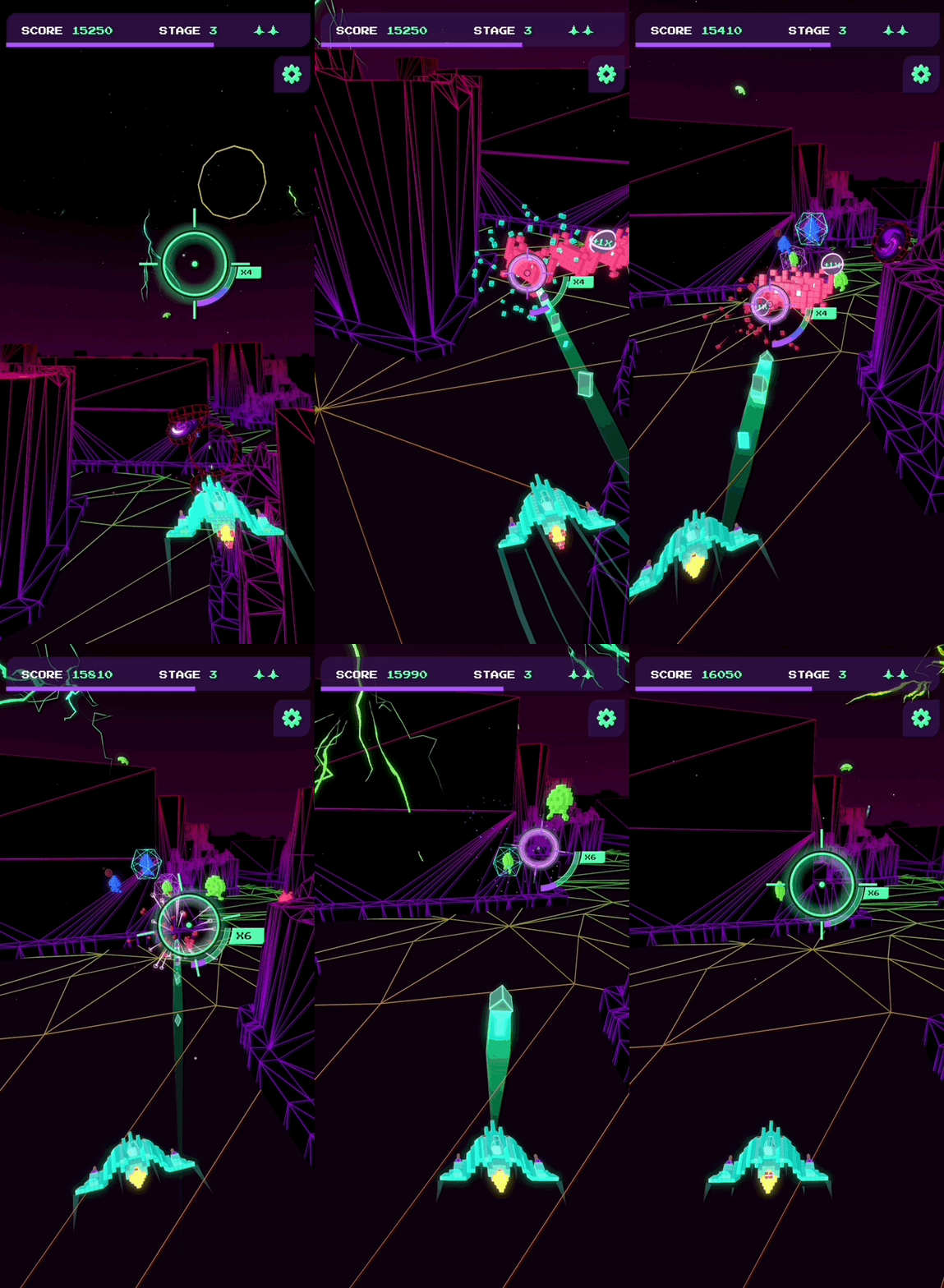
To celebrate the 45th anniversary of “SPACE INVADERS,” we collaborated with TAITO, the Japanese developer of the original arcade game, and UNIT9 to launch “SPACE INVADERS: World Defense,” an immersive game that takes advantage of the most advanced location-based AR technology. Players around the world can go outside to explore their local neighborhoods, defend the Earth from virtual Space Invaders that spawn from nearby structures, and score points by taking them down – all with augmented reality.

The game is powered by our latest ARCore technology - Geospatial API, Streetscape Geometry API, and Geospatial Creator. We’re excited to show you behind the scenes of how the game was developed and how we used our newest features and tools to design the first of its kind procedural, global AR gameplay.

Geospatial API: Turn the world into a playground

Geospatial API enables you to attach content remotely to any area mapped by Google Street View and create richer and more robust immersive experiences linked to real-world locations on a global scale. SPACE INVADERS: World Defense is available in over 100 countries in areas with high Visual Positioning Service (VPS) coverage in Street View, adapting the gameplay to busy urban environments as well as smaller towns and villages.

For players who live in areas without VPS coverage, we have recently updated the game to include our new mode called Indoor Mode, which allows you to defend the Earth from Space Invaders in any setting or location - indoors or outdoors.

Indoor Mode
The new Indoor Mode in Space Invaders brings the immersive gameplay to any indoor building setting

Creating the initial user flow

ARCore Geospatial API uses camera images from the user’s device to scan for feature points and compares those to images from Google Street View in order to precisely position the device in real-world space.

Geospatial API
Geospatial API is based on VPS with tens of billions of images in Street View to enable developers to build world-anchored experiences remotely in over 100 countries

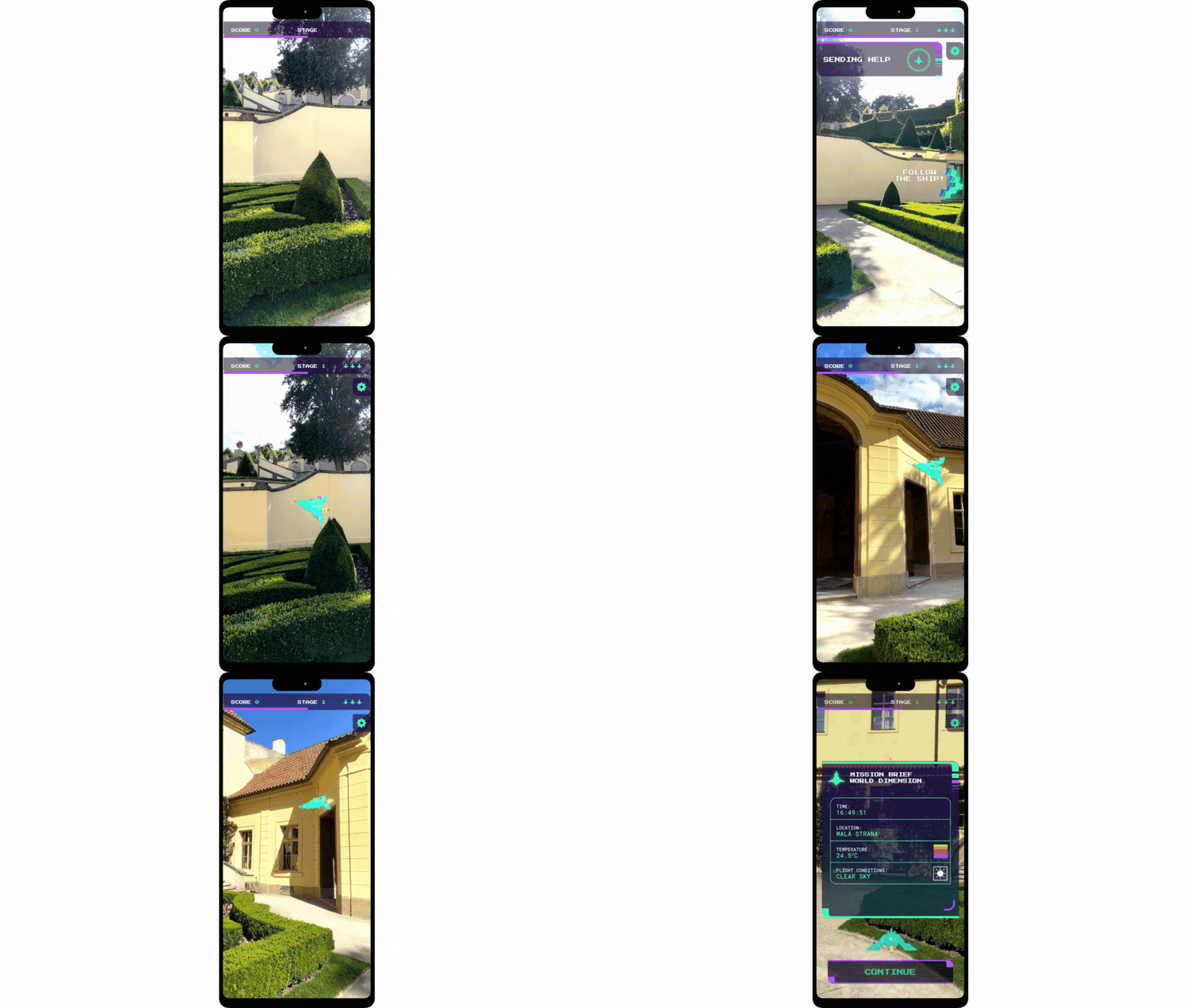
This requires the user to hold up their phone and pan around the area such that enough data is collected to accurately position the user. To do this, we employed a clever technique to get users to scan the area, by requiring them to track the spaceship in the camera’s field of view.

Start of Game spaceship
To get started, follow the spaceship to scan your local surroundings

Using this user flow, we continually check whether the Geospatial API has gathered enough data for a high quality experience:

if (earthManager.EarthTrackingState == TrackingState.Tracking) {         var yawAcc = earthManager.CameraGeospatialPose.OrientationYawAccuracy;         var horiAcc = earthManager.CameraGeospatialPose.HorizontalAccuracy;         bool yawIsAccurate = yawAcc <= 5;         bool horizontalIsAccurate = horiAcc <= 10; return yawIsAccurate && horizontalIsAccurate; }

Transforming the environment into the playground

After scanning the nearby area, the game uses mesh data from the Streetscape Geometry API to algorithmically make playing the game in different locations a unique experience. Every real-world location has its own topography and city layout, affecting the gameplay in its own unique way.

Space Invaders played in diferent locations
Gameplay is varied depending on your location - from towns in Czech Republic (left) to cities in New York (right)

In the game, SPACE INVADERS can spawn from buildings, so we constructed test cases using building geometry obtained from different parts of the world. This ensures that the game would perform optimally in diverse environments from local villages to bustling cities.

Portal Placement
A visualization of how the algorithm would place portals in the real-world

Entering the Invader’s dimension

From our research studies, we learned that it can be tiring for users to keep holding their hands up for a prolonged period of time for an augmented reality experience. This knowledge influenced our gameplay development - we created the Invader’s dimension to give players a chance to relax their phone arm and improve user comfort.

Our favorite ‘wow’ moment that really shows you the power of the Geospatial API is the transition between real-world AR and virtually generated, 3D dimensions.

Transition AR to 3D
Gameplay transition from real-world AR to 3D dimension

This effect is achieved by blending the camera feed with the virtual environment shader that renders the buildings and terrain in the distinct wireframe style.

Portal Transition Editor
The Invader’s dimension appears around the player in the Unity Editor, seamlessly transitioning between the two modes

After the player enters the Invader’s dimension, the player’s spaceship flies through an algorithmically generated path through their local neighborhood. This is done by creating a depth image of the user’s environment from an overhead camera. In this image, the red channel represents buildings and the blue channel represents space that could potentially be used for the flight path. This image is then used to generate a grid with points that the path should follow, and an A* search algorithm is used to solve for a path that follows all the points.

Finally, the generated A-Star path is post-processed to smooth out any potential jittering, sharp turns and collisions.

To smooth out the spaceship’s pathway, the jitter is removed by sampling the path over a set interval of nodes. Then, we determine if there are any sharp turns on a path by analyzing the angles along the path. If a sharp turn is present, we introduce two additional points to round it out. Lastly we see if this smoothed path would collide with any obstacles, and adjust it to fly over them if detected.

Depth Composite on the left and 3D Path on the right
A visualization of the depth map and a generated sample path in the Invader’s dimension

Creating a global gaming experience

A key takeaway from building the game was that the complexity of the contextual generation required worldwide testing. With Unity, we brought multiple environments into test cases, which allowed us to rapidly iterate and validate changes to these algorithms. This gave us confidence to deploy the game globally.

Visualizing SPACE INVADERS using Geospatial Creator

We used Geospatial Creator, powered by ARCore and Photorealistic 3D Tiles from Google Maps Platform, to validate how virtual content, such as Space Invaders, would appear next to specific landmarks within Tokyo in Unity.

Japan 3D Tiles
With Photorealistic 3D Tiles, we were able to visualize Invaders in specific locations, including the Tokyo Tower in Japan

Future updates and releases

Since the game’s launch, we have heard our players’ feedback and have been actively updating and improving the gameplay experience.

  • We have added a new gameplay mode, Indoor Mode, which allows all players without VPS coverage or players who do not want to use AR mode to experience the game.
  • To encourage users to play the game in AR, scores have been rebalanced to reward players who play outside more than players who play indoors.

Download the game on Android or iOS today and join the ranks of an elite Earth defender force to compete in your neighborhood for the highest score. To hear the latest game updates, follow us on Twitter (@GoogleARVR) to hear how we are improving the game. Plus, visit our ARCore and Geospatial Creator websites to learn how to get started building with Google’s AR technology.

Reconstructing indoor spaces with NeRF

When choosing a venue, we often find ourselves with questions like the following: Does this restaurant have the right vibe for a date? Is there good outdoor seating? Are there enough screens to watch the game? While photos and videos may partially answer questions like these, they are no substitute for feeling like you’re there, even when visiting in person isn't an option.

Immersive experiences that are interactive, photorealistic, and multi-dimensional stand to bridge this gap and recreate the feel and vibe of a space, empowering users to naturally and intuitively find the information they need. To help with this, Google Maps launched Immersive View, which uses advances in machine learning (ML) and computer vision to fuse billions of Street View and aerial images to create a rich, digital model of the world. Beyond that, it layers helpful information on top, like the weather, traffic, and how busy a place is. Immersive View provides indoor views of restaurants, cafes, and other venues to give users a virtual up-close look that can help them confidently decide where to go.

Today we describe the work put into delivering these indoor views in Immersive View. We build on neural radiance fields (NeRF), a state-of-the-art approach for fusing photos to produce a realistic, multi-dimensional reconstruction within a neural network. We describe our pipeline for creation of NeRFs, which includes custom photo capture of the space using DSLR cameras, image processing and scene reproduction. We take advantage of Alphabet’s recent advances in the field to design a method matching or outperforming the prior state-of-the-art in visual fidelity. These models are then embedded as interactive 360° videos following curated flight paths, enabling them to be available on smartphones.


The reconstruction of The Seafood Bar in Amsterdam in Immersive View.


From photos to NeRFs

At the core of our work is NeRF, a recently-developed method for 3D reconstruction and novel view synthesis. Given a collection of photos describing a scene, NeRF distills these photos into a neural field, which can then be used to render photos from viewpoints not present in the original collection.

While NeRF largely solves the challenge of reconstruction, a user-facing product based on real-world data brings a wide variety of challenges to the table. For example, reconstruction quality and user experience should remain consistent across venues, from dimly-lit bars to sidewalk cafes to hotel restaurants. At the same time, privacy should be respected and any potentially personally identifiable information should be removed. Importantly, scenes should be captured consistently and efficiently, reliably resulting in high-quality reconstructions while minimizing the effort needed to capture the necessary photographs. Finally, the same natural experience should be available to all mobile users, regardless of the device on hand.


The Immersive View indoor reconstruction pipeline.


Capture & preprocessing

The first step to producing a high-quality NeRF is the careful capture of a scene: a dense collection of photos from which 3D geometry and color can be derived. To obtain the best possible reconstruction quality, every surface should be observed from multiple different directions. The more information a model has about an object’s surface, the better it will be in discovering the object’s shape and the way it interacts with lights.

In addition, NeRF models place further assumptions on the camera and the scene itself. For example, most of the camera’s properties, such as white balance and aperture, are assumed to be fixed throughout the capture. Likewise, the scene itself is assumed to be frozen in time: lighting changes and movement should be avoided. This must be balanced with practical concerns, including the time needed for the capture, available lighting, equipment weight, and privacy. In partnership with professional photographers, we developed a strategy for quickly and reliably capturing venue photos using DSLR cameras within only an hour timeframe. This approach has been used for all of our NeRF reconstructions to date.

Once the capture is uploaded to our system, processing begins. As photos may inadvertently contain sensitive information, we automatically scan and blur personally identifiable content. We then apply a structure-from-motion pipeline to solve for each photo's camera parameters: its position and orientation relative to other photos, along with lens properties like focal length. These parameters associate each pixel with a point and a direction in 3D space and constitute a key signal in the NeRF reconstruction process.


NeRF reconstruction

Unlike many ML models, a new NeRF model is trained from scratch on each captured location. To obtain the best possible reconstruction quality within a target compute budget, we incorporate features from a variety of published works on NeRF developed at Alphabet. Some of these include:

  • We build on mip-NeRF 360, one of the best-performing NeRF models to date. While more computationally intensive than Nvidia's widely-used Instant NGP, we find the mip-NeRF 360 consistently produces fewer artifacts and higher reconstruction quality.
  • We incorporate the low-dimensional generative latent optimization (GLO) vectors introduced in NeRF in the Wild as an auxiliary input to the model’s radiance network. These are learned real-valued latent vectors that embed appearance information for each image. By assigning each image in its own latent vector, the model can capture phenomena such as lighting changes without resorting to cloudy geometry, a common artifact in casual NeRF captures.
  • We also incorporate exposure conditioning as introduced in Block-NeRF. Unlike GLO vectors, which are uninterpretable model parameters, exposure is directly derived from a photo's metadata and fed as an additional input to the model’s radiance network. This offers two major benefits: it opens up the possibility of varying ISO and provides a method for controlling an image’s brightness at inference time. We find both properties invaluable for capturing and reconstructing dimly-lit venues.

We train each NeRF model on TPU or GPU accelerators, which provide different trade-off points. As with all Google products, we continue to search for new ways to improve, from reducing compute requirements to improving reconstruction quality.


A side-by-side comparison of our method and a mip-NeRF 360 baseline.


A scalable user experience

Once a NeRF is trained, we have the ability to produce new photos of a scene from any viewpoint and camera lens we choose. Our goal is to deliver a meaningful and helpful user experience: not only the reconstructions themselves, but guided, interactive tours that give users the freedom to naturally explore spaces from the comfort of their smartphones.

To this end, we designed a controllable 360° video player that emulates flying through an indoor space along a predefined path, allowing the user to freely look around and travel forward or backwards. As the first Google product exploring this new technology, 360° videos were chosen as the format to deliver the generated content for a few reasons.

On the technical side, real-time inference and baked representations are still resource intensive on a per-client basis (either on device or cloud computed), and relying on them would limit the number of users able to access this experience. By using videos, we are able to scale the storage and delivery of videos to all users by taking advantage of the same video management and serving infrastructure used by YouTube. On the operations side, videos give us clearer editorial control over the exploration experience and are easier to inspect for quality in large volumes.

While we had considered capturing the space with a 360° camera directly, using a NeRF to reconstruct and render the space has several advantages. A virtual camera can fly anywhere in space, including over obstacles and through windows, and can use any desired camera lens. The camera path can also be edited post-hoc for smoothness and speed, unlike a live recording. A NeRF capture also does not require the use of specialized camera hardware.

Our 360° videos are rendered by ray casting through each pixel of a virtual, spherical camera and compositing the visible elements of the scene. Each video follows a smooth path defined by a sequence of keyframe photos taken by the photographer during capture. The position of the camera for each picture is computed during structure-from-motion, and the sequence of pictures is smoothly interpolated into a flight path.

To keep speed consistent across different venues, we calibrate the distances for each by capturing pairs of images, each of which is 3 meters apart. By knowing measurements in the space, we scale the generated model, and render all videos at a natural velocity.

The final experience is surfaced to the user within Immersive View: the user can seamlessly fly into restaurants and other indoor venues and discover the space by flying through the photorealistic 360° videos.


Open research questions

We believe that this feature is the first step of many in a journey towards universally accessible, AI-powered, immersive experiences. From a NeRF research perspective, more questions remain open. Some of these include:

  1. Enhancing reconstructions with scene segmentation, adding semantic information to the scenes that could make scenes, for example, searchable and easier to navigate.
  2. Adapting NeRF to outdoor photo collections, in addition to indoor. In doing so, we'd unlock similar experiences to every corner of the world and change how users could experience the outdoor world.
  3. Enabling real-time, interactive 3D exploration through neural-rendering on-device.


Reconstruction of an outdoor scene with a NeRF model trained on Street View panoramas.

As we continue to grow, we look forward to engaging with and contributing to the community to build the next generation of immersive experiences.


Acknowledgments

This work is a collaboration across multiple teams at Google. Contributors to the project include Jon Barron, Julius Beres, Daniel Duckworth, Roman Dudko, Magdalena Filak, Mike Harm, Peter Hedman, Claudio Martella, Ben Mildenhall, Cardin Moffett, Etienne Pot, Konstantinos Rematas, Yves Sallat, Marcos Seefelder, Lilyana Sirakovat, Sven Tresp and Peter Zhizhin.

Also, we’d like to extend our thanks to Luke Barrington, Daniel Filip, Tom Funkhouser, Charles Goran, Pramod Gupta, Mario Lučić, Isalo Montacute and Dan Thomasset for valuable feedback and suggestions.

Source: Google AI Blog


Create world-scale augmented reality experiences in minutes with Google’s Geospatial Creator

Posted by Stevan Silva, Senior Product Manager

ARCore, our augmented reality developer platform, provides developers and creators alike with simple yet powerful tools to build world-scale and room-scale immersive experiences on 1.4 billion Android devices.

Since last year, we have extended coverage of the ARCore Geospatial API from 87 countries to over 100 countries provided by Google’s Visual Positioning System and the expansion of Street View coverage, helping developers build and publish more transformative and robust location-based, immersive experiences. We continue to push the boundaries of introducing helpful applications and delightful new world-scale use cases, whether it's the innovative hackathon submissions from the ARCore Geospatial API Challenge or our partnership with Gorillaz, where we transformed Times Square and Piccadilly Circus into a music stage to witness Gorillaz play in a larger-than-life immersive performance.

One thing we’ve consistently heard from you over the past year is to broaden access to these powerful resources and ensure anyone can create, visualize, and deploy augmented reality experiences around the world.

Introducing Geospatial Creator


Today, we are launching Geospatial Creator, a tool that helps anyone easily visualize, design, and publish world-anchored immersive content in minutes straight from platforms you already know and love — Unity or Adobe Aero.

Easily visualize, create, and publish augmented reality experiences with Geospatial Creator in Unity (left) and Adobe Aero (right)

Geospatial Creator, powered by ARCore and Photorealistic 3D Tiles from Google Maps Platform, enables developers and creators to easily visualize where in the real-world they want to place their digital content, similar to how Google Earth or Google Street View visualize the world. Geospatial Creator also includes new capabilities, such as Rooftop anchors, to make it even easier to anchor virtual content with the 3D Tiles, saving developers and creators time and effort in the creation process.

These tools help you build world-anchored, cross-platform experiences on supported devices on both Android and iOS. Immersive experiences built in Adobe Aero can be shared via a simple QR code scan or link with no full app download required. Everything you create in Geospatial Creator can be experienced in the physical world through real time localization and real world augmentation.


With Geospatial Creator, developers and creators can now build on top of Photorealistic 3D Tiles from Google Maps Platform (left) which provide real time localization and real time augmentation (right)

When the physical world is augmented with digital content, it redefines the way people play, shop, learn, create, shop and get information. To give you an idea of what you can achieve with these tools, we’ve been working with partners in gaming, retail, and local discovery including Gap, Mattel, Global Street Art, Singapore Tourism Board, Gensler, TAITO, and more to build real world use cases.

SPACE INVADERS: World Defense immersive game turns the world into a playground

Later this summer you’ll be able to play one of the most acclaimed arcade games in real life, in the real world. To celebrate the 45 year anniversary of the original release, TAITO will launch SPACE INVADERS: World Defense. The game, powered by ARCore and Geospatial Creator, is inspired by the original gameplay where players will have to defend the Earth from SPACE INVADERS in their neighborhood. It will combine AR and 3D gameplay to deliver a fully contextual and highly engaging immersive experience that connects multi-generations of players.


Gap and Mattel transform a storefront into an interactive immersive experience

Gap and Mattel will transform the iconic Times Square Gap Store into an interactive Gap x Barbie experience powered by Geospatial Creator in Adobe Aero. Starting May 23, customers will see the store come to life with colors and shapes and be able to interact with Barbie and her friends modeling the new limited edition Gap x Barbie collection of clothing.

moving image of Gap by Mattel

Global Street Art brings street art to a new dimension with AR murals

Google Arts & Culture partnered with Global Street Art and three world-renowned artists to augment physical murals in London (Camille Walala), Mexico City (Edgar Saner), and Los Angeles (Tristan Eaton). The artists used Geospatial Creator in Adobe Aero to create the virtual experience, augmenting physical murals digitally in AR and bringing to life a deeper and richer story about the art pieces.


Singapore Tourism Board creates an immersive guided tour to explore Singapore

Google Partner Innovation team partnered with Singapore Tourism Board to launch a preview of an immersive Singapore guided tour in their VisitSingapore app. Merli, Singapore's tourism mascot, leads visitors on an interactive augmented tour of the city’s iconic landmarks and hidden gems, beginning with the iconic Merlion Park and engaging visitors with an AR symphony performance at Victoria Theatre and Concert Hall. The full guided tour is launching later this summer, and will help visitors discover the best local hawker food, uncover the city's history through scenes from the past, and more.


Gensler helps communities visualize new urban projects

Gensler used Geospatial Creator in Adobe Aero to help communities easily envision what new city projects might look like for the unhoused. The immersive designs of housing projects allows everyone to better visualize the proposed urban changes and their social impact—ultimately bringing suitable shelter to those who need it.

moving image of city projects from Gensler

Geospatial Creator gives anyone the superpower of creating world scale AR experience remotely. Both developers and creators can build and publish immersive experiences in minutes in countries where Photorealistic 3D Tiles are available. In just a few clicks, you can create applications that help communities, delight your users, and provide solutions to businesses. Get started today at goo.gle/geospatialcreator. We’re excited to see what you create when the world is your canvas, playground, gallery, or more!

Unlock new use cases and increase developer velocity with the latest ARCore updates

Posted by Ian Zhang, Product Manager, AR & Zeina Oweis, Product Manager, AR

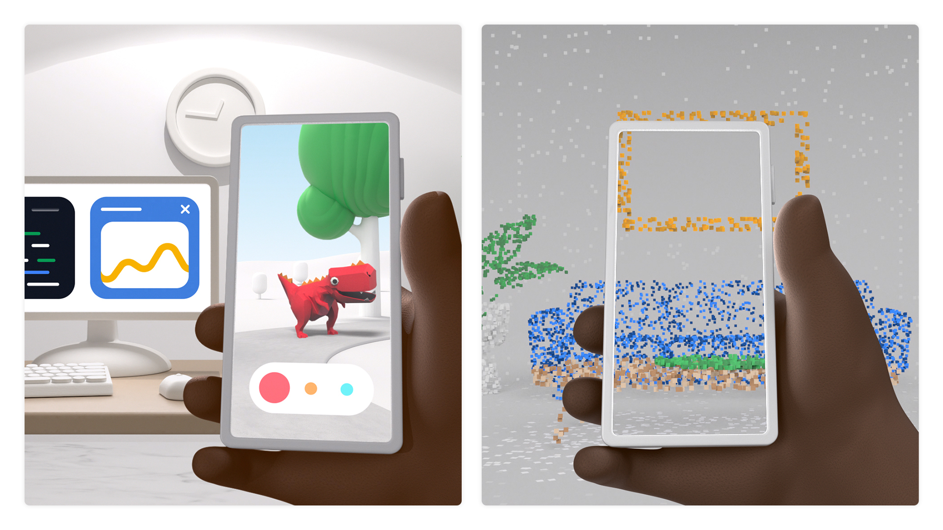
Two phones showing animated screens

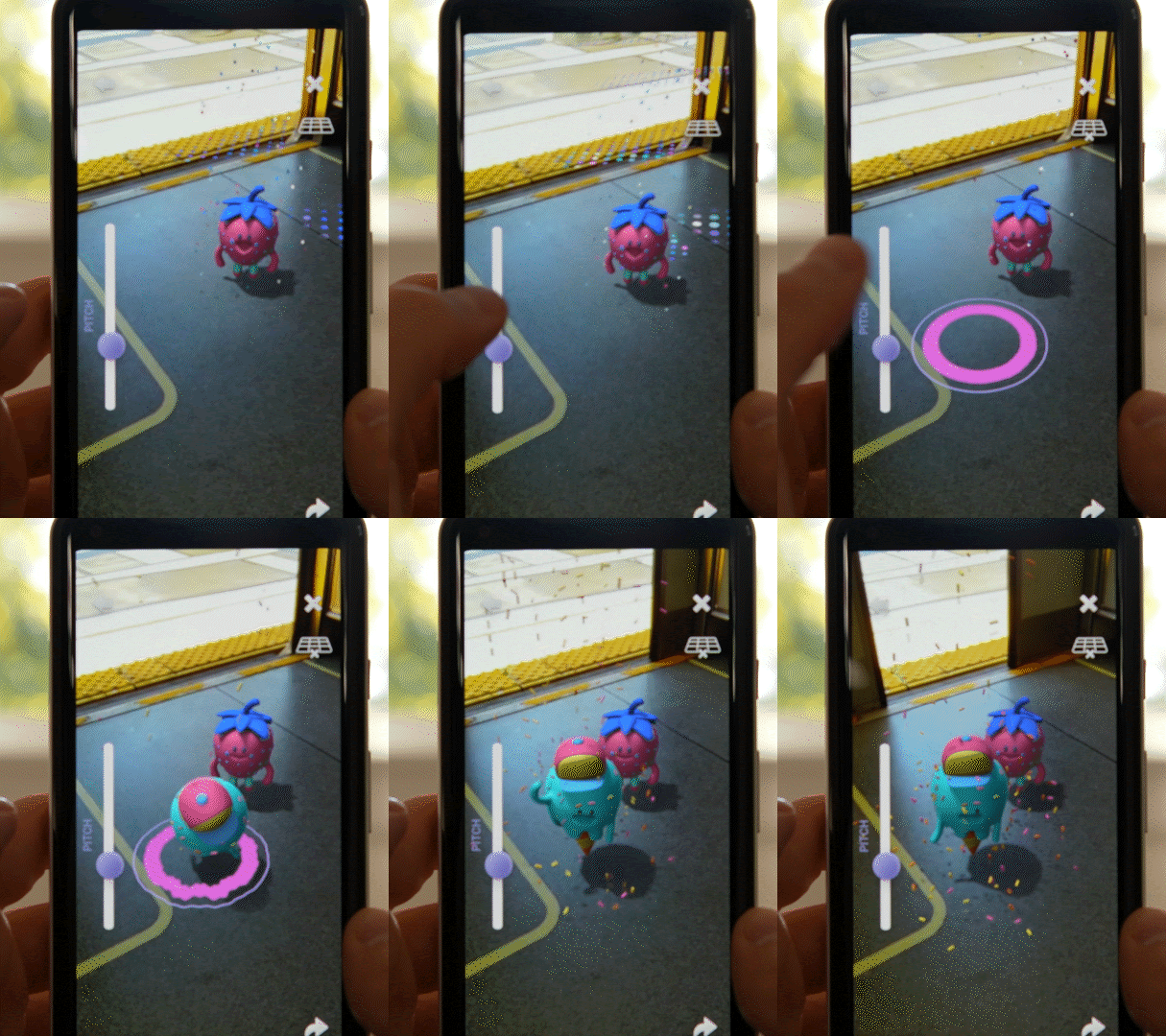
ARCore was created to provide developers with simple yet powerful tools to seamlessly blend the digital and physical worlds. Over the last few years, we’ve seen developers create apps that entertain, engage, and help people in different ways–from letting fans interact with their favorite characters, to placing virtual electronics and furniture for the perfect home setup and beyond.

At I/O this year, we continue on the mission of improving and building AR developer tools. With the launch of ARCore 1.24, we’re introducing the Raw Depth API and the Recording and Playback API. These new APIs will enable developers to create new types of AR experiences and speed up their development cycles.

Increase AR realism and precision with depth

When we launched the Depth API last year, hundreds of millions of Android devices gained the ability to generate depth maps in real time without needing specialized depth sensors. Data in these depth maps was smoothed, filling in any gaps that would otherwise occur due to missing visual information, making it easy for developers to create depth effects like occlusion.

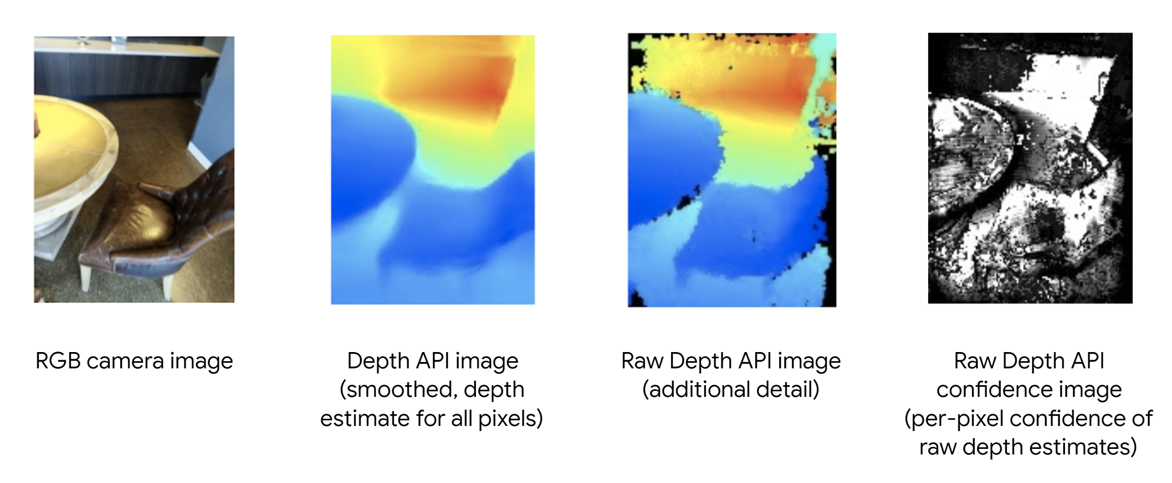
The new ARCore Raw Depth API provides more detailed representations of the geometry of objects in the scene by generating “raw” depth maps with corresponding confidence images. These raw depth maps include unsmoothed data points, and the confidence images provide the confidence of the depth estimate for each pixel in the raw depth map.

4 examples of ARCore Raw Depth API

Improved geometry from the Raw Depth API enables more accurate depth measurements and spatial awareness. In the ARConnect app, these more accurate measurements give users a deeper understanding of their physical surroundings. The AR Doodads app utilizes raw depth’s spatial awareness to allow users to build realistic virtual Rube Goldberg machines.

ARConnect by PHORIA (left) and AR Doodads by Jam3 (right) use the improved geometry from the Raw Depth AP

ARConnect by PHORIA (left) and AR Doodads by Jam3 (right) use the improved geometry from the Raw Depth API

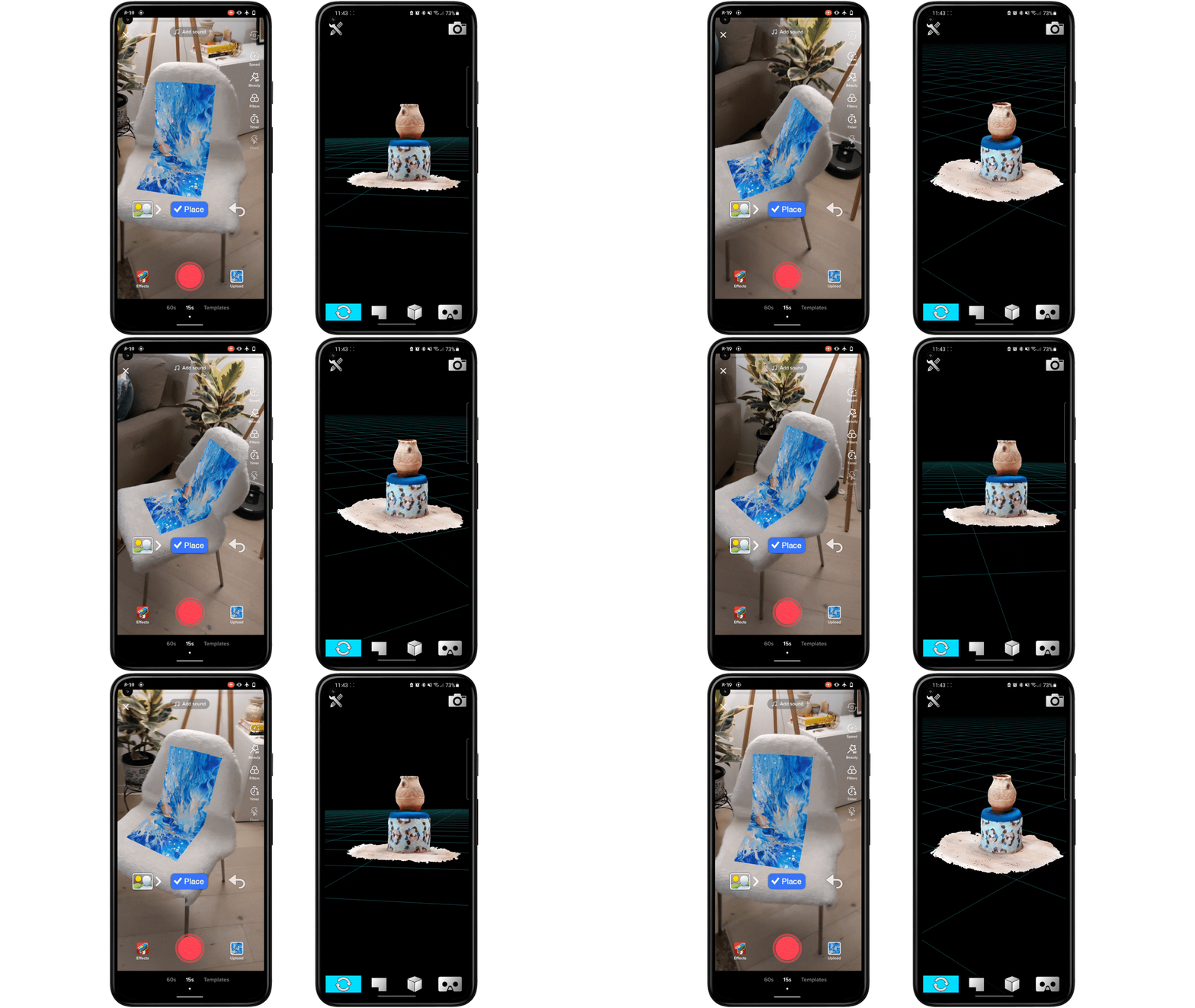
The confidence image in the Raw Depth API allows developers to filter depth data in real time. For example, TikTok’s newest effect enables users to upload an image and wrap it onto real world objects. The image conforms to surfaces where there is high confidence in the underlying depth estimate. The ability for developers to filter for high confidence depth data is also essential for 3D object and scene reconstruction. This can be seen in the 3D Live Scanner app, which enables users to scan their space and create, edit, and share 3D models.

TikTok by TikTok Pte. Ltd. (left) and  3D Live Scanner by Lubos Vonasek Programmierung (right) use confidence images from the ARCore Raw Depth API

TikTok by TikTok Pte. Ltd. (left) and 3D Live Scanner by Lubos Vonasek Programmierung (right) use confidence images from the ARCore Raw Depth API

We’re also introducing a new type of hit-test that uses the geometry from the depth map to provide more hit-test results, even in low-texture and non-planar areas. Previously, hit-test worked best on surfaces with lots of visual features.

Hit Results with Planes (left)

Works best on horizontal, planar surfaces with 

good texture

Hit Results with Depth (right)

Gives more results, even on non-planar or
low-texture areas

The lifeAR app uses this improved hit-test to bring AR to video calls. Users see accurate virtual annotations on the real-world objects as they tap into the expertise of their social circle for instant help to tackle everyday problems.

lifeAR by TeamViewer uses the improved depth hit-test

As with the previous Depth API, these updates leverage depth from motion, making them available on hundreds of millions of Android devices without relying on specialized sensors. Although depth sensors such as time-of-flight (ToF) sensors are not required, having them will further improve the quality of your experiences.

In addition to these apps, the ARCore Depth Lab has been updated with examples of both the Raw Depth API and the depth hit-test. You can find those and more on the Depth API documentation page and start building with Android and Unity today.

Increase developer velocity and post-capture AR

A recurring pain point for AR developers is the need to continually test in specific places and scenarios. Developers may not always have access to the location, lighting will change, and sensors won’t catch the exact same information during every live camera session.

The new ARCore Recording and Playback API addresses this by enabling developers to record not just video footage, but also IMU and depth sensor data. On playback, this same data can be accessed, enabling developers to duplicate the exact same scenario and test the experience from the comfort of their workspace.

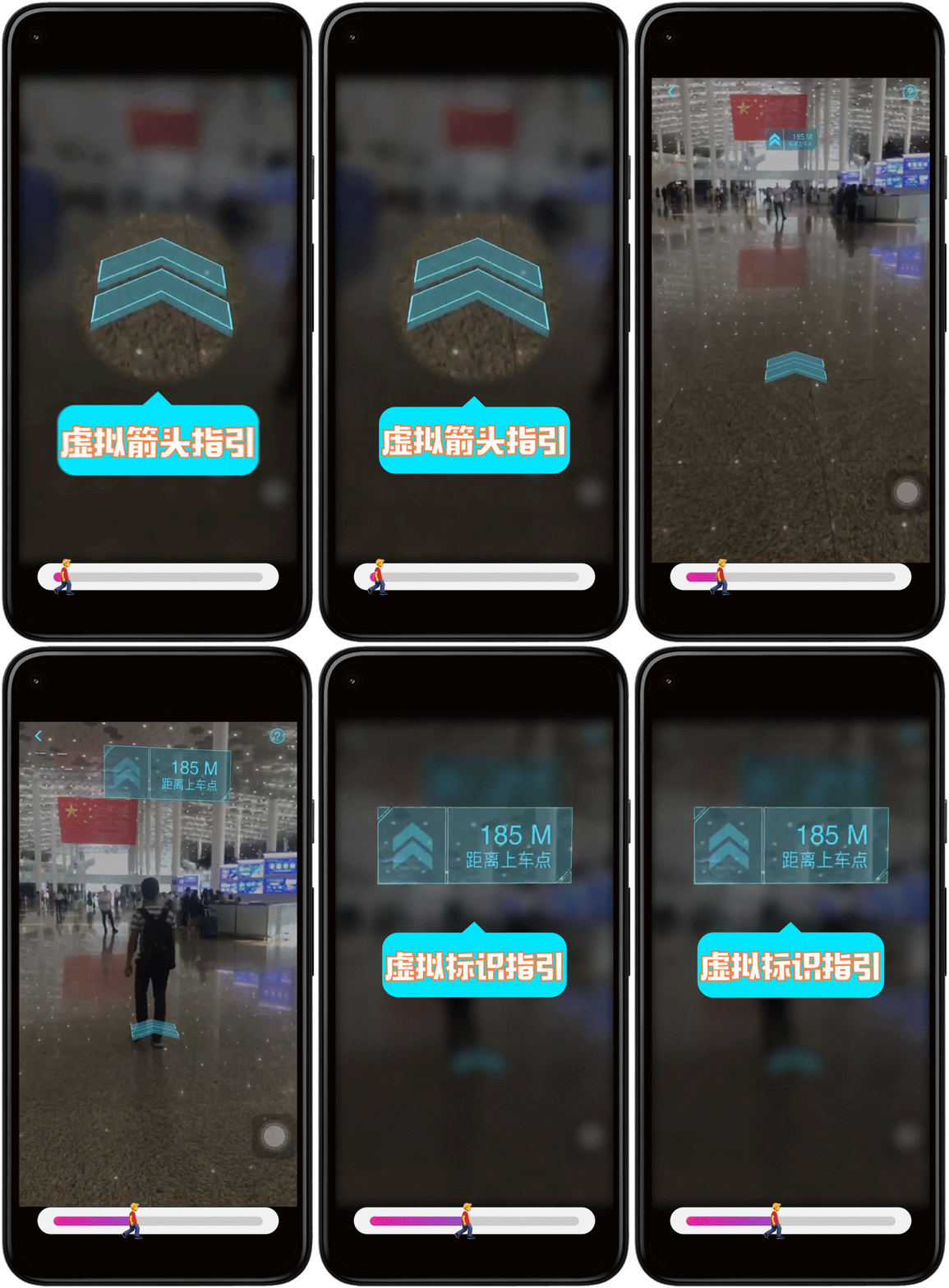
DiDi used the Recording and Playback API to build and test AR directions in their DiDi-Rider app. They were able to save 25% on R&D and testing costs, 60% on travel costs, and accelerated their development cycle by 6 months.

DiDi-Rider by Didi Chuxing saves on development resources with the Recording and Playback API

DiDi-Rider by Didi Chuxing saves on development resources with the Recording and Playback API

In addition to increasing developer velocity, recording and playback unlocks opportunities for new AR experiences, such as post-capture AR. Using videos enables asynchronous AR experiences that remove time and place constraints. For instance, when visualizing AR furniture, users no longer have to be in their home. They can instead pull up a video of their home and accurately place AR assets, enabling them to “take AR anywhere”.

Jump AR by SK Telecom uses the Recording and Playback API to transport scenes from South Korea right into users’ homes to augment with culturally relevant volumetric and 3D AR content.

JumpAR by SKT uses Recording and Playback to bring SouthKorea to your home

JumpAR by SKT uses Recording and Playback to bring SouthKorea to your home

VoxPlop! by Nexus Studios is experimenting with the notion of Spatial Video co-creation, where users can reach in and interact with a recorded space rather than simply placing content on top of a video. The Recording and Playback API enables users to record videos, drop in 3D characters and messages, and share them with family and friends.

VoxPlop! by Nexus Studios uses the Recording and Playback API to experiment with Spatial Video co-creation

VoxPlop! by Nexus Studios uses the Recording and Playback API to experiment with Spatial Video co-creation

Learn more and get started with the Recording and Playback API docs.

Get started with ARCore today

These latest ARCore updates round out a robust set of powerful developer tools for creating engaging and realistic AR experiences. With over a billion lifetime installs and 850 million compatible devices, ARCore makes augmented reality accessible to nearly everyone with a smartphone. We're looking forward to seeing how you innovate and reach more users with ARCore. To learn more and get started with the new APIs, visit the ARCore developer website.

Passionate former DSC lead Irene inspires others to learn Google technologies with her new podcast and more

Posted by Erica Hanson, Global Program Manager, Google Developer Student Clubs

(Irene (left) and her DSC team from the Polytechnic University of Cartagena (photo prior to COVID-19)

Irene Ruiz Pozo is a former Google Developer Student Club (DSC) Lead at the Polytechnic University of Cartagena in Murcia, Spain. As one of the founding members, Irene has seen the club grow from just a few student developers at her university to hosting multiple learning events across Spain. Recently, we spoke with Irene to understand more about the unique ways in which her team helped local university students learn more about Google technologies.

Real world ML and AR learning opportunities

Irene mentioned two fascinating projects that she had the chance to work on through her DSC at the Polytechnic University of Cartagena. The first was a learning lab that helped students understand how to use 360º cameras and 3D scanners for machine learning.

(A DSC member giving a demo of a 360º camera to students at the National Museum of Underwater Archeology in Cartagena)

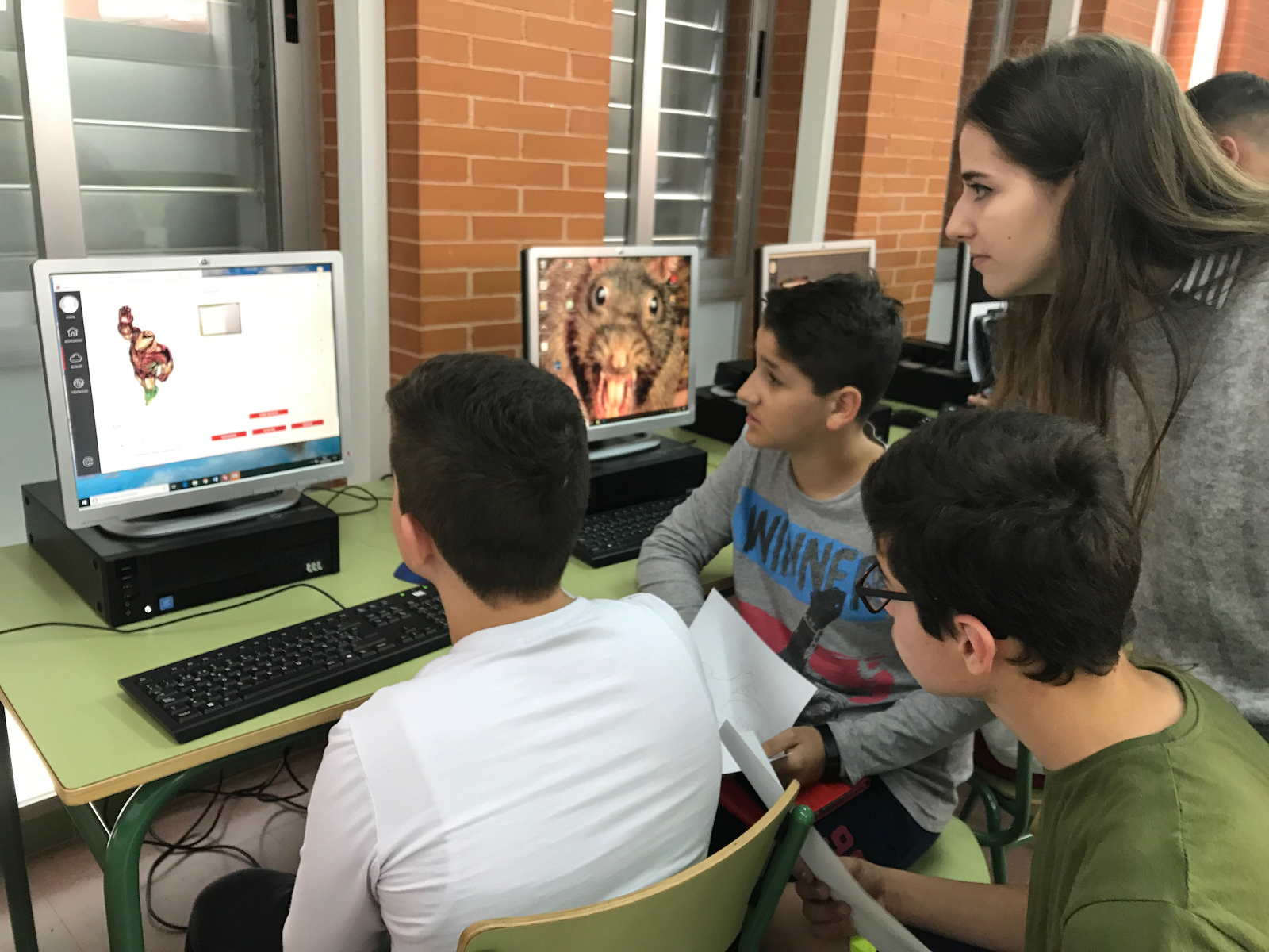
The second was a partnership with the National Museum of Underwater Archeology, where Irene and her team created an augmented reality game that let students explore a digital rendition of the museum’s exhibitions.

(An image from the augmented reality game created for the National Museum of Underwater Archeology)

In the above AR experience created by Irene’s team, users can create their own character and move throughout the museum and explore different virtual renditions of exhibits in a video game-like setting.

Hash Code competition and experiencing the Google work culture

One particularly memorable experience for Irene and her DSC was participating in Google’s annual programming competition, Hash Code. As Irene explained, the event allowed developers to share their skills and connect in small teams of two to four programmers. They would then come together to tackle engineering problems like how to best design the layout of a Google data center, create the perfect video streaming experience on YouTube, or establish the best practices for compiling code at Google scale.

(Students working on the Hash Code competition (photo taken prior to COVID-19)

To Irene, the experience felt like a live look at being a software engineer at Google. The event taught her and her DSC team that while programming skills are important, communication and collaboration skills are what really help solve problems. For Irene, the experience truly bridged the gap between theory and practice.

Expanding knowledge with a podcast for student developers

(Irene’s team working with other student developers (photo taken before COVID-19)

After the event, Irene felt that if a true mentorship network was established among other DSCs in Europe, students would feel more comfortable partnering with one another to talk about common problems they faced. Inspired, she began to build out her mentorship program which included a podcast where student developers could collaborate on projects together.

The podcast, which just released its second episode, also highlights upcoming opportunities for students. In the most recent episode, Irene and friends dive into how to apply for Google Summer of Code Scholarships and talk about other upcoming open source project opportunities. Organizing these types of learning experiences for the community was one of the most fulfilling parts of working as a DSC Lead, according to Irene. She explained that the podcast has been an exciting space that allows her and other students to get more experience presenting ideas to an audience. Through this podcast, Irene has already seen many new DSC members eager to join the conversation and collaborate on new ideas.

As Irene now looks out on her future, she is excited for all the learning and career development that awaits her from the entire Google Developer community. Having graduated from university, Irene is now a Google Developer Groups (GDG) Lead - a program similar to DSC, but created for the professional developer community. In this role, she is excited to learn new skills and make professional connections that will help her start her career.

Are you also a student with a passion for code? Then join a local Google Developer Student Club near you, here.

Improving shared AR experiences with Cloud Anchors in ARCore 1.20

Posted by Eric Lai, Product Manager, Augmented Reality

Augmented reality (AR) can help you explore the world around you in new, seemingly magical ways. Whether you want to venture through the Earth’s unique habitats, explore historic cultures or even just find the shortest path to your destination, there’s no shortage of ways that AR can help you interact with the world.

That’s why we’re constantly improving ARCore — so developers can build amazing AR experiences that help us reimagine what’s possible.

In 2018, we introduced the Cloud Anchors API in ARCore, which lets people across devices view and share the same AR content in real-world spaces. Since then, we’ve been working on new ways for developers to use Cloud Anchors to make AR content persist and more easily discoverable.

Create long-lasting AR experiences

Last year, we previewed persistent Cloud Anchors, which lets people return to shared AR experiences again and again. With ARCore 1.20, this feature is now widely available to Android, iOS, and Unity mobile developers.

Developers all over the world are already using this technology to help people learn, share and engage with the world around them in new ways.

MARK, which we highlighted last year, is a social platform that lets people leave AR messages in real-world locations for friends, family and their community to discover. MARK is now available globally and will be launching the MARK Hope Campaign in the US to help people raise funds for their favorite charities and have their donations matched for a limited time.

AR photo

MARK by People Sharing Streetart Together Limited

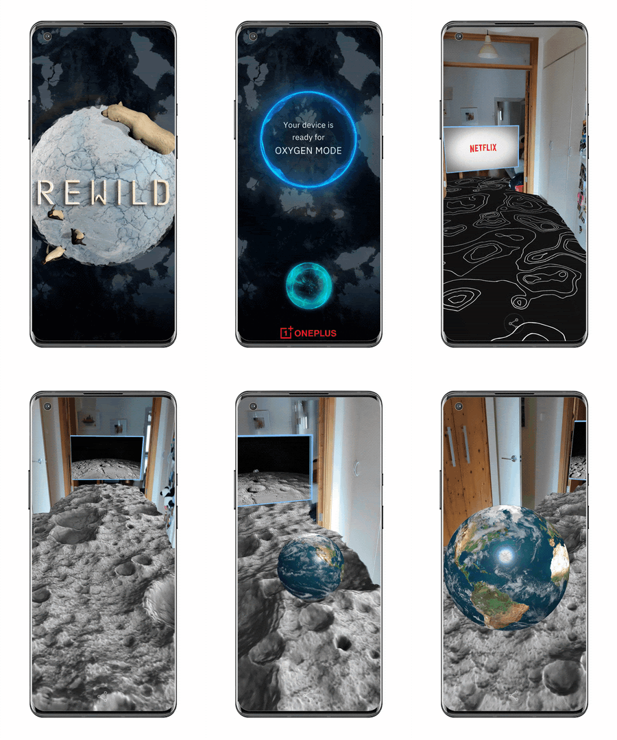
REWILD Our Planet is an AR nature series produced by Melbourne based studio PHORIA. The experience is based on the Netflix original documentary series Our Planet. REWILD uses Ultra High Definition Video alongside AR content to let you venture into earth’s unique habitats and interact with endangered wildlife. It originally launched in museums, but can now be enjoyed on your smartphone in your living room. As episodes of the show are released, persistent Cloud Anchors allow you to return to the same spot in your own home to see how nature is changing.

AR image

REWILD Our Planet by PHORIA

Changdeok ARirang is an AR tour guide app that combines the power of SK Telecom’s 5G with persistent Cloud Anchors. Visitors at Changdeokgung Palace in South Korea are guided by the legendary Haechi to relevant locations where they can experience historical and cultural high fidelity AR content. Changdeok ARirang at Home was also launched so that this same experience can be accessed from the comfort of your couch.

AR image

Changdeok ARirang by SK Telecom

In Sweden, SJ Labs, the innovation arm of Swedish Railways, together with Bontouch, their tech innovation partner, uses persistent Cloud Anchors to help passengers find their way at Central Station in Stockholm, making it easier and faster for them to make their train departures.

AR image

SJ Labs by SJ – Swedish Railways

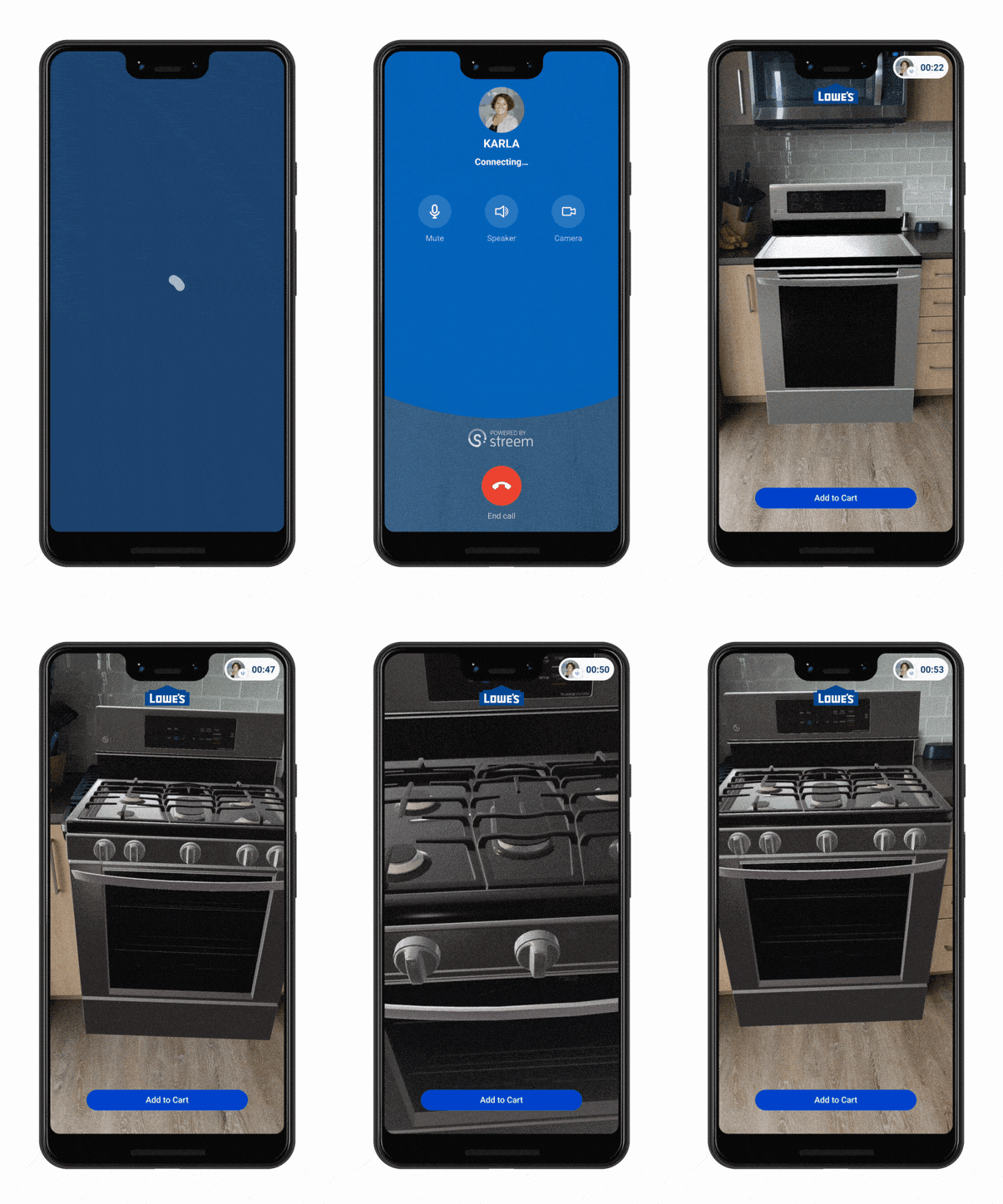
Coming soon, Lowe’s Persistent View will let you design your home in AR with the help of an expert. You’ll be able to add furniture and appliances to different areas of your home to see how they’d look, and return to the experience as many times as needed before making a purchase.

AR example

Lowe’s Persistent View powered by Streem

If you’re interested in building AR experiences that last over time, you can learn more about persistent Cloud Anchors in our docs.

Call for collaborators: test a new way to find AR content

As developers use Cloud Anchors to attach more AR experiences to the world, we also want to make it easier for people to discover them. That’s why we’re working on earth Cloud Anchors, a new feature that uses AR and global localization—the underlying technology that powers Live View features on Google Maps—to easily guide users to AR content. If you’re interested in early access to test this feature, you can apply here.

Some earth Cloud Anchors concepts