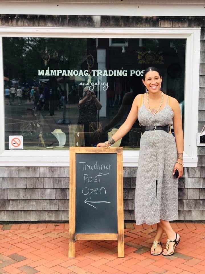
Danielle Greendeer is the owner of Wampanoag Trading Post and Gallery in Massachusetts, which sells handmade Eastern Woodland art made by Indigenous artists. She is also a member of the Mashpee Wampanoag Nation. The Wampanoag are associated with what became known as the “first Thanksgiving.”
“The year 2020 marks the 400th year since the arrival of the Mayflower and the introduction of the Pilgrims to the Wampanoag Nation,” she told our team at Google.org earlier this month. “For the Mashpee Wampanoag people, it is important to tell the history from our perspective and educate the public on the challenges that our Tribe is still trying to overcome. The survival and evolution of our art is an example of how resilient our culture is.”
November is also Native American Heritage Month. As an Indigenous person, I see this moment as a reminder for society to reflect on, honor and celebrate the resilience of the people who are the first inhabitants of the United States.
The COVID-19 pandemic has hit these communities especially hard, both in terms of health and economic stability. Earlier this year, we awarded $1 million in loans to Citizen Potawatomi Community Development Center through Grow with Google, and $250,000 in Google.org grants to the National Congress of American Indians (NCAI), to provide immediate relief to small businesses owned by Native Americans/American Indians. We’re also working with NCAI to offer Grow with Google training for small businesses and job seekers in Native American communities. This embedded digital training program will train more than 5,000 Native businesses owners to better leverage their online presence by April 2021.
Danielle’s business received financial support from Google.org and NCAI, which helped her hire temporary part-time workers, support six more Indigenous artisans and schedule workshops and screenings of Native films. For Native American Heritage Month, they have opened an extension space and are screening a documentary film called Mashpee Nine. “Offering this film to the public at no charge is part of our commitment to educate our community about the history of the Mashpee Wampanoag Tribe,” she says.
We know there are many more amazing businesses like Danielle’s, which is why we’re announcing an additional $1 million in funding through Google.org to NCAI which will directly support hundreds of businesses. The fund is open to Native American/American Indian business owners for applications today. Head to the NCAI fund website for more information or to apply.