Tag Archives: Google Earth

Shellebrating Christmas Island’s extraordinary nature with Street View and Google Earth

In December, we took the Street View trekker to Christmas Island, a remote tropical territory of Australia just south of Indonesia. With Parks Australia, we joined the island’s red crabs as they marched in the millions from the forest to the sea for their annual migration.


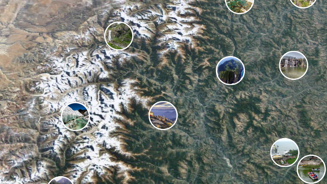
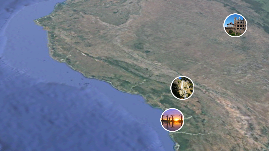
Now it’s time to shellebrate. Starting today on Google Maps Street View and Google Earth, you can explore Christmas Island and Cocos (Keeling) Islands’ unique wildlife, dazzling ocean vistas and lush rainforests, including the grand finale of the red crab migration—the spawning. The red crabs wait all year for this very moment—and the precise alignment of the rains, moon and tides—to release their eggs at the coastal waters.

Christmas Island’s remote location makes it home to a wild and diverse ecosystem—including 600 species of tropical fish, 14 species of terrestrial crabs, more than 100 bird species and four native reptile species. Exploring its wetlands and blowholes and coastline, you can see for yourself why the island is often called “Australia’s Galapagos.”

Christmas Island’s nature and wildlife is so treasured and protected that the crabs have right of way. Roads are often closed during the migration, and Parks Australia have erected fences to direct the crabs to safe crossing points with under-road passes, or fly-over bridges. Now you can join the island’s 45 million red crabs as they crawl along the forest floor, climb the cliffs and finally, spawn at the water’s edge.

Scuttle over to Street View and Google Earth to experience the wonderland of wildlife on Christmas Island and the white sand beaches of Cocos (Keeling) Islands. And as you step into this moment in time, we welcome you to join the crabs as they lead this magnificent dance of nature.

I’m Feeling Earthy: Earth Day trends and more

It’s Earth Day—take a walk with us.

First, let’s dig into issues taking root in Search. Ahead of Earth Day, “solar energy,” “drought” and “endangered species” climbed in popularity this week. Meanwhile, people are looking for ways their own actions can make a positive impact. The top “how to recycle” searches were for plastic, paper, batteries, plastic bags, and styrofoam. And around the world, trending queries about Earth Day were “how many trees will be saved by recycling?” and “which type of plastic is more friendly to the environment?”  

To explore some of the other searches that are blooming for Earth Day, take a look at our trends page.

ed

In our corner of the world, Earth Day celebrations started on Google Earth’s first birthday (tweet at @googleearth with #ImFeelingEarthy and see where it takes you!). The party continues today with a special tribute to Jane Goodall in today’s Doodle, and kids inspired by the Doodle can create their own Google logo, thanks to our partnership with World Wildlife Fund. And while we’re feeling extra Earthy this week, the environment is important to our work all year long—here’s what we’re doing for our operations, our surroundings, our customers, and our community.

How we explored the whole wide world with Google Earth in the past year

From polar bears in Canada to the highest peaks on the planet, hundreds of millions of people searched to the edge of the world and beyond with Google Earth in the last year.


On Earth Day 2017, we shared a brand new version of Google Earth that works on the web, Android and iOS. Since then, hundreds of millions of people, big and small, took a spin on the globe; armchair explorers everywhere followed along with more than 300 Voyager stories in 8 languages; and we learned that you can have too much of a good thing ?.To celebrate the past year of whizzing around the globe, here’s a look at what made Google Earth go round over the last 365 days.

earth

1.  Home is where the searches start. But they don’t stay there.

The first place most people search for on Google Earth is home. But that’s only the beginning. From there, you search most for natural wonders and famous landmarks of the world, like Times Square, Taj Mahal, Eiffel Tower, Mount Everest and Niagara Falls. Many of you have an out-of-this-world fascination with Area 51. And, yes, we recently saw a bump in searches for Wakanda.
3

When it came to physically leaving home, many people stuck with classic travel destinations like New York City and Paris. But you also had dreams of oceanside views and crystal waters—our next most popular travel itinerary was for Santorini, Greece.

2. Three billion people got an updated view of their neighborhood.

We’re updating the imagery you see in Google Earth and Google Maps all the time. Within the past 12 months, we’ve added enough new 3D and 2D imagery to cover 3 billion people, or about 40 percent of the world’s population. New York City, Stockholm and Hakodate, Japan are just some of the more than 400 cities and metro areas that got a makeover with new high-resolution 3D imagery.
g

3. Yahtzee! You’ve rolled the dice 190 million times.

I’m Feeling Lucky is now one of Earth’s most popular features. It’s simple: Click the dice icon and fly to a random, awesome place on the globe. Since launch, you’ve rolled the dice 190 million times, or about six rolls per second. And because it’s almost our favorite day of the year, Earth Day, we’re feeling extra Lucky—Earthy, even. Tweet #ImFeelingEarthy to @googleearth and see where it takes you.
e

4. You’ve got mail! The world created $50 million worth of postcards.

We’ve all been there: Daydreaming about that next great adventure. That’s why we built the Postcards feature for our Android and iOS apps, so that once you found that beautiful place—Lagos, Portugal, anyone?—you could share with a friend and get them dreaming too. Last year, you created more than 40 million postcards—in postage that’s about $50 million, €39 million or ¥3 billion.

5. You got the warm fuzzies watching 18 live animal cams.

Thanks to Explore.org’s network of live nature cams in Earth, you could observe brown bears fishing for salmon in Alaska and polar bears poking around the Tundra Buggy Lodge in Churchill, Canada. Even when Charlotte and Charlie’s osprey nest was empty, we couldn’t look away! Stay tuned for puffin and guillemot action in the next few weeks.
ex

Cute animal photos courtesy of Explore.org


6. Voyager stories took you from home to space, and everywhere in between.  

From the Great Sphinx to Mars to a crater in Mexico, millions of you followed along with more than 300 interactive tours in Voyager. Our most popular stories introduced new cultures and habitats: This is Home, I Am Amazon and BBC Earth’s Natural Treasures. Teachers and students explored the solar system with Japan’s Miraikan and investigated the end of the dinosaur age with HHMI Biointeractive. And some stories were just great eye candy: Earth View and NASA’s Earth at Night.
ecl

We built an eclipse generator for the coolest event of 2017.

It’s been a busy first year for the new Google Earth! Here’s to another 365 days of exploring the world.

A new public energy tool to reduce emissions

Renewable energy, and the transition to a low-carbon future, has long been a priority for Google. However, there is still a long way to go toward the low-carbon future we envision.

Electricity generation from fossil fuels accounts for about 45 percent of global carbon emissions yet useful and accessible information to guide the transition to clean energy is still needed. Now with satellite data, cutting-edge science and powerful cloud computing technology like Google Earth Engine, we can achieve an unprecedented understanding of our changing environment and use that to guide wiser decision-making.

Today, the World Resources Institute (WRI) and Google, in partnership with leading global research institutions including Global Energy Observatory, KTH Royal Institute of Technology in Stockholm, and the University of Groningen, are releasing a global database of power plants. This database standardizes power sector information to encourage providers to adopt a common approach for reporting power plant features—like location, fuel type, and emissions—in the future.

Energy

Global database of power plants 

Drawing from over 700 publicly available data sources, this database compiles information to cover 80 percent of globally installed electrical capacity from 168 countries, and includes capacity, generation rates, fuel type, ownership and location. Making this kind of information open and accessible to researchers and scientists can help reduce carbon emissions and increase energy access. Power capacity and generation indicators can be used to develop a more granular understanding of the emissions created from the electricity we use, and to develop pathways to decarbonize electricity supply.

Information about power plants—such as location and size—can help researchers study emissions and air pollution at an international, national, and local scale. And, as a high-quality geospatial data source, it can also be used to augment remote sensing and enable machine learning analysis to discover a wide variety of important environmental insights. The data is now available in Earth Engine and WRI’s Resource Watch, where it can be easily combined with other data to create new insights.

Until recently it wasn’t possible to monitor the health of Earth’s critical resources in both a globally consistent and locally relevant manner. Making global data openly available for researchers is a core mission of the Earth Outreach team. By working closely with on-the-ground partners we can put this data into the hands of those who can take action. With the increased visibility into the power sector that this database provides, we see the potential to make the transition to a low-carbon future happen even faster.

Take a walk on the wild side in Google Earth

This World Wildlife Day, become one with nature—and its animal inhabitants—on Voyager, Google Earth’s storytelling feature. We’ve launched three interactive tours with Explore.org, National Geographic Society and The Nature Conservancy that let you get up close with our planet’s magnificent animals and the challenges they face.

This live cam is owl you need

First, fly to the treetops of Montana with Explore.org to see owls and ospreys in the wild. You can watch live streams of three different owl species—Long-eared, Great Horned and Great Gray Owls — raising their young in their nests.

RaptorsOfMontana_OwlCam_GIF_1_Smaller_1.gif

All aboard

Hop on the National Geographic Photo Ark, an ambitious project from photographer Joel Sartore to document every species living in human care. Peek behind the scenes to see how Sartore captures these amazing shots, and don’t miss the last page for a choose-your-own-adventure look at 30 of the feathered, furry and finned friends that have already joined the Photo Ark.

up

Turtle power

Finally, dive into the South Pacific near the Arnavon Islands. Here you’ll find The Nature Conservancy and local communities working to protect the largest nesting site of the endangered hawksbill turtle.

SeaTurtleCam_GIF_1_Smaller_2.gif

The economic impact of geospatial services

With Google Maps, we’re committed to creating a rich, deep, and detailed understanding of the world. By digitizing and providing access to a wealth of information about the real world, we allow people to easily explore the world around them, provide tools for businesses to attract and connect with customers, power map and location experiences for third party apps and websites, and enable NGOs and governments to leverage our map and resources to tackle real-world challenges like urban planning or emergency response.

Google is continually looking for ways to add value––for our users, for local businesses, and for our partners across many industries. We want to stretch people’s perceptions of what a map can do for them, of the types of questions we can answer about the world, and the tasks we can help with. And to do that, we need to understand maps today and the impact they have on people’s lives.

With this in mind, we commissioned a detailed study to look at the impact of the geospatial industry—the ecosystem of industries that rely on geospatial technology (both online and offline)—and the direct benefit it provides to people, businesses and society. We worked with AlphaBeta, a strategy advisory business, to analyze the global impact of the geospatial industry in 2016. We asked AlphaBeta to highlight some of their findings and the methodology behind them. — Jen Fitzpatrick, VP Google Maps


At AlphaBeta, we’re passionate about identifying the forces shaping global markets and developing practical plans to create prosperity and well-being. We believe that geospatial technology is one of these forces, which is why we recently undertook research, commissioned by Google, to evaluate the impact of digital maps and their underlying technologies.

We asked ourselves: what is the full value of digital maps for users? How is this technology affecting the broader economic environment? How can societies make the most out of it?

We used consumer surveys across 22 countries spanning six regions, and other estimation approaches (such as big data analysis of online job postings), and found that geospatial services make an impact in three key ways:

Geospatial1

Consumer benefits
Maps help people move and shop in a faster and more efficient way. For example, not only do digital maps reduce travel time, they also help people save time on purchases by providing information like directions and product availability. By helping people plan routes in areas they aren’t familiar with, maps also improve public safety.

Geospatial2
Business benefits

Maps help make small and large businesses more visible, productive and profitable. By providing useful facts such as store hours, contact information and reviews, maps help drive sales—particularly important for small businesses that may find potential new customers without incurring additional advertising costs. Geospatial services also play a strategic role in helping companies in sectors covering approximately three quarters of the world’s GDP raise revenues and/or diminish costs. For example, retail companies use digital maps for market research and to identify the most profitable locations for their network of stores.

Geospatial3
Societal benefits

Finally, maps have positive spillover effects on the environment and societies around the world—for example, by creating jobs and reducing CO2 emissions through more efficient vehicle trips and easier identification of alternative transportation options. Geospatial technology can also play a role in emergencies—such as helping people prepare for a natural disaster by highlighting flood-risk areas.

The impact of geospatial services also varies from country to country—showing that there’s still room in many places to maximize the benefits of geospatial services for everyone. To do so, the geospatial industry, businesses, NGOs and governments in these areas will need to work together to promote, adopt and implement existing and new applications of geospatial technology.

To find out more, visit www.valueoftheweb.com.


Source: Google LatLong


The economic impact of geospatial services

With Google Maps, we’re committed to creating a rich, deep, and detailed understanding of the world. By digitizing and providing access to a wealth of information about the real world, we allow people to easily explore the world around them, provide tools for businesses to attract and connect with customers, power map and location experiences for third party apps and websites, and enable NGOs and governments to leverage our map and resources to tackle real-world challenges like urban planning or emergency response.

Google is continually looking for ways to add value––for our users, for local businesses, and for our partners across many industries. We want to stretch people’s perceptions of what a map can do for them, of the types of questions we can answer about the world, and the tasks we can help with. And to do that, we need to understand maps today and the impact they have on people’s lives.

With this in mind, we commissioned a detailed study to look at the impact of the geospatial industry—the ecosystem of industries that rely on geospatial technology (both online and offline)—and the direct benefit it provides to people, businesses and society. We worked with AlphaBeta, a strategy advisory business, to analyze the global impact of the geospatial industry in 2016. We asked AlphaBeta to highlight some of their findings and the methodology behind them. — Jen Fitzpatrick, VP Google Maps


At AlphaBeta, we’re passionate about identifying the forces shaping global markets and developing practical plans to create prosperity and well-being. We believe that geospatial technology is one of these forces, which is why we recently undertook research, commissioned by Google, to evaluate the impact of digital maps and their underlying technologies.

We asked ourselves: what is the full value of digital maps for users? How is this technology affecting the broader economic environment? How can societies make the most out of it?

We used consumer surveys across 22 countries spanning six regions, and other estimation approaches (such as big data analysis of online job postings), and found that geospatial services make an impact in three key ways:

Geospatial1

Consumer benefits
Maps help people move and shop in a faster and more efficient way. For example, not only do digital maps reduce travel time, they also help people save time on purchases by providing information like directions and product availability. By helping people plan routes in areas they aren’t familiar with, maps also improve public safety.

Geospatial2
Business benefits

Maps help make small and large businesses more visible, productive and profitable. By providing useful facts such as store hours, contact information and reviews, maps help drive sales—particularly important for small businesses that may find potential new customers without incurring additional advertising costs. Geospatial services also play a strategic role in helping companies in sectors covering approximately three quarters of the world’s GDP raise revenues and/or diminish costs. For example, retail companies use digital maps for market research and to identify the most profitable locations for their network of stores.

Geospatial3
Societal benefits

Finally, maps have positive spillover effects on the environment and societies around the world—for example, by creating jobs and reducing CO2 emissions through more efficient vehicle trips and easier identification of alternative transportation options. Geospatial technology can also play a role in emergencies—such as helping people prepare for a natural disaster by highlighting flood-risk areas.

The impact of geospatial services also varies from country to country—showing that there’s still room in many places to maximize the benefits of geospatial services for everyone. To do so, the geospatial industry, businesses, NGOs and governments in these areas will need to work together to promote, adopt and implement existing and new applications of geospatial technology.

To find out more, visit www.valueoftheweb.com.


View the world through someone else’s lens in Google Earth

Every day, hundreds of millions of people are snapping photos of the world around them. What if you could explore the world through the eyes of all those people? Starting today you're invited to explore a global map of crowdsourced photos in Google Earth. Take a walk around Shinto shrines or hang out on a beach in Bora Bora—wherever you look, you're bound to find a unique perspective on the world.

To get started, open the Google Earth app on Android and iOS, or go to Google Earth in your Chrome browser on desktop. Open the main menu and turn on the Photos toggle. As you explore the world and zoom in, relevant photos from each location will appear. Click on any thumbnail to see a full-screen version of the photo, and then flip through related photos.

photos in Earth

To build this new experience, we used finely-tuned machine learning to pull the most beautiful and interesting photos from the millions and millions already shared in Google Maps by Local Guides and other contributors. This means that you can add your own great photos—and if you've already posted some, start looking for your photos in Earth.

Whether you're looking for travel inspiration, preparing a geography report for school, or simply taking flight from the comfort of your couch, the new Photos layer gives you the ability to look at far off places up close. And with new photos being added every day, there's a great reason to keep coming back for more.

Turn around, bright eyes… and experience the total solar eclipse with Google

Move over, blue moon—there’s a more rare astronomical event in town. For the first time since 1979, a total eclipse of the sun is coming to the continental United States this Monday, August 21. Starting on the west coast around 9 a.m., the moon will begin to block the face of the sun. Not long later, the moon will completely cover the sun, leaving only the bright corona visible for as long as two minutes and 40 seconds.

Whether you’re traveling to see the “totality,” catching a glimpse of the partial eclipse from another location, or simply curious, Google can help you learn more about this unique moment. Grab your solar glasses and peep what we’ve got in store:

Live from the solar eclipse

Even if you’re not in the path of the solar eclipse you can tune to YouTube to watch the magic unfold live as it crosses over the U.S. Catch livestreams from NASA, The Weather Channel, Exploratorium, Discovery's Science Channel, and Univision.

Sun, moon and Google Earth

With a new Voyager story in Google Earth, you can learn more about the science behind the eclipse. You can also see what it will look like where you live.

Futures made of virtual totality

If you’re not in 70 mile wide path of totality, fret not. Travel to Mt. Jefferson, OR in Google Earth VR (on Rift and Vive) and view it in virtual reality. From the menu, select Total Solar Eclipse to get a view from the center of the action.

Lights, camera, astronomical action

We’re working with UC Berkeley, other partners and volunteer photographers to capture images of the sun’s corona at the moment of totality for use in scientific research. We’re also using our technology to algorithmically align these images into the Eclipse Megamovie, a continuous view of the eclipse. Read about some of the people involved in this project, and stay tuned for the complete Megamovie soon after the eclipse on https://eclipsemega.movie.

It’s a bird, it’s a plane, it’s Android O!

People worldwide have explained solar eclipses through the lens of myth and legend for centuries. This year, there’s a new supernatural being whose identity will be revealed as the sun and the moon do their celestial dance. Get ready to meet Android O at android.com/o.

While a solar eclipse is a pretty rare astronomical event, don’t worry it’s not too early to start planning for the next one passing over the United States on October 14, 2023. You can always set a Google Calendar reminder to make sure you don’t forget.

Source: Android


Turn around, bright eyes… and experience the total solar eclipse with Google

Move over, blue moon—there’s a more rare astronomical event in town. For the first time since 1979, a total eclipse of the sun is coming to the continental United States this Monday, August 21. Starting on the west coast around 9 a.m., the moon will begin to block the face of the sun. Not long later, the moon will completely cover the sun, leaving only the bright corona visible for as long as two minutes and 40 seconds.

Whether you’re traveling to see the “totality,” catching a glimpse of the partial eclipse from another location, or simply curious, Google can help you learn more about this unique moment. Grab your solar glasses and peep what we’ve got in store:

Live from the solar eclipse

Even if you’re not in the path of the solar eclipse you can tune to YouTube to watch the magic unfold live as it crosses over the U.S. Catch livestreams from NASA, The Weather Channel, Exploratorium, Discovery's Science Channel, and Univision.

Sun, moon and Google Earth

With a new Voyager story in Google Earth, you can learn more about the science behind the eclipse. You can also see what it will look like where you live.

Futures made of virtual totality

If you’re not in 70 mile wide path of totality, fret not. Travel to Mt. Jefferson, OR in Google Earth VR (on Rift and Vive) and view it in virtual reality. From the menu, select Total Solar Eclipse to get a view from the center of the action.

Lights, camera, astronomical action

We’re working with UC Berkeley, other partners and volunteer photographers to capture images of the sun’s corona at the moment of totality for use in scientific research. We’re also using our technology to algorithmically align these images into the Eclipse Megamovie, a continuous view of the eclipse. Read about some of the people involved in this project, and stay tuned for the complete Megamovie soon after the eclipse on https://eclipsemega.movie.

It’s a bird, it’s a plane, it’s Android O!

People worldwide have explained solar eclipses through the lens of myth and legend for centuries. This year, there’s a new supernatural being whose identity will be revealed as the sun and the moon do their celestial dance. Get ready to meet Android O at android.com/o.

While a solar eclipse is a pretty rare astrological event, don’t worry it’s not too early to start planning for the next one passing over the United States on October 14, 2023. You can always set a Google Calendar reminder to make sure you don’t forget.

Source: Android