In 2013, we released Google Earth Timelapse, our most comprehensive picture of the Earth's changing surface. This interactive experience enabled people to explore these changes like never before—to watch the sprouting of Dubai’s artificial Palm Islands, the retreat of Alaska’s Columbia Glacier, and the impressive urban expansion of Las Vegas, Nevada. Today, we're making our largest update to Timelapse yet, with four additional years of imagery, petabytes of new data, and a sharper view of the Earth from 1984 to 2016. We’ve even teamed up again with our friends at TIME to give you an updated take on compelling locations.
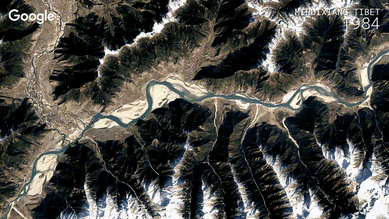
Meandering river in Nyingchi, Tibet, China [view in Timelapse] (Image credit: Landsat / Copernicus*)
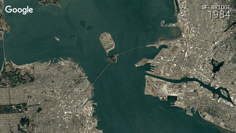
Leveraging the same techniques we used to improve Google Maps and Google Earth back in June, the new Timelapse reveals a sharper view of our planet, with truer colors and fewer distracting artifacts. A great example of this is San Francisco and Oakland in California:
There’s much more to see, including glacial movement in Antarctica, urban growth, forest gain and loss, and infrastructure development:
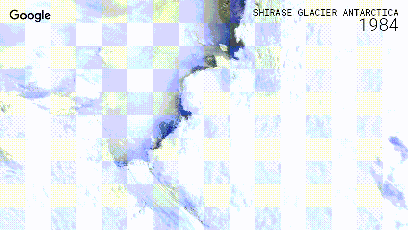
Shirase Glacier, Antarctica [view in Timelapse] (Image credit: Landsat / Copernicus)
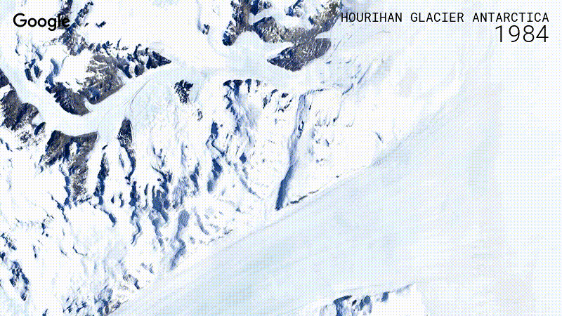
Hourihan Glacier, Antarctica [view in Timelapse] (Image credit: Landsat / Copernicus*)
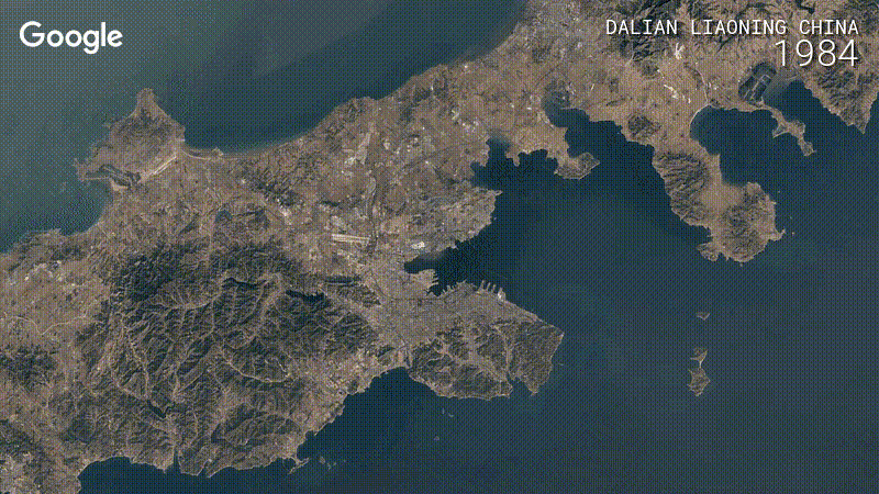
Dalian Liaoning, China [view in Timelapse] (Image credit: Landsat / Copernicus*)
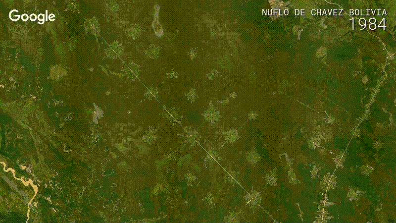
Nuflo de Chavez, Bolivia [view in Timelapse] (Image credit: Landsat / Copernicus*)
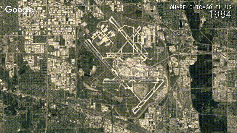
O'Hare Airport, Chicago, Illinois [view in Timelapse] (Image credit: Landsat / Copernicus*)
Using Google Earth Engine, we sifted through about three quadrillion pixels—that's 3 followed by 15 zeroes—from more than 5,000,000 satellite images. For this latest update, we had access to more images from the past, thanks to the Landsat Global Archive Consolidation Program, and fresh images from two new satellites, Landsat 8 and Sentinel-2.
We took the best of all those pixels to create 33 images of the entire planet, one for each year. We then encoded these new 3.95 terapixel global images into just over 25,000,000 overlapping multi-resolution video tiles, made interactively explorable by Carnegie Mellon CREATE Lab's Time Machine library, a technology for creating and viewing zoomable and pannable timelapses over space and time.
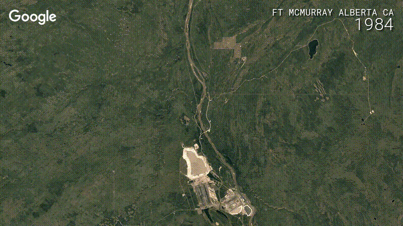
Alberta Tar Sands, Canada [View in Timelapse] (Image credit: Landsat / Copernicus*)
To view the new Timelapse, head over to the Earth Engine website. You can also view the new annual mosaics in Google Earth's historical imagery feature on desktop, or spend a mesmerizing 40 minutes watching this YouTube playlist. Happy exploring!
*Landsat imagery courtesy of NASA Goddard Space Flight Center and U.S. Geological Survey. Images also contain modified Copernicus Sentinel data 2015- 2016.