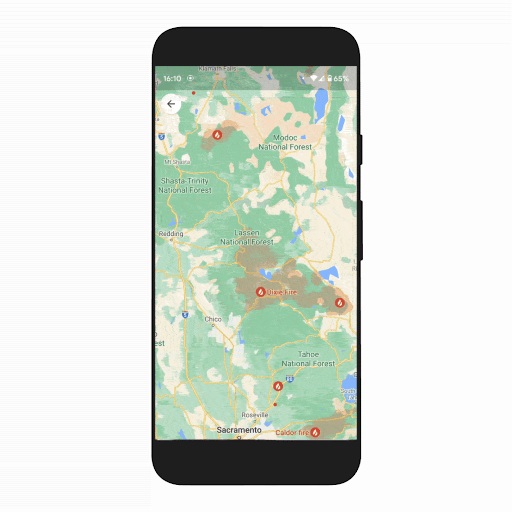
We’re at a unique inflection point in our relationship with the planet. We face existential climate threats — a growing crisis already manifesting in extreme weather events, coupled with the loss of nature resulting from human activities such as deforestation. But at the same time, the world is mobilizing around climate action. Citizens are demanding progress, and governments and companies are making unprecedented commitments to transform how we live on this planet — from policy decisions to business practices. Over the years, one of the top climate challenges I’ve heard from businesses, governments and organizations is that they’re drowning in data but thirsty for insights.
So starting today, we’re making Google Earth Engine available to businesses and governments worldwide as an enterprise-grade service through Google Cloud. With access to reliable, up-to-date insights on how our planet is changing, organizations will be better equipped to move their sustainability efforts forward.
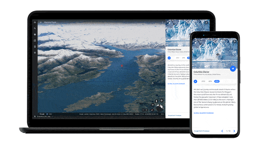
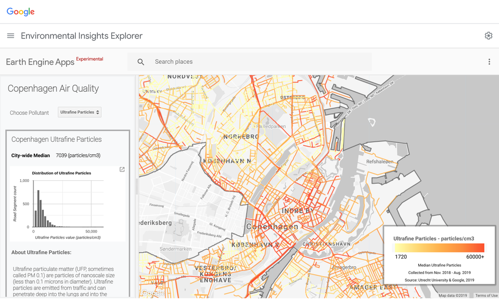
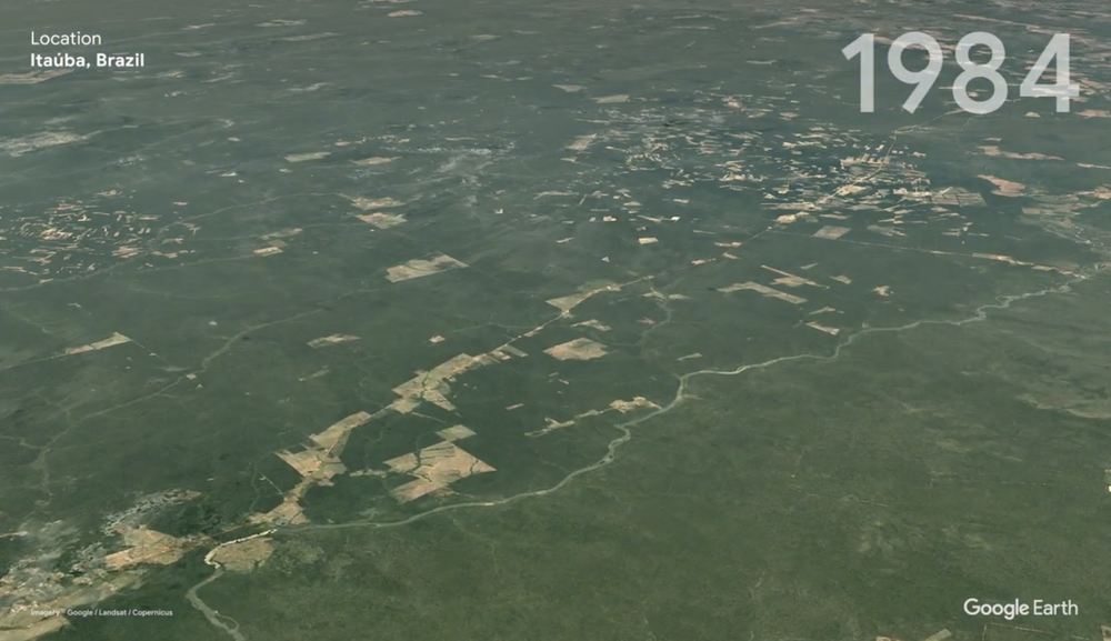
Google Earth Engine, which originally launched to scientists and NGOs in 2010, is a leading technology for planetary-scale environmental monitoring. Google Earth Engine combines data from hundreds of satellites and earth observation datasets with powerful cloud computing to show timely, accurate, high-resolution insights about the state of the world’s habitats and ecosystems — and how they’re changing over time. With one of the largest publicly available data catalogs and a global data archive that goes back 50 years and updates every 15 minutes, it’s possible to detect trends and understand correlations between human activities and environmental impact. This technology is already beginning to bring greater transparency and traceability to commodity supply chains, supporting climate resilience and allowing for more sustainable management of natural resources such as forests and water.
Earth Engine will be available at no charge to government researchers, least-developed countries, tribal nations and news organizations. And it will remain available at no cost for nonprofit organizations, research scientists, and other impact users for their non-commercial and research projects.
Earth Engine will also be available to startups that are a part of the Google for Startups Cloud Program. Through this initiative we provide funded startups with access to dedicated mentors, industry experts, product and technical support, and Cloud cost coverage (up to $100,000) for each of the first two years and more.
How organizations are using Earth Engine
Since we announced the preview of Earth Engine in Google Cloud last October, we’ve been working with dozens of companies and organizations across industries — from consumer packaged goods and insurance companies to agriculture technology and the public sector — to use Earth Engine’s satellite imagery and geospatial data in incredible ways.
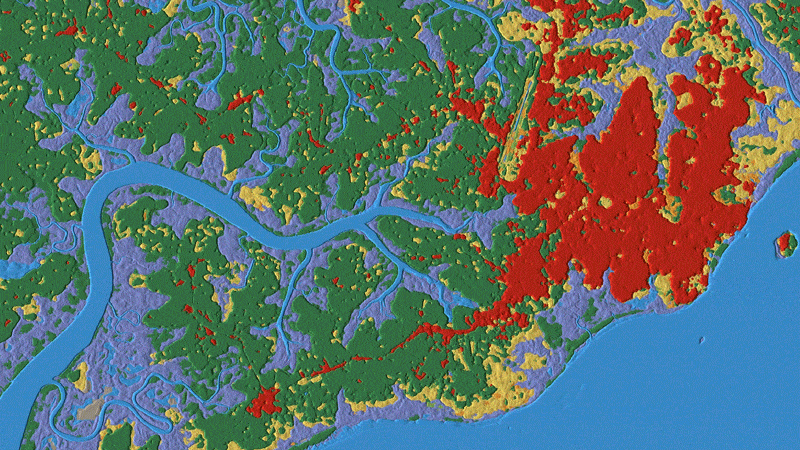
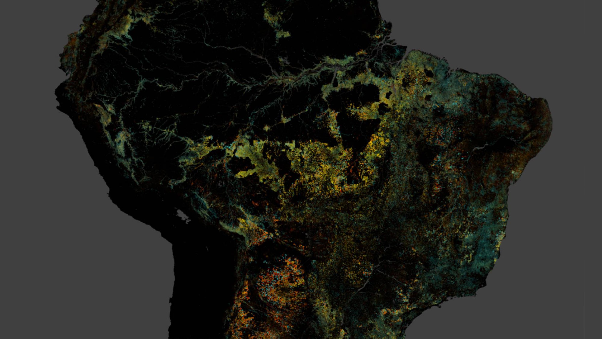
Dynamic World, a global machine learning derived land classification over time available in Earth Engine's public data catalog, was developed in partnership with World Resources Institute (WRI).
For example, Regrow, a company that helps large consumer packaged goods corporations decarbonize their agricultural practices, started using Earth Engine to report and verify regenerative and sustainable techniques. Through Earth Engine’s analysis of historical and satellite imagery, Regrow can generate granular field data at the state or country levels across millions of acres of farmland around the world.
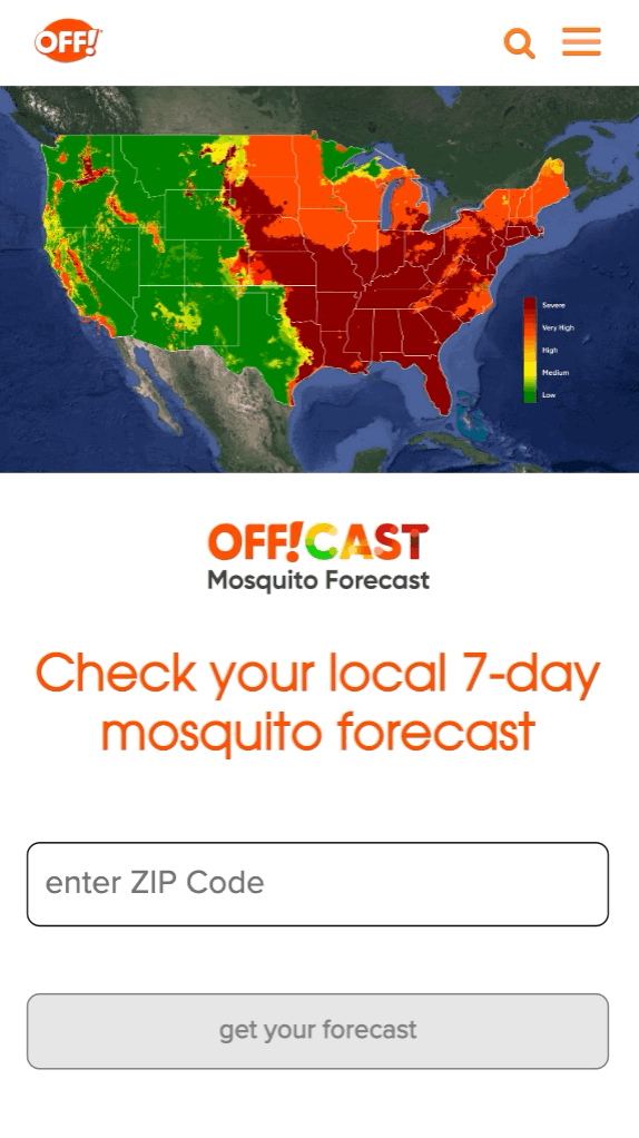
As climate change causes shifts in biodiversity, Earth Engine is helping communities adapt to the effects of these changes, such as new mosquito outbreaks. SC Johnson partnered with Google Cloud to use Earth Engine to develop a publicly accessible, predictive model of when and where mosquito populations are emerging nationwide. The forecast accounts for billions of individual weather data points and over 60 years of mosquito knowledge in forecasting models.
For organizations that may not have resources dedicated to working with Earth Engine, we’ve continued to grow our partner network to support them. For example, our partner NGIS worked with Rainforest Trust to get action-oriented and tailored insights that can help them conserve 39 million acres of tropical forests around the world.
It’s not too late to protect and restore a livable planet for ourselves and generations to come. Climate change experts have declared the next ten years the ‘Decade of Action’, a critical time to act in order to curb the effects of climate change. Making a global difference will require a transformational change from everyone, including businesses and governments. With Google Earth Engine, we hope to help organizations contribute to this change.