Tag Archives: LatLong

Pride 2017: Show love, show progress, #ShowUp

Growing up in Chandigarh, India, a small, conservative city about five hours north of New Delhi, I knew early on that something about me was different. After undergrad, I moved to Champaign, IL to get a master’s degree in engineering, leaving behind the hustle and bustle of India for a small, quiet university town in the Midwest. My newfound independence abroad gave me the space to confront and accept my difference—and come out as gay.

During my first summer in the U.S., I visited Boystown in Chicago, one of the most famous gay neighborhoods in the country. It was a bright summer day and the streets were packed with smiling, laughing people from across the LGBTQ community. It was only a matter of seconds before my friends and I got caught up in the excitement and camaraderie of the place. For the first time, I felt I could be myself.

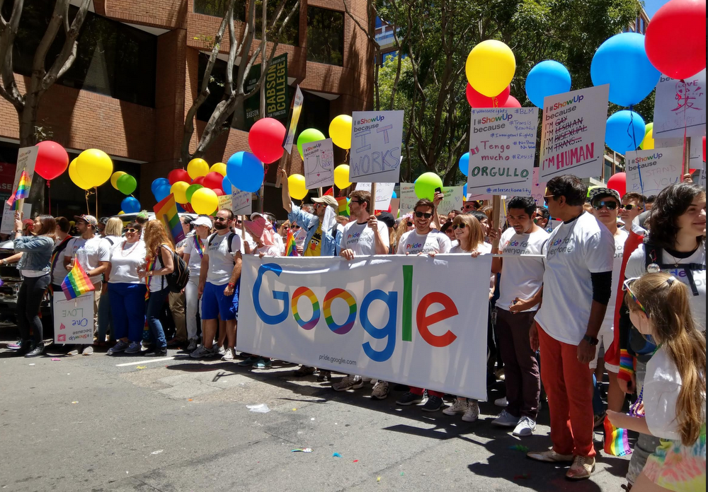
When I joined Google, I was excited to find a community of LGBTQ Googlers and allies who celebrate Pride across the world, and not just by marching in parades (although we do lots of that, too). As a company, we want to make sure our products help LGBTQ people feel they can be themselves, whether they’re in Chandigarh or Chicago.

lgbt_parade.png
From displaying Pride parade routes in Maps, to the fifth consecutive year of YouTube’s #ProudToBe campaign, 2017 was all about connecting people with local Pride events and sharing experiences across the globe.

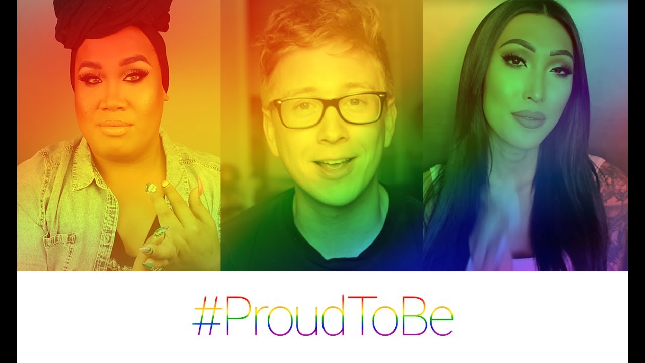
In addition to #ProudToBe, which encourages people to share their stories and connect with others around the world, YouTube made a number of commitments to continue supporting the LGBTQ community and shared a video celebrating Pride and all the great LGBTQ YouTube Creators.

#ProudToBe: Celebrate Brave Voices this Pride

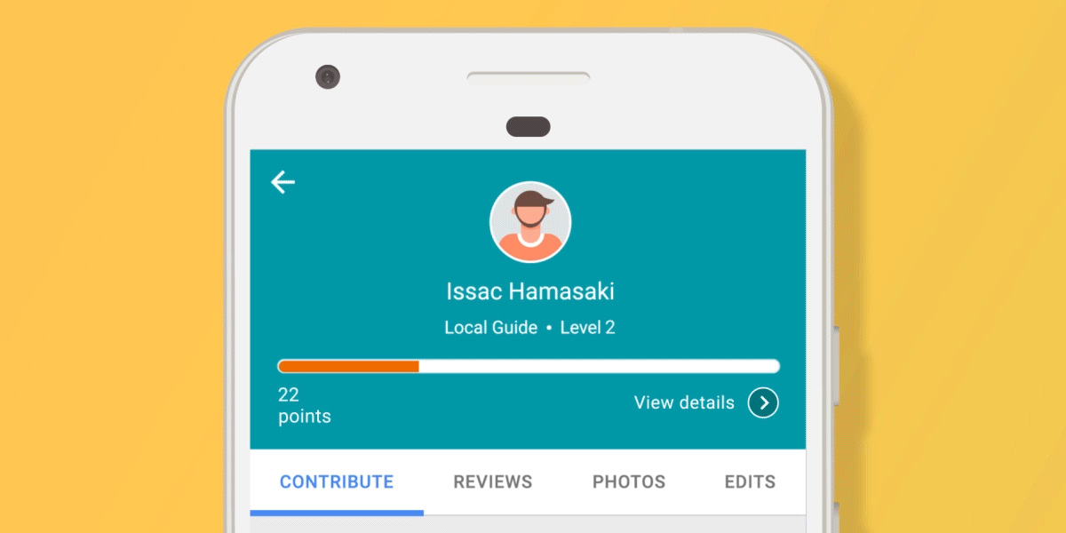
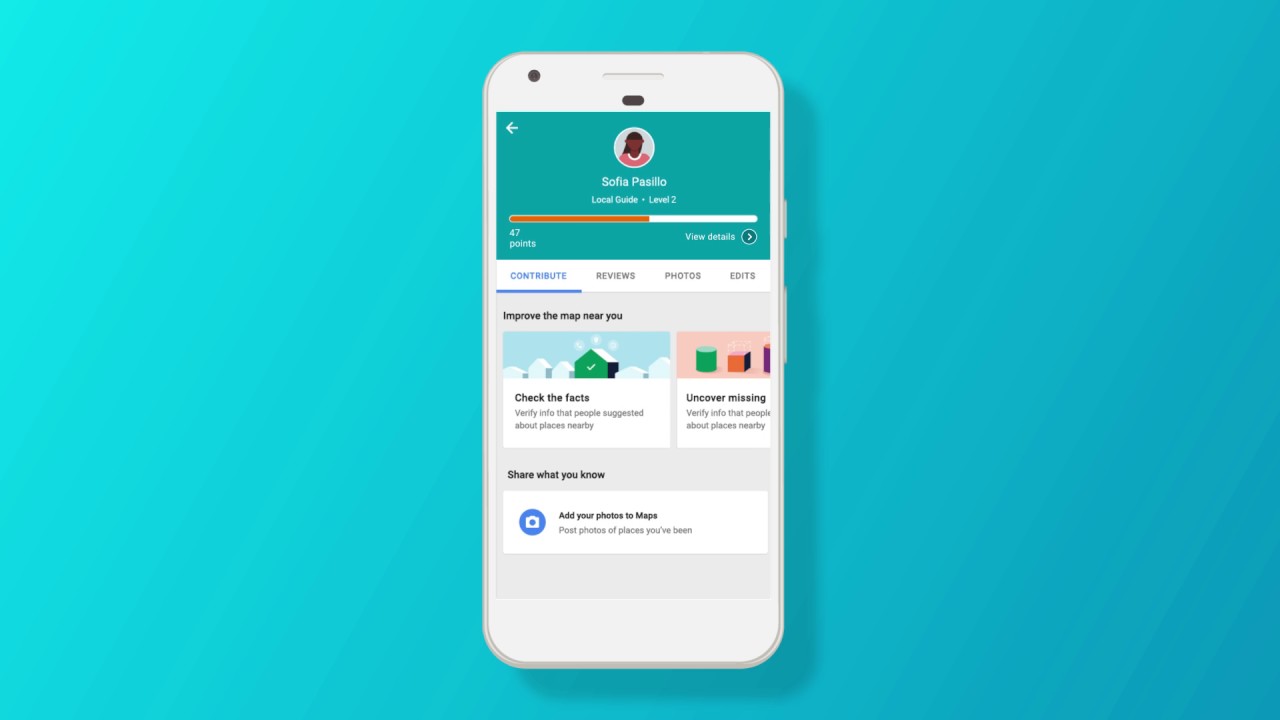
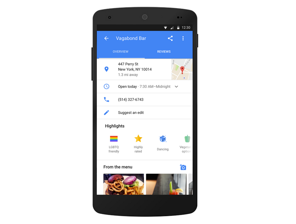
Google My Business made it easier for merchants worldwide to let people know their business is “LGBTQ-friendly” or a “Transgender Safe Space.” Once merchants opt into these attributes, they’re shown on business listings in Google Maps and Search to signal to potential visitors that their establishment respects and treats all people equally.

LGBT_highlight mobile_1850.png

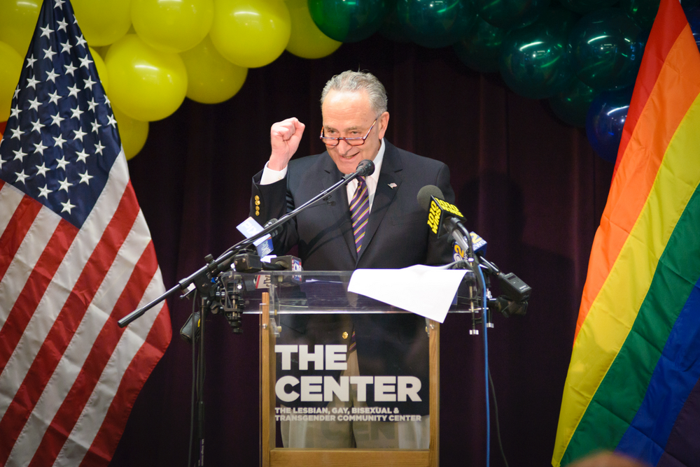
In New York, Senator Chuck Schumer announced a $1 million Google.org grant to record critical moments in LGBTQ history, including the night of the 1969 Stonewall Uprising. The Stonewall Uprising is important to the ongoing road to civil rights for LGBTQ communities around the world—and its message is as resonant and necessary today as it was in 1969.

Schumer-pride.jpg
US Senator Chuck Schumer announcing a Google.org grant to the LGBT Community Center of New York City in support of the Stonewall National Monument

And we launched #ShowUp, a project designed to help people take action in support of the LGBTQ community at a local level. By entering their zip code on the #ShowUp homepage, people can find the nearest parades, marches and LGBTQ-supporting nonprofits in their communities. The campaign also aims to chart progress in LGBTQ rights across eight U.S. cities by recording individual stories about why showing up matters.

#ShowUp Stories: Lily | Birmingham, AL

Boystown made me feel safe to be myself. All people deserve to feel this way. At Google, we hope that, by  connecting people with local events and sharing experiences across the globe, Google can help even a few more LGBTQ people feel safe to be themselves.

Source: Google LatLong


Google Earth, class is now in session

So much of what students learn in the classroom—from social studies to history, science and literature—relates to a geographic place on Earth. Recently, we announced a new version of Google Earth, and since then, educators have been telling us what a valuable tool Google Earth is for their students. They use the “I’m feeling lucky” feature to inspire writing exercises, do research exercises with Knowledge Cards, and explore satellite imagery and cloud strata with their students. Now, to make it even easier for teachers to use Google Earth in the classroom, we’ve created a new “Education” category in the Voyager section, which includes new stories—complete with classroom activities—from National Geographic Society, PBS Education, HHMI Biointeractive and Mission Blue.

The National Geographic Society stories take students on adventures following explorers through the Middle East, India, and coral reefs. To supplement the experience, National Geographic Society created idea for activities that highlight a range of geographical concepts, such as interpreting land forms and comparing map projections.

With PBS Education, classrooms can go back in time and track the paths of famous explorers, from Lewis and Clark to the Vikings. As students follow along, they, in turn, become modern-day explorers.

HHMI Biointeractive and Mission Blue created Voyager stories more geared towards science and math. With HHMI Biointeractive, students join “Scientists at Work” as they investigate important problems, from endangered coral reefs to the Ebola outbreak. And Mission Blue’s story teaches students about the unique oceanographic conditions of Costa Rica thermal dome. Short videos and questions embedded in the stories will help guide students with their own scientific research.

Educators everywhere can find classroom activities (created by teachers, for teachers) at our new Google Earth Education website, and easily share locations and stories directly to Google Classroom. In addition, this week Google Earth will become an Additional Service for Google for Education users, which can be managed by IT administrators through the Google Admin console.

Google Earth was built to inspire curious minds to explore, learn and care about our vast, fragile planet. With these updates, we’re excited to make it easier for the next generation to see the world from a new perspective.

Source: Google LatLong


Google Earth, class is now in session

So much of what students learn in the classroom—from social studies to history, science and literature—relates to a geographic place on Earth. Recently, we announced a new version of Google Earth, and since then, educators have been telling us what a valuable tool Google Earth is for their students. They use the “I’m feeling lucky” feature to inspire writing exercises, do research exercises with Knowledge Cards, and explore satellite imagery and cloud strata with their students. Now, to make it even easier for teachers to use Google Earth in the classroom, we’ve created a new “Education” category in the Voyager section, which includes new stories—complete with classroom activities—from National Geographic Society, PBS Education, HHMI Biointeractive and Mission Blue.

Edu-category600px.gif
Just click the new "Education" category on the Voyager homepage for new stories, complete with classroom activities for teachers

The National Geographic Society stories take students on adventures following explorers through the Middle East, India, and coral reefs. To supplement the experience, National Geographic Society created idea for activities that highlight a range of geographical concepts, such as interpreting land forms and comparing map projections.

With PBS Education, classrooms can go back in time and track the paths of famous explorers, from Lewis and Clark to the Vikings. As students follow along, they, in turn, become modern-day explorers.

HHMI Biointeractive and Mission Blue created Voyager stories more geared towards science and math. With HHMI Biointeractive, students join “Scientists at Work” as they investigate important problems, from endangered coral reefs to the Ebola outbreak. And Mission Blue’s story teaches students about the unique oceanographic conditions of Costa Rica thermal dome. Short videos and questions embedded in the stories will help guide students with their own scientific research.

Educators everywhere can find classroom activities (created by teachers, for teachers) at our new Google Earth Education website, and easily share locations and stories directly to Google Classroom. In addition, this week Google Earth will become an Additional Service for Google for Education users, which can be managed by IT administrators through the Google Admin console.

Google Earth was built to inspire curious minds to explore, learn and care about our vast, fragile planet. With these updates, we’re excited to make it easier for the next generation to see the world from a new perspective.

Source: Google LatLong


More Levels, and more way to contribute for Local Guides

Luis Duran, from Santo Domingo, Dominican Republic, is passionate about helping people with disabilities better navigate and explore his city. Kim Flowers, in Melbourne, Australia, believes everyone should think locally and prides herself on helping businesses in her community. Chioma James from Lagos, Nigeria, is working to ensure that victims of sexual crimes can easily find necessary resources like hospitals, police stations and counseling centers. All three of these individuals are Local Guides—people from around the world who help their communities by adding reviews, photos and updated location information to Google Maps.

Contributions

Since 2014, our Local Guides community has grown to more than 30 million contributors. Once you sign up to be a Local Guide, every contribution you make to Google Maps earns you points towards unlocking something new—like early access to new Google Maps features, exclusive contests, events and perks. Over the next few days we’re rolling out updates to the Local Guides program, including a new point system, new levels that unlock different kinds of perks, and new ways to earn points.

Thank you

Certain kinds of contributions that have a higher impact for Google Maps users—like being the first to add a place to the map or leaving a review—earn you more points. In addition, Local Guides now earn points for rating places and checking facts from other community members. All points earned are shown immediately after each contribution, and are visible in the “contribute” tab.

 Just like before, Local Guides Level 2 and above can enjoy early access to new product features, and get occasional perks from Google and local perks from partners. Starting today, in select countries, Local Guides Level 4-10 can redeem a free three-month Google Play Music subscription and 75 percent off rentals in the Google Play Movie store.

Pts V2 Level Up

We’ve added five new levels to Local Guides, bringing the total number from 5 to 10. For levels 4-10, we’ve designed unique badges, giving guides at higher levels a new way to be recognized for their contributions, and helping users quickly identify the Local Guides who contribute the most. These badges will appear next to each Local Guides’ profile picture in Google Maps.

Local Guides: New Points, Levels, Badging and Features

Around the world, Local Guides help people get around easier, navigate and explore with confidence, and support local businesses. We look forward to continuing to work with Local Guides to make the world and local communities more accessible to everyone.

Source: Google LatLong


More Levels, and more ways to contribute for Local Guides

Luis Duran, from Santo Domingo, Dominican Republic, is passionate about helping people with disabilities better navigate and explore his city. Kim Flowers, in Melbourne, Australia, believes everyone should think locally and prides herself on helping businesses in her community. Chioma James from Lagos, Nigeria, is working to ensure that victims of sexual crimes can easily find necessary resources like hospitals, police stations and counseling centers. All three of these individuals are Local Guides—people from around the world who help their communities by adding reviews, photos and updated location information to Google Maps.

Contributions

Since 2014, our Local Guides community has grown to more than 30 million contributors. Once you sign up to be a Local Guide, every contribution you make to Google Maps earns you points towards unlocking something new—like early access to new Google Maps features, exclusive contests, events and perks. Over the next few days we’re rolling out updates to the Local Guides program, including a new point system, new levels that unlock different kinds of perks, and new ways to earn points.

Thank you

Certain kinds of contributions that have a higher impact for Google Maps users—like being the first to add a place to the map or leaving a review—earn you more points. In addition, Local Guides now earn points for rating places and checking facts from other community members. All points earned are shown immediately after each contribution, and are visible in the “contribute” tab.

 Just like before, Local Guides Level 2 and above can enjoy early access to new product features, and get occasional perks from Google and local perks from partners. Starting today, in select countries, Local Guides Level 4-10 can redeem a free three-month Google Play Music subscription and 75 percent off a rental in the Google Play Movie store.

Pts V2 Level Up

We’ve added five new levels to Local Guides, bringing the total number from 5 to 10. For levels 4-10, we’ve designed unique badges, giving guides at higher levels a new way to be recognized for their contributions, and helping users quickly identify the Local Guides who contribute the most. These badges will appear next to each Local Guides’ profile picture in Google Maps.

Local Guides: New Points, Levels, Badging and Features

Around the world, Local Guides help people get around easier, navigate and explore with confidence, and support local businesses. We look forward to continuing to work with Local Guides to make the world and local communities more accessible to everyone.

Source: Google LatLong


Finding the Qibla in augmented reality

Qibla_Finder_Landing_White_EN.gif
The Qibla Finder uses your phone camera to paint a clear blue line towards the Qibla

When people search for the Qibla—the direction Muslims turn to at prayer—they often look for a website or an app to point them in the right direction. Which explains why the word “compass” often pops up when we look at Qibla-related search results over the past five years.

It would be a lot easier to simply hold up your phone and have it tell you the right direction to pray towards. So we’re launching the Qibla Finder (g.co/QiblaFinder), a web app that uses the latest in augmented reality to paint a clear blue line within the imagery your phone camera sees, pointing you towards the Kaaba.

The service is available through your browser today and will be also be available long after Ramadan. Visit our Ramadan Hub (g.co/Ramadan) to find out more about the Qibla Finder and other features to help you observe the month.

Source: Google LatLong


Using machine learning to help people make smart decisions about solar energy

 A few years ago, when my family was first deciding whether or not to go solar, I remember driving around the neighborhood, looking at all the solar arrays on nearby rooftops. It made me realize: Wow, solar isn’t some futuristic concept, it’s already part of the fabric of my town! Seeing that others around me were already benefiting from solar helped me decide to do the same.

We want to make it easy for people to make informed decisions about whether to invest in solar. Project Sunroof already shows you solar potential and cost saving for more than 60 million individual homes. Today we’re adding a new feature, Project Sunroof Data Explorer, which shows a map of existing solar installations in neighborhoods throughout the United States. Now instead of driving street to street, it’s a little easier to see if houses around you and communities nearby have already gone solar.  
one
Click on “existing arrays” in the upper right corner to see number of existing installations in your region

This feature combines machine learning with imagery from Google Maps and Google Earth to provide an estimate of how many houses in an area have solar. We started by taking in high-resolution imagery of rooftops and manually identifying solar installations. We then used that data as the initial training set for our algorithm. After many iterations, our machine learning algorithms can now automatically find and identify installations in the imagery (both photovoltaic panels, which produce electricity, and solar hot water heaters). Even for machines, practice makes perfect!

2

So far we’ve identified around 700,000 installations in the U.S. and over time, as we continue to train the algorithms and apply improvements, we will be able to find and show more installations. We hope that this new feature will provide policy makers, communities and individuals with more information to help make smarter decisions in their transition to cleaner power sources.

Source: Google LatLong


Using machine learning to help people make smart decisions about solar energy

 A few years ago, when my family was first deciding whether or not to go solar, I remember driving around the neighborhood, looking at all the solar arrays on nearby rooftops. It made me realize: Wow, solar isn’t some futuristic concept, it’s already part of the fabric of my town! Seeing that others around me were already benefiting from solar helped me decide to do the same.

We want to make it easy for people to make informed decisions about whether to invest in solar. Project Sunroof already shows you solar potential and cost saving for more than 60 million individual homes. Today we’re adding a new feature, Project Sunroof Data Explorer, which shows a map of existing solar installations in neighborhoods throughout the United States. Now instead of driving street to street, it’s a little easier to see if houses around you and communities nearby have already gone solar.
one
Click on “existing arrays” in the upper right corner to see number of existing installations in your region

This feature combines machine learning with imagery from Google Maps and Google Earth to provide an estimate of how many houses in an area have solar. We started by taking in high-resolution imagery of rooftops and manually identifying solar installations. We then used that data as the initial training set for our algorithm. After many iterations, our machine learning algorithms can now automatically find and identify installations in the imagery (both photovoltaic panels, which produce electricity, and solar hot water heaters). Even for machines, practice makes perfect!

2

So far we’ve identified around 700,000 installations in the U.S. and over time, as we continue to train the algorithms and apply improvements, we will be able to find and show more installations. We hope that this new feature will provide policy makers, communities and individuals with more information to help make smarter decisions in their transition to cleaner power sources.

Source: Google LatLong


Dive into World Oceans Day with Google Earth and Maps

This World Oceans Day, explore our oceans and learn from experts leading marine conservation efforts around the world with Street View and Google Earth.

We hope these stories and sights will inspire you to get involved and help protect our vast and fragile oceans. So jump on in, the water’s fine!Start your underwater adventure in Voyager. With the Ocean Agency, tour Raja Ampat, Indonesia’s rich marine center containing 76 percent of the world’s coral species and 36 percent of the world’s reef fish species—more than any other marine region in the world. Then head to the Gulf of California with Dr. Sylvia Earle to see leaping mobula rays and learn about efforts to combat shark finning. Finally, head south to swim alongside the playful sea lions of the Galápagos Islands, one of the most biodiverse and unique places on the planet.

Once you’ve gotten your sea legs in Voyager, sail on over to Street View for even more beautiful blues. Go tete-a-tete with turtles in the Great Barrier Reef off Heron Island, Australia, snorkel through colorful coral in DA Bai Shah, Taiwan, and enroll yourself in a school of fish in Bali.

We hope these stories and sights will inspire you to get involved and help protect our vast and fragile oceans. So jump on in, the water’s fine!

Photo credit for header image of Raja Ampat: Jayne Jenkins

Source: Google LatLong