Author Archives: Emily Henderson

Tips for learning at home with Google Earth

I'm an aunt to eight nieces and nephews, who over the past few weeks transitioned to distance learning. I also have a sister who works in Special Education and now spends half of her time meeting directly with parents, creating strategies to modify coursework and ensuring that families have the tech to support academic progress.

It hasn't been an easy adjustment, but my family is one of the many using different tools to connect with their classrooms and stay busy.

With millions of students out of school due to COVID-19, educators are rising to the challenge of teaching remotely at an unprecedented scale and parents are putting in extra time to support their kids with productive learning sessions. Adults, too, are looking to learn new things and explore the world around them from home.

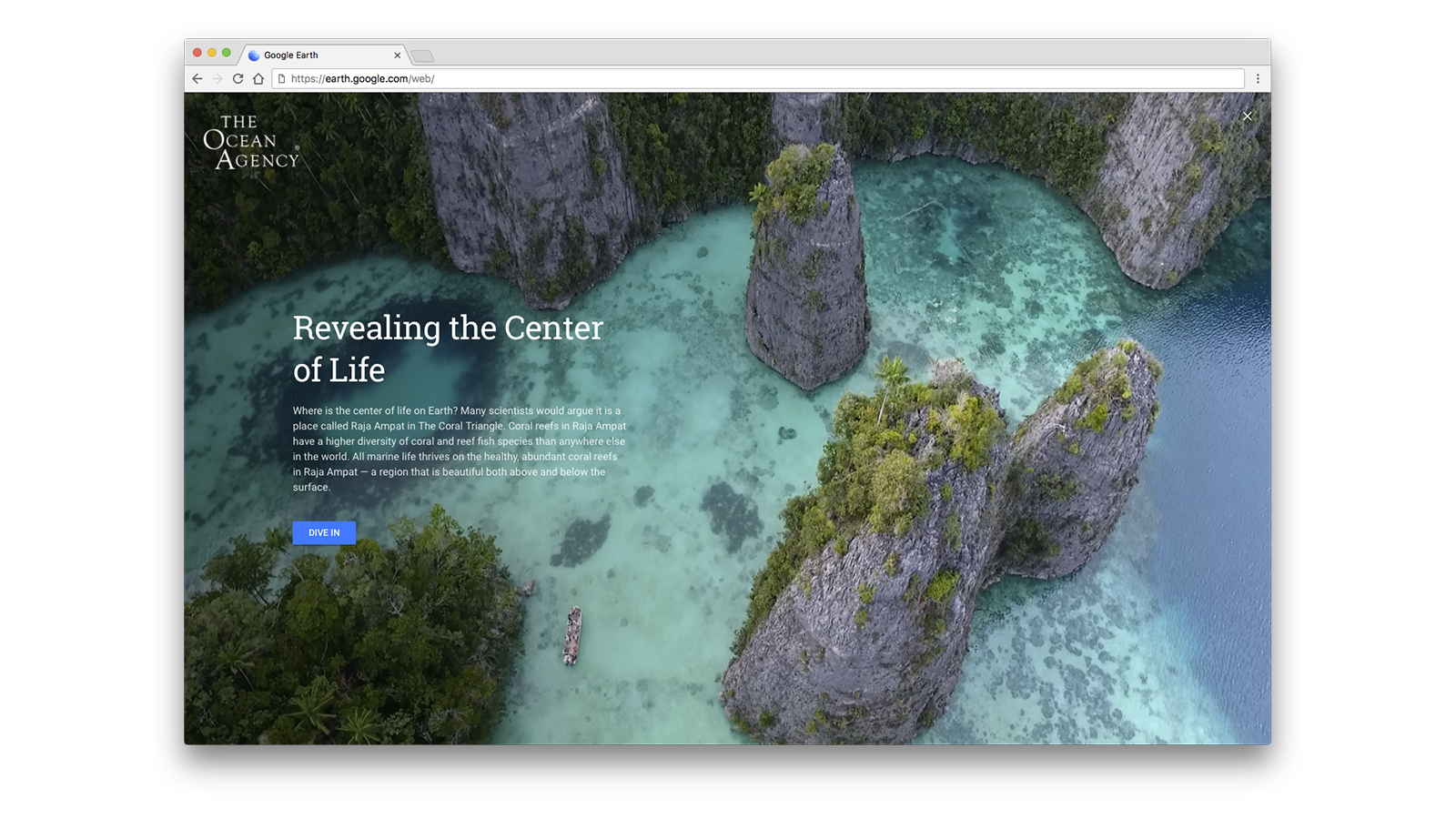
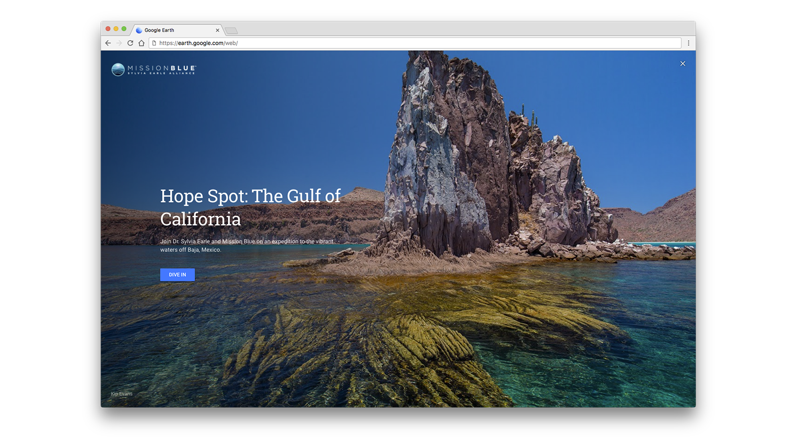
While there are many resources for distance learning for both kids and adults—such as Google’s new information hub Teach from Home and the Learn@Home YouTube channel—sometimes all you need is a quick activity that doesn’t require much prep. And one place you’re sure to find that is Google Earth.

Here are four easy ways anyone can use Google Earth as a learning tool or even simply to experience new places and adventures while staying safe at home.

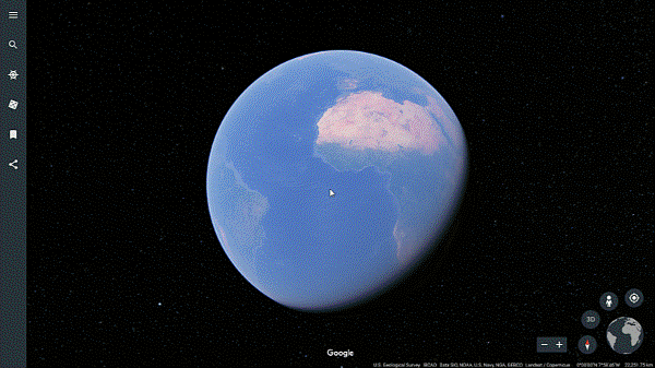
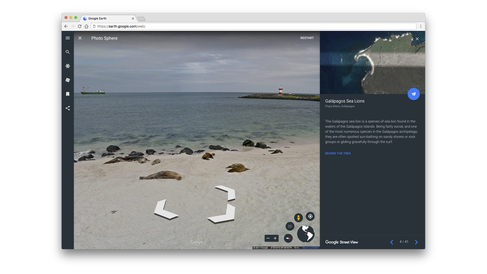
Take a spin around the globe with the “I’m Feeling Lucky” button

Google Earth’s “I’m Feeling Lucky” feature recreates the feeling of spinning a globe and dropping your finger down somewhere unexpected. With a click of the “dice” button, you can learn about the world and travel to unexpected destinations.

Google Earth's I'm Feeling Lucky feature

Uncover hidden gems the world over with “I'm Feeling lucky,” a feature that takes you somewhere unexpected with the click of a button.

Measure the world 

If you’ve ever wondered how far your home is from Machu Picchu or what the nautical miles between Easter Island and Hawaii are, you’re in luck. With Google Earth’s measure tool, you can easily discover the distance between locations, along paths and the area of places. Challenge yourself by changing the unit of measurement, perhaps to a smoot, and figure out how long it would take for you to walk, boogie, swim, paddle or fly to a place you love.
Google Earth's Measure Tool

Use lines and shapes to check distances and estimate sizes of different features on Earth

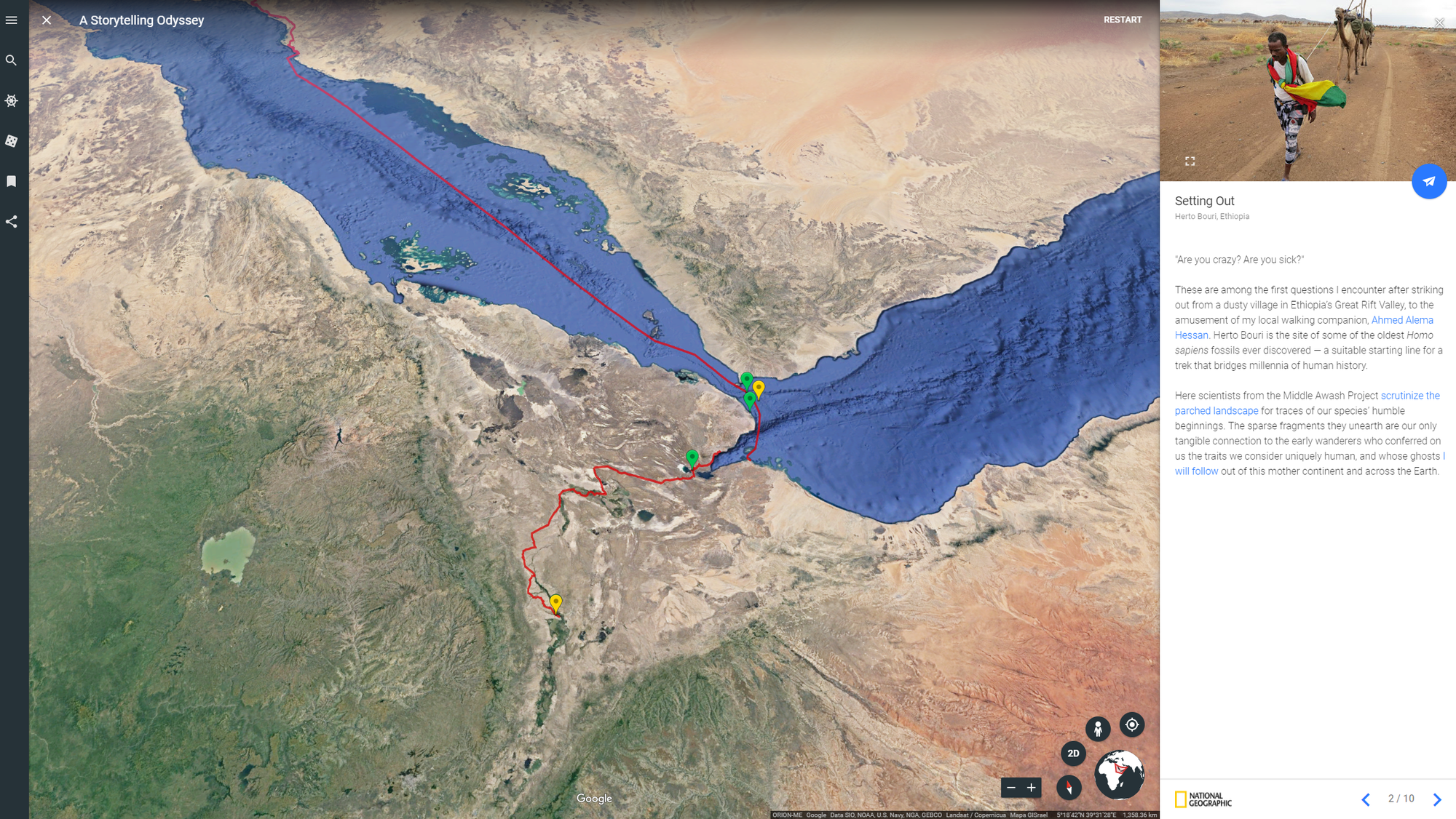
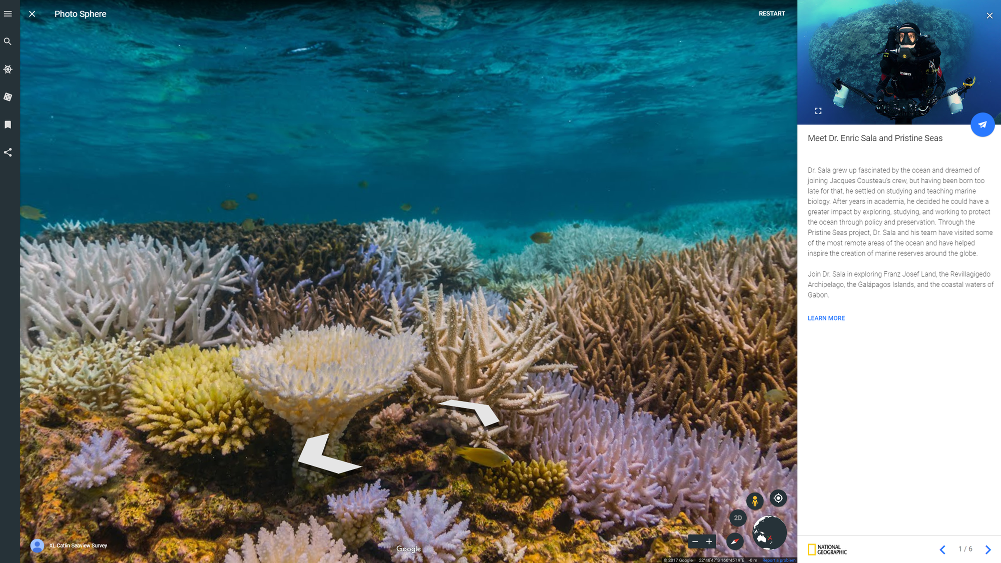
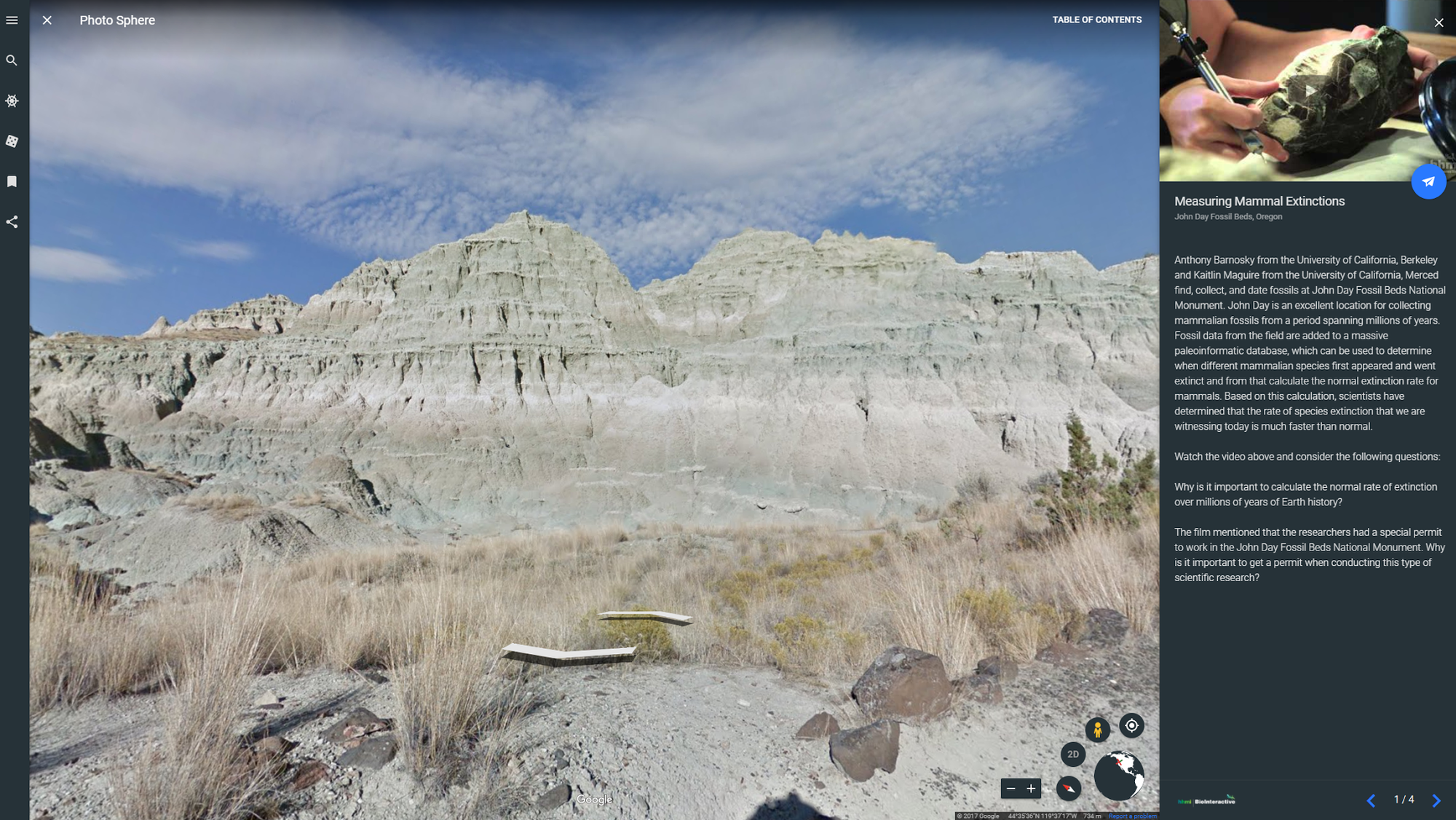
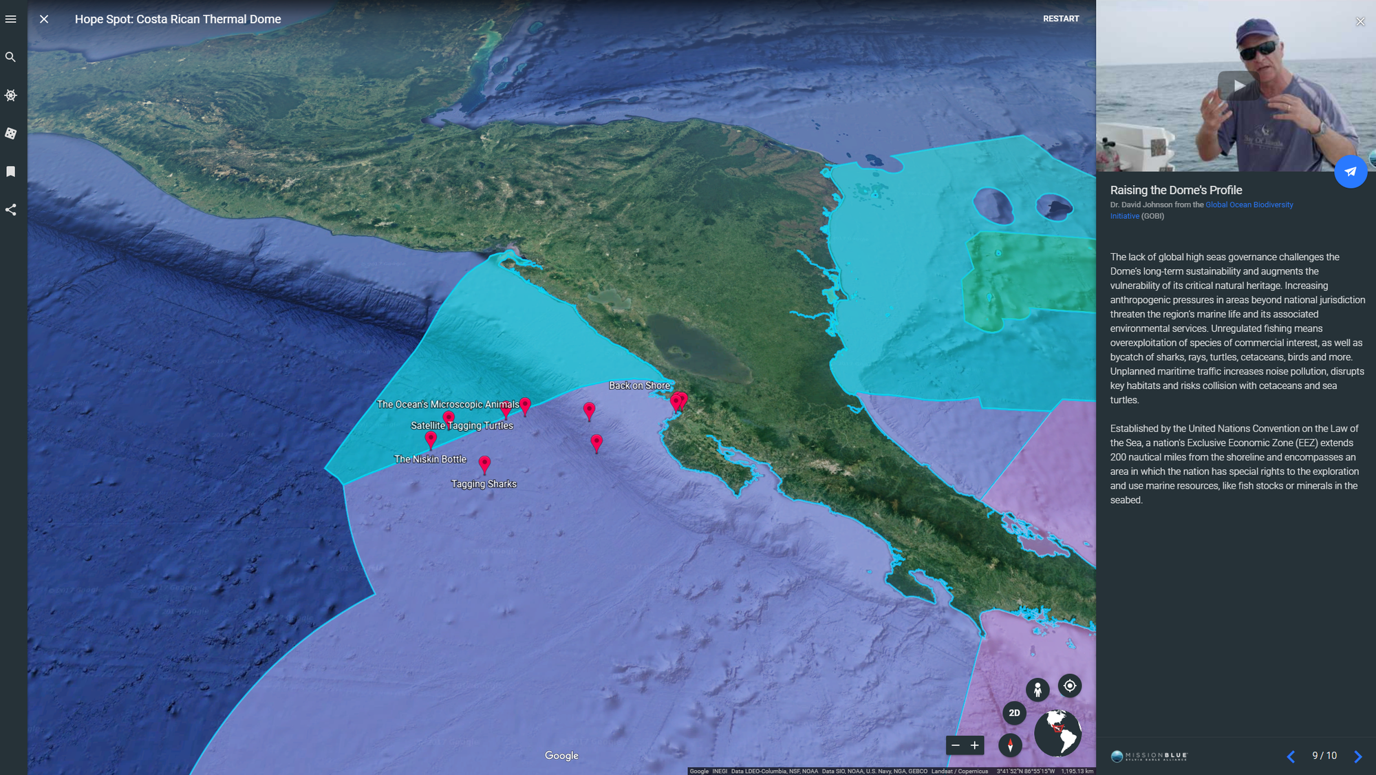
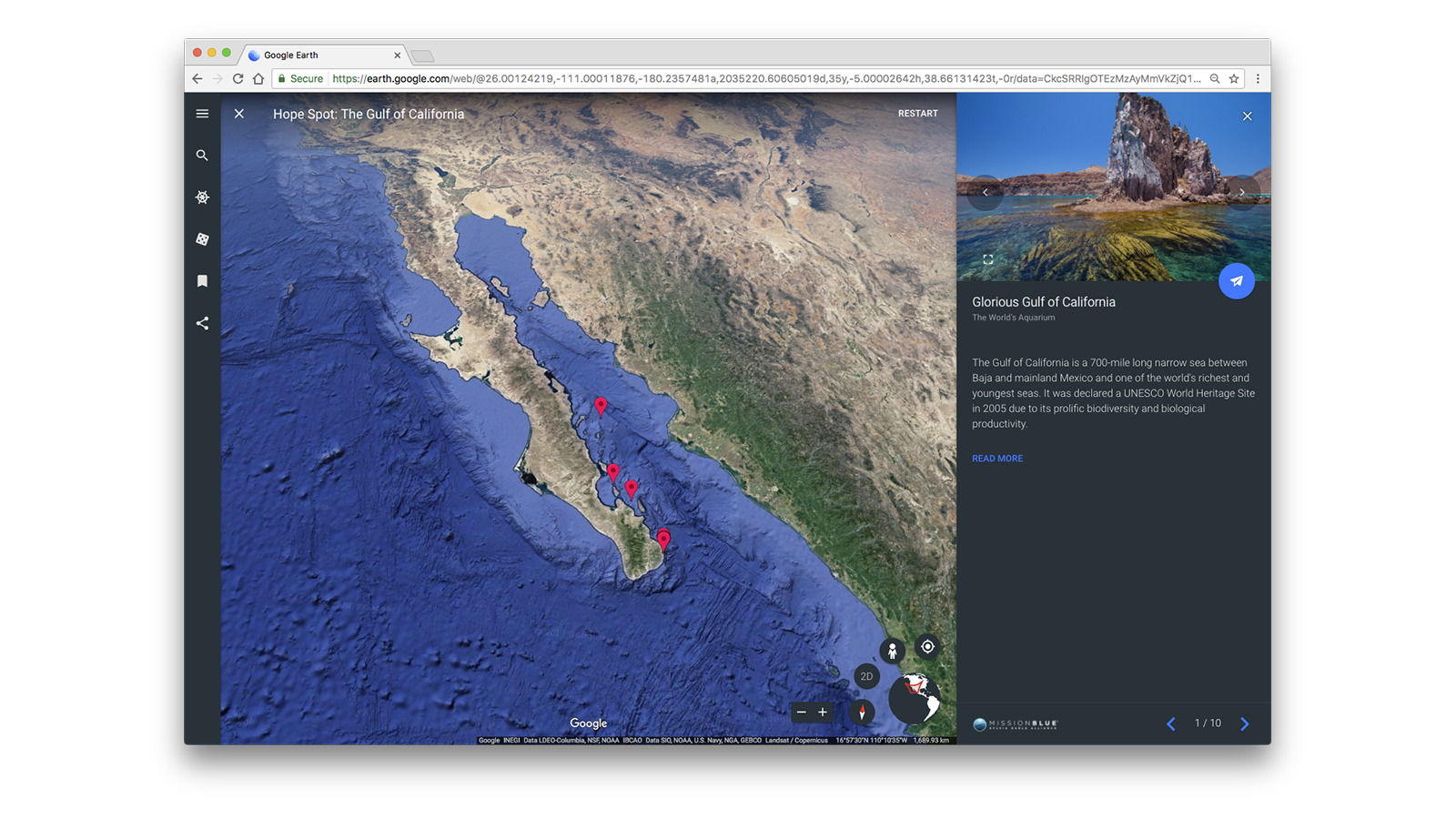
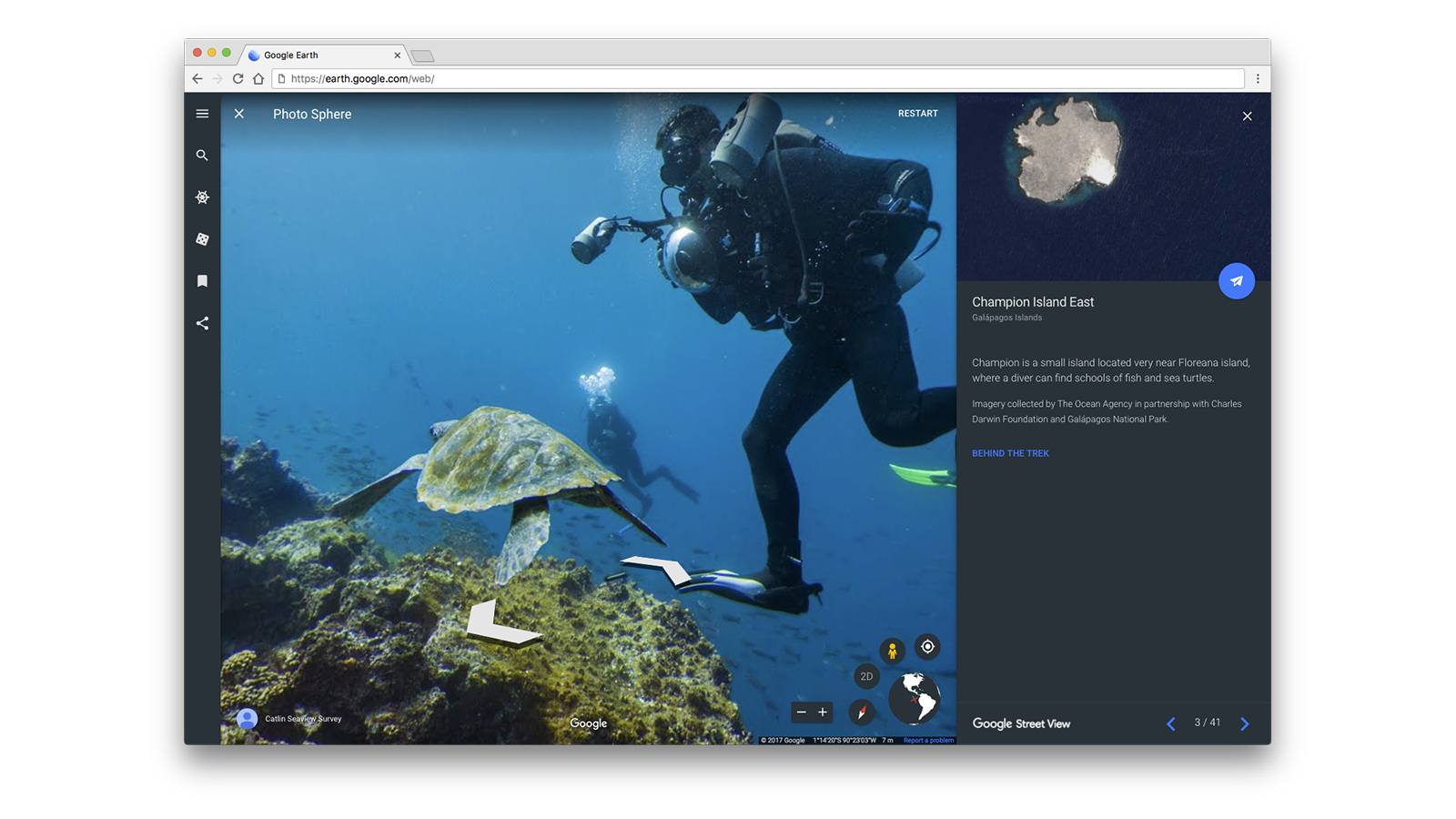
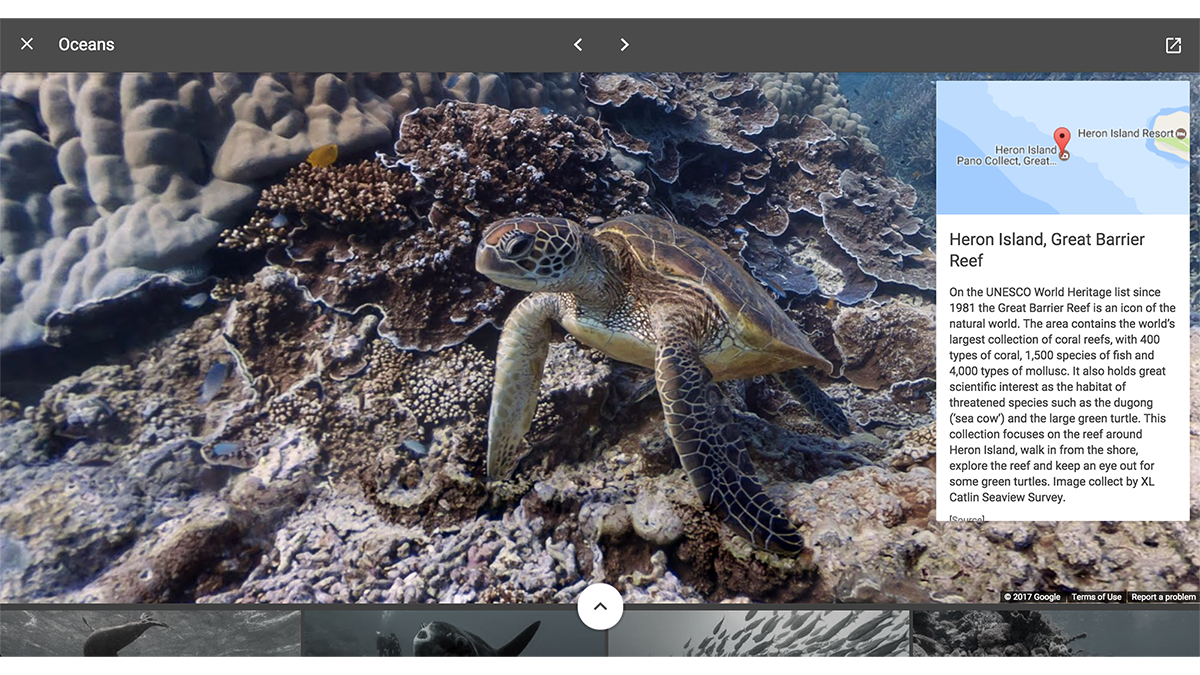
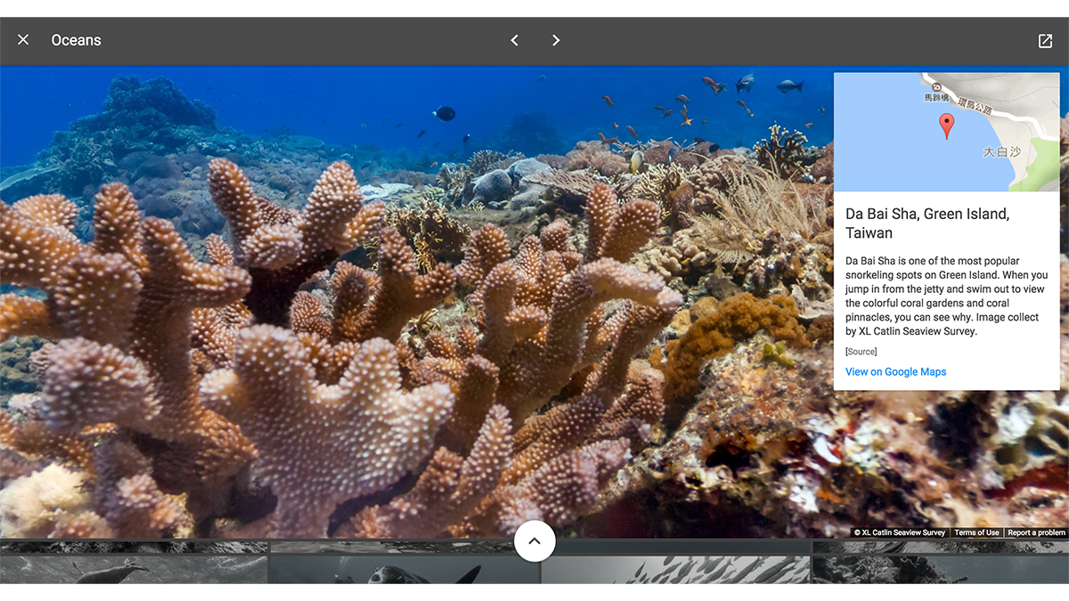
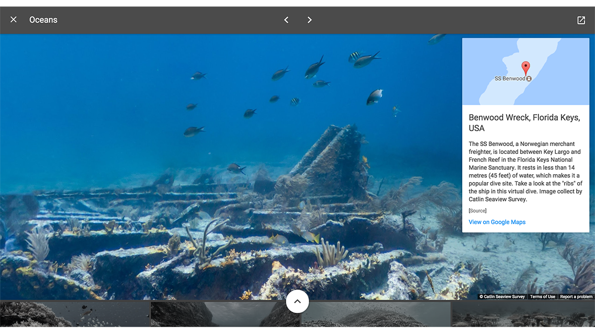
Explore Google Earth Voyager games and imagery

How well do you know the world’s national parks? What about the sound a penguin makes? With a few clicks, you can test your knowledge  on national parks, animal sounds or space exploration. You can even travel the world with Carmen Sandiego.
Carmen Sandiego in Google Earth

Join Carmen Sandiego in a globe-trotting game and learn about new places, cultures and customs

Students can also try a round of Earth Bingo or discover the ABCs using satellite imagery. Also, think about using Street View to put a digital spin on the game “I spy with my little eye” and look for objects in the online version of students’ streets and neighborhoods, or take the classic game for an artistic spin inside of a museum.


Visit Google’s education partner websites

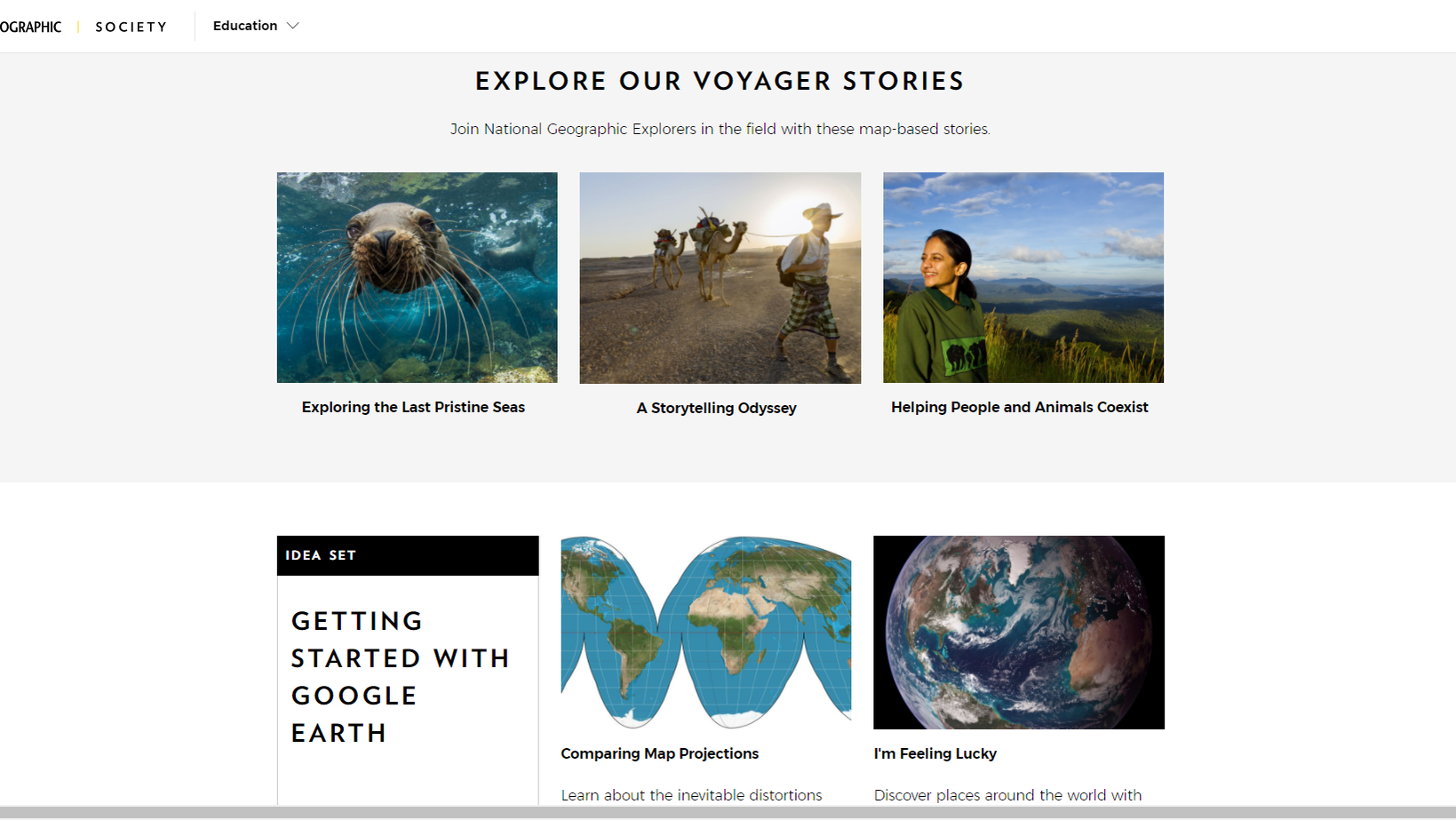
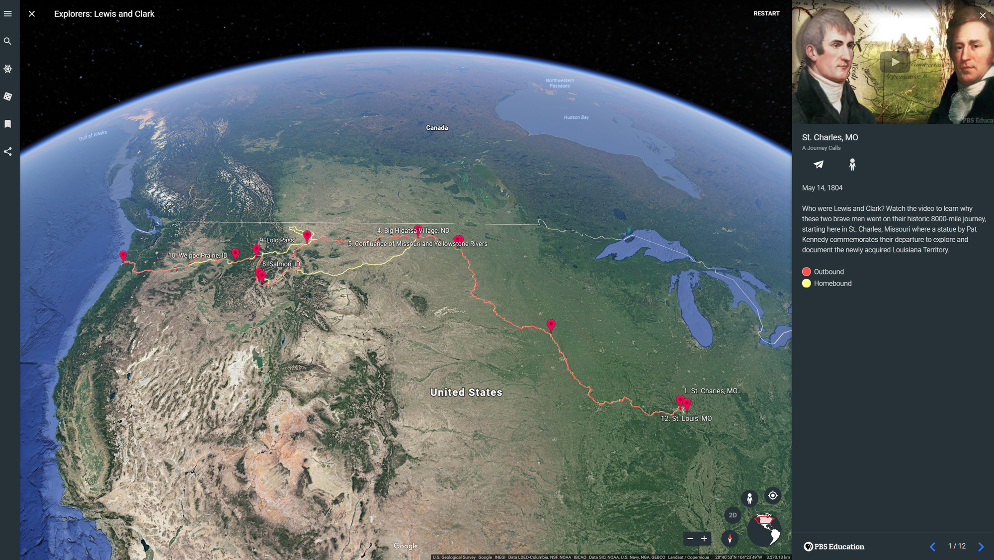
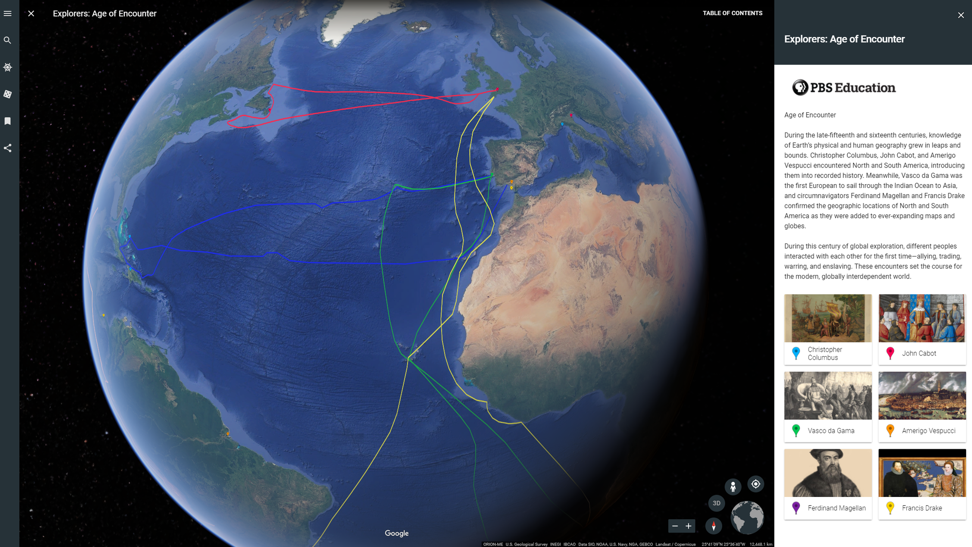
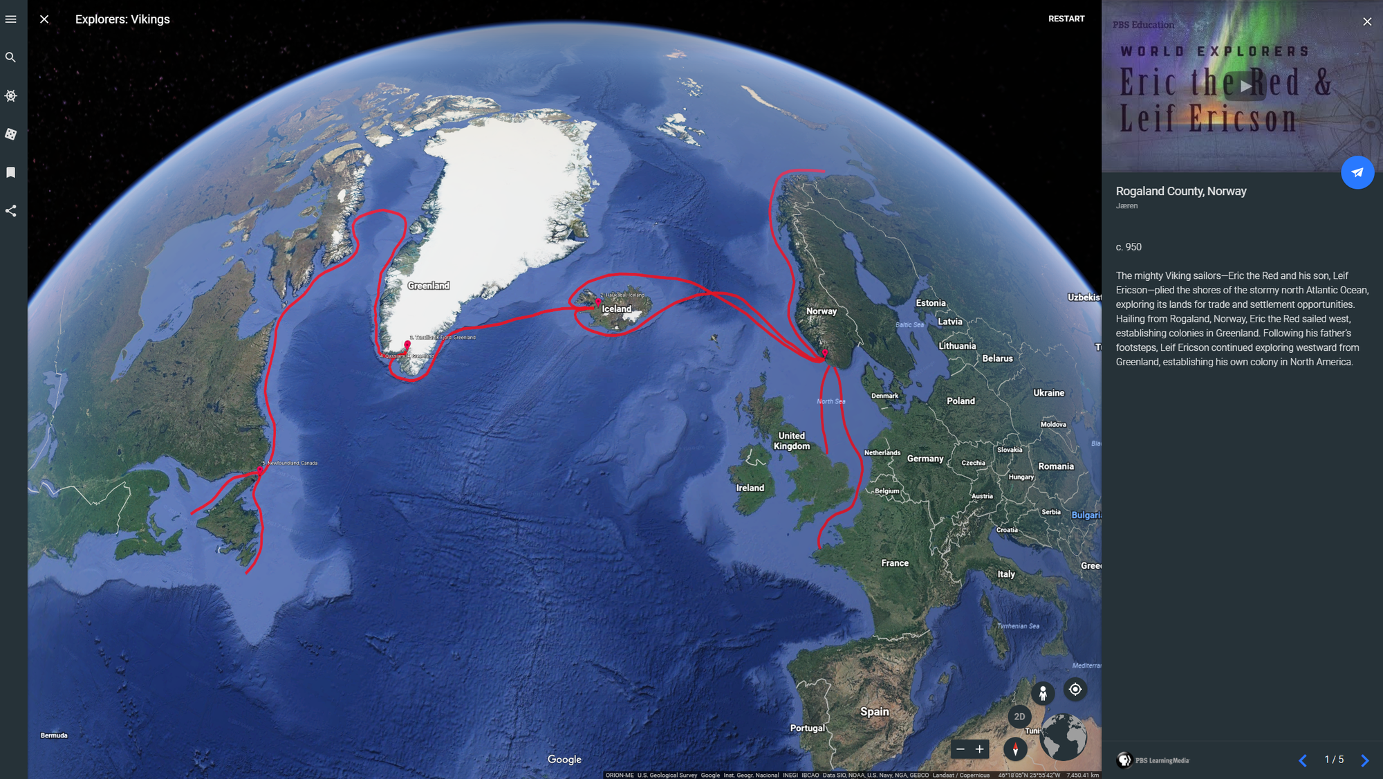
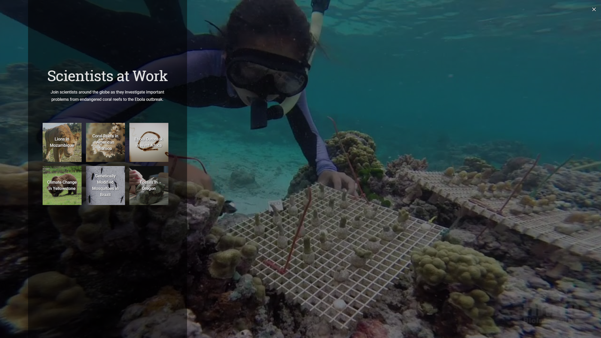
Many of the authors of our Voyager stories have free online resources and activities that use Google Earth. Students can hone their geo-literacy skills and gain inspiration with National Geographic. A click of the “Share to Google Classroom” button will bring PBS Learning Media’s collection of World Explorers videos and lesson plans to an entire classroom.

Media4Math has developed a collection of resources that give mathematical principles real world context, such as the geometry of castles and circular structures.

Media4Math Triangular Structures Google Earth Voyager story

Learn how triangles are incorporated into famous buildings

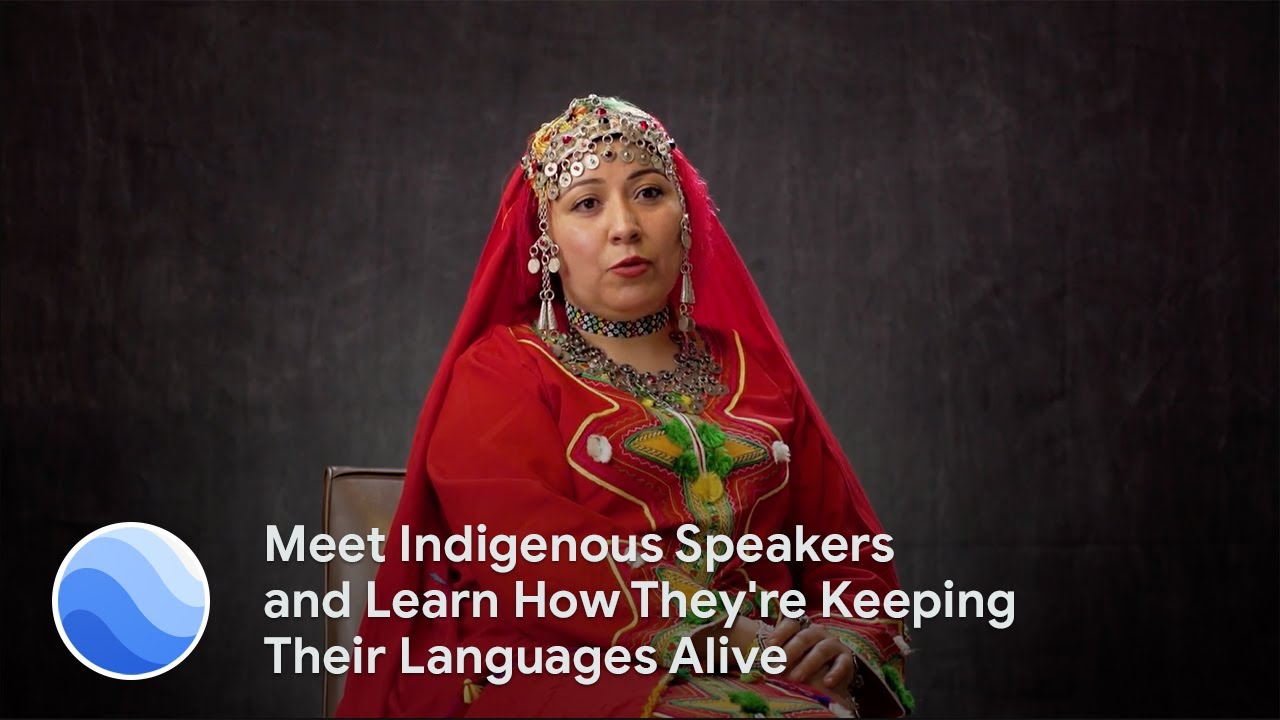
Once you’ve learned about shapes, move onto sound, with the Global Oneness Project curriculum that explores the linguistic diversity and vitality of indigenous languages from speakers around the world. The curriculum is a companion to the Google Earth audio collection, Celebrating Indigenous Languages.

Meet Indigenous Speakers and Learn How They're Keeping Their Languages Alive

You can find more Google Earth resources and classroom activities on the Google Earth Education website, as well as TES, a resource hub with plenty of home learning essentials. Educators looking to connect with other teachers to share ideas on using Google Earth and mapping tools in the classroom can check out the new Google Earth Education Community Forum, and continue to follow Google Earth on Twitter and Facebook.

Google Earth education resources

Google Earth, class is now in session

So much of what students learn in the classroom—from social studies to history, science and literature—relates to a geographic place on Earth. Recently, we announced a new version of Google Earth, and since then, educators have been telling us what a valuable tool Google Earth is for their students. They use the “I’m feeling lucky” feature to inspire writing exercises, do research exercises with Knowledge Cards, and explore satellite imagery and cloud strata with their students. Now, to make it even easier for teachers to use Google Earth in the classroom, we’ve created a new “Education” category in the Voyager section, which includes new stories—complete with classroom activities—from National Geographic Society, PBS Education, HHMI Biointeractive and Mission Blue.

Edu-category600px.gif
Just click the new "Education" category on the Voyager homepage for new stories, complete with classroom activities for teachers

The National Geographic Society stories take students on adventures following explorers through the Middle East, India, and coral reefs. To supplement the experience, National Geographic Society created idea for activities that highlight a range of geographical concepts, such as interpreting land forms and comparing map projections.

With PBS Education, classrooms can go back in time and track the paths of famous explorers, from Lewis and Clark to the Vikings. As students follow along, they, in turn, become modern-day explorers.

HHMI Biointeractive and Mission Blue created Voyager stories more geared towards science and math. With HHMI Biointeractive, students join “Scientists at Work” as they investigate important problems, from endangered coral reefs to the Ebola outbreak. And Mission Blue’s story teaches students about the unique oceanographic conditions of Costa Rica thermal dome. Short videos and questions embedded in the stories will help guide students with their own scientific research.

Educators everywhere can find classroom activities (created by teachers, for teachers) at our new Google Earth Education website, and easily share locations and stories directly to Google Classroom. In addition, this week Google Earth will become an Additional Service for Google for Education users, which can be managed by IT administrators through the Google Admin console.

Google Earth was built to inspire curious minds to explore, learn and care about our vast, fragile planet. With these updates, we’re excited to make it easier for the next generation to see the world from a new perspective.

Source: Education


Google Earth, class is now in session

So much of what students learn in the classroom—from social studies to history, science and literature—relates to a geographic place on Earth. Recently, we announced a new version of Google Earth, and since then, educators have been telling us what a valuable tool Google Earth is for their students. They use the “I’m feeling lucky” feature to inspire writing exercises, do research exercises with Knowledge Cards, and explore satellite imagery and cloud strata with their students. Now, to make it even easier for teachers to use Google Earth in the classroom, we’ve created a new “Education” category in the Voyager section, which includes new stories—complete with classroom activities—from National Geographic Society, PBS Education, HHMI Biointeractive and Mission Blue.

The National Geographic Society stories take students on adventures following explorers through the Middle East, India, and coral reefs. To supplement the experience, National Geographic Society created idea for activities that highlight a range of geographical concepts, such as interpreting land forms and comparing map projections.

With PBS Education, classrooms can go back in time and track the paths of famous explorers, from Lewis and Clark to the Vikings. As students follow along, they, in turn, become modern-day explorers.

HHMI Biointeractive and Mission Blue created Voyager stories more geared towards science and math. With HHMI Biointeractive, students join “Scientists at Work” as they investigate important problems, from endangered coral reefs to the Ebola outbreak. And Mission Blue’s story teaches students about the unique oceanographic conditions of Costa Rica thermal dome. Short videos and questions embedded in the stories will help guide students with their own scientific research.

Educators everywhere can find classroom activities (created by teachers, for teachers) at our new Google Earth Education website, and easily share locations and stories directly to Google Classroom. In addition, this week Google Earth will become an Additional Service for Google for Education users, which can be managed by IT administrators through the Google Admin console.

Google Earth was built to inspire curious minds to explore, learn and care about our vast, fragile planet. With these updates, we’re excited to make it easier for the next generation to see the world from a new perspective.

Source: Google LatLong


Dive into World Oceans Day with Google Earth and Maps

This World Oceans Day, explore our oceans and learn from experts leading marine conservation efforts around the world with Street View and Google Earth.

We hope these stories and sights will inspire you to get involved and help protect our vast and fragile oceans. So jump on in, the water’s fine!Start your underwater adventure in Voyager. With the Ocean Agency, tour Raja Ampat, Indonesia’s rich marine center containing 76 percent of the world’s coral species and 36 percent of the world’s reef fish species—more than any other marine region in the world. Then head to the Gulf of California with Dr. Sylvia Earle to see leaping mobula rays and learn about efforts to combat shark finning. Finally, head south to swim alongside the playful sea lions of the Galápagos Islands, one of the most biodiverse and unique places on the planet.

Once you’ve gotten your sea legs in Voyager, sail on over to Street View for even more beautiful blues. Go tete-a-tete with turtles in the Great Barrier Reef off Heron Island, Australia, snorkel through colorful coral in DA Bai Shah, Taiwan, and enroll yourself in a school of fish in Bali.

We hope these stories and sights will inspire you to get involved and help protect our vast and fragile oceans. So jump on in, the water’s fine!

Photo credit for header image of Raja Ampat: Jayne Jenkins

Bring the world’s changing forests inside the classroom

Forests are the mighty lungs of our planet. They absorb carbon dioxide, and emit oxygen on which all people and animals on Earth rely. For the sake of our future, it is critical that all people, including the next generation, understand our global forests in order to manage them sustainably. Today, Science in the Classroom, Dr. Matt Hansen of the University of Maryland, and Google Earth Engine are presenting Global Forest Change Explorer to help engage young people in forest conservation.

Changing Forests_2.png
Fly to different parts of the world and compare data. 

The Global Forest Change Explorer website contains maps that are available for interactive analysis as well as an accompanying activity worksheet. The Explorer Tool allows students to quickly visualize trends in forest loss and gain, compare different countries and ecoregions, and apply the forest data to try to predict underlying causes where there is significant change in forest density. The Explorer Tool relies on open data that is used by remote sensing and GIS professionals in their work.

A number of years ago, Dr. Matt Hansen and a team of researchers at the University of Maryland turned to Google Earth Engine to map high-resolution global forest cover with Earth Engine's cloud-based image processing and computing. The team mapped global forest loss and gain from 2000 to 2012 at 30-meter resolution for the entire globe. In 2013, the methods and results were published in Science Magazine and online for everyone to explore. These findings are now an important part of the website Global Forest Watch, which gives governments and decision makers free access to the data and tools required to monitor and manage their forests. 

Changing Forests_4.png
Dr. Matt Hansen presenting at the World Economic Forum 

Science in the Classroom (SitC) thought this was great research to bring into the classroom and make available to anyone online. SitC packages annotated research papers with supplemental teaching materials to help pre-college and college students understand the structure and workings of scientific research. SitC and Google Earth Engine built the Global Forest Change Explorer to make Dr. Hansen’s data accessible to a younger audience.

Changing Forests_3.png

We live in a dynamic world where the pressures of population growth increasingly impact and threaten our forests. However, as technology, open data, and people continue to mobilize, we are given more tools to research the health of our planet. Educators can easily flip their classrooms into science labs by combining SitC materials with Global Forest Change Explorer. With these tools, students will leave sessions with richer understanding of environmental change, more curiosity, and a desire to actively participate in protecting our forests.

Get started with Global Forest Change Explorer today!