Tag Archives: #GoogleMaps

Google Maps update to help Canadians during times of crisis

SOS alerts help you quickly access authoritative, real-time information during times of crisis. Today, we’re improving SOS alerts by adding visual information about natural disasters and a new navigation warning system on Google Maps so Canadians can more reliably know where a disaster is and anticipate where it’s headed. Read on to learn about what’s changing, along with three ways to help you stay connected and informed during times of emergency.

Earthquake shakemaps 

With SOS alerts, you can already see important crisis information—a summary of what’s happening, relevant news stories, emergency phone numbers and websites, Twitter updates from local authorities, and tips to help you find your way to safety. Now, you’ll also be able to see detailed visualizations about earthquakes to give you a better understanding of the situation on the ground.

After an earthquake strikes, tapping the crisis card located on the Maps home screen will lead to a display of the earthquake’s shakemap —a visualization that shows you its epicenter, its magnitude, along with colour coding to indicate how intense the shaking was in surrounding areas. This information can help you quickly assess the reach of the earthquake and identify areas likely to have experienced the highest impact.

The above image is an example of the crisis-related information Canadians will be able to see after the occurrence of a major earthquake. The above is a depiction of an actual earthquake that took place near Port Hardy, British Columbia, in 2014.

When you’re outside of the impacted area, you may still want to see these visualizations and other crisis details. Searches on Google for relevant terms—like the name of the disaster or the location—will display an SOS Alert that provides the same overview in addition to features like donation opportunities when they’re available.

Crisis navigation warnings on Google Maps

In addition, later this summer you’ll see a prominent alert if we think your route may be affected by crisis activity— and when possible, we’ll do our best to route you away from the disrupted area.

Canadians will be able to receive navigation warnings during crises such as earthquakes. 

During a crisis, every minute matters. Here are three other ways you can use Google Maps to stay connected and quickly get the information you need:

  • Share your location: Letting loved ones know where you are is vital during fast-moving, chaotic situations. The crisis card provides the option to share your live location with friends and family for as little as 15 minutes, or until you decide to stop sharing. 
  • See and report road closures: Turn on the traffic layer to see all known and suspected road closures in an area. If you encounter a closure on your drive, you can report it to help others nearby. You can also confirm whether or not a road is still closed with a quick tap on Android. 
  • Share crisis information directly with the ones you care about: Tap on the share button from the crisis card to keep friends and family up to date about the situation. They’ll be directed to Google Maps where they’ll see all available crisis information - which could include a summary, visualizations, emergency contact information, and more. 
Earthquake shakemaps will start rolling out in the coming weeks on Android, iOS, desktop, and mobile web.

Take your own journey: Experience one of Parks Canada’s breathtaking destinations with new Google Street View imagery


Authored by the Honourable Catherine McKenna, Canada’s Minister of Environment and Climate Change and Minister responsible for Parks Canada

Every year, on April 22, people around the world celebrate Earth Day in support of the environment. What better time to launch new Google Street View imagery, featuring some of Parks Canada’s most awe-inspiring places. As a result of the long-term collaboration between two iconic organizations - Google and Parks Canada, virtual visitors can explore mountain-top vistas, meandering ocean-side trails, and UNESCO World Heritage sites.

Our national parks represent the best that Canada has to offer and are gateways to nature. This new Google Street View imagery introduces you to some of the incredible wonders of Canada’s vast network of protected wilderness and encourages you to discover more. It may even inspire you to visit. I can promise you incredible memories that will last a lifetime if you do.

The new Google Street View imagery is also a reminder that we have a collective responsibility to protect the natural world. As we continue to see the impacts of climate change on our land and water, the need to protect them only increases. Allowing more people to see these treasured places will help build appreciation for them and future stewards to help protect them.

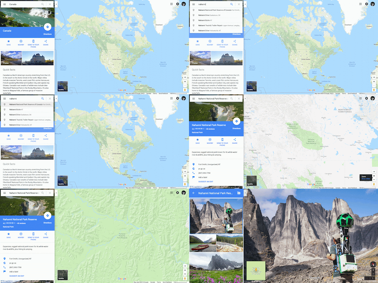
This latest Google Street View release includes stunning images of Nahanni National Park Reserve (Nahʔą Dehé, Northwest Territories). The park touches the Boreal Cordillera Ecozone, is globally renowned for its geological landforms, and its natural heritage is internationally recognized by UNESCO. Virtual visitors anywhere can experience Virginia Falls, also known by the Dene name, Náįlįcho. They can also explore the amazing Rabbitkettle (Gahnîhthah) mineral springs and tufa mound, and rock climbing mecca, the Cirque of the Unclimbables.

Enjoy the rugged backcountry, mountain climbs, and a hot spring of one of our newest (and least-visited) national parks - Nááts'ı̨hch'oh National Park Reserve (Northwest Territories) that have been captured on Google Street View. The park is named after Nááts'ı̨hch'oh the mountain, which is a powerful place for the people of Sahtu, and is located in the traditional lands of Shúhtaot'ine (Mountain Dene). The imagery captured of the park will include highlights of Hamlet of Tulita, a fly-in access only community that is the main base of operations for Nááts'ı̨hch'oh.

Wonders from Banff National Park (Alberta), Pacific Rim National Park Reserve (British Columbia), Terra Nova National Park (Newfoundland), and Glacier and Mount Revelstoke national parks (British Columbia) have also been published as part of this release for you to explore and experience virtually.

Parks Canada preserves the sensitive ecosystems of our national parks, while providing Canadians with unparalleled opportunities to connect with nature. And Parks Canada works with Indigenous peoples to protect these treasured places and shares their stories with the world. I hope that experiencing this new Google Street View imagery will provide a better appreciation and understanding of the importance of our national parks. I encourage you to take the journey with Parks Canada and Google to learn about Canada’s natural, cultural and Indigenous heritage, and start dreaming about your next trip.

 Happy (early) Earth Day!

Get ready to explore our national parks and historic sites on #ParksDay!

Editor’s note: Today’s blog is authored by Michael White who works in the Brand Experience Branch at Parks Canada and leads the Agency’s collaboration with Google Maps

Outdoor adventures are the heart and soul of the Canadian summer and there’s no better way to get outside and experience the wonder of our country than with a trip to one of our national parks, national marine conservation areas or national historic sites.

Once again we’ve teamed up with Google to capture more 360 degree imagery from these amazing Parks Canada places. New Street View imagery of  dozens of National Parks and Historic Sites  launches today on Google Street View just in time for Parks Day (July 16th), the annual celebration of Canada’s amazing natural and historic places.


Parks Canada employee collecting Street View imagery from the Bullion Plateau in Kluane National Park and Reserve

Whether you’re planning to spend a day hiking and swimming, planning a week of camping, canoeing and portaging, or travelling back through time in one of Canada’s national historic sites, our parks and historic sites from coast to coast to coast will remind you why Canadian summers are the best summers.

Many Canadians enjoy camping in the great outdoors while visiting one of Canada’s national parks, and when it comes to camping, Canadians have got a lot of questions…

64d1409c2d3ecb78f76de1cc14f90037.png

Luckily, Parks Canada has resources to help you plan your camping adventure!

Get started with our Learn to Camp program, which is available in French, English, Chinese (standard and simplified), Punjabi, Spanish and Tagalog. From what to wear and what to bring, to tasty, trail-tested recipes, we’ve got you covered. In the spring of 2017 Parks Canada will also launch an expanded Learn to Camp program that will ensure more low and middle-income families will have an opportunity to experience Canada’s outdoors.  Stay tuned for more information.You can also download the Learn to Camp app for Android and iPhone to reference onsite as needed.

Before you get packed, you can also check out our YouTube channel in both English and French to learn how to set up a tent, how to build a campfire and our tips for planning your trip and camping with wildlife.

Then head over to Google Street View to check out the new images of places like Chilkoot Trail National Historic Site and Kluane National Park in the Yukon, Gwaii Haanas National Park Reserve, Haida Heritage Centre or Gulf Islands National Park Reserve in British Columbia, Banff and Jasper National Parks in Alberta, Batoche National Historic Site in Saskatchewan, Riding Mountain National Park in Manitoba, Pukaskwa and Georgian Bay Islands National Parks in Ontario, Forillon National Park and Saguenay St. Lawrence Marine Park in Quebec, Fundy National Park in New Brunswick, Kejimkujik National Park Seaside or Cape Breton Highlands National Park in Nova Scotia or L’Anse aux Meadows National Historic Site and Gros Morne National Park in Newfoundland and Labrador, and get excited about the great Canadian outdoors this Parks Day!

Posted by Michael White, Parks Canada