It’s easy to take for granted how much information about the world is now available at our fingertips. But it wasn’t long ago that traveling to a new place meant fumbling through sheets of turn-by-turn instructions while trying to keep one hand on the steering wheel, with no way to anticipate how bad traffic would be or find a restaurant along the way. It was around that time, 15 years ago, that Google Maps set out on an audacious goal to map the world.
I remember seeing early versions of Google Maps and being amazed at how easily you could scroll, zoom and search the world. One of my earliest memories of working on Google Maps was as a member of our user experience team, which designs and improves the usability of our products. In a world before smartphones, one of the biggest questions that we agonized over was where to put the Print button on the page so that people could easily take their directions on the go.
Needless to say, a lot has changed. Google Maps has mapped more than 220 countries, surfaced information for about 200 million places and businesses, and helped billions of people get from point A to point B with confidence. In the beginning, we focused on answering the question: “How do I get from here to there?” Over time, our mission has expanded from helping you navigate to also helping you discover the best places to go and things to do once you’re there. As we celebrate our birthday this week, we’re reflecting on how the definition of what a map can do has broadened, and how machine learning will propel us forward from here.
Navigating the world: From simple directions to Live View
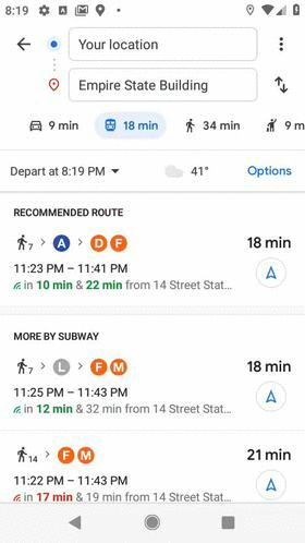
Fifteen years ago, printing out directions was considered state-of-the-art. So the idea of getting turn-by-turn driving navigation from your phone while on the road seemed revolutionary. In 2009, Google Maps pioneered turn-by-turn mobile navigation, and we’ve since added directions and navigation for walking, transit, bicycles, two-wheelers, and more--all with the goal of helping you with every trip across every mode of transportation. Since people increasingly use a mix of transportation options in a single trip--like walking to the train station and then taking a rideshare to their final stop--one of our next challenges involves stitching together these navigation options and ETAs for a more seamless experience.
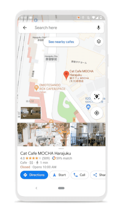
Directions alone aren’t enough. We’re also helping you get there faster and more comfortably by arming you with relevant real-time information like live traffic alerts, predictions for how crowded your bus will be and which bike-sharing locations have available bikes. And we’ve used technology like augmented reality (AR) to help bring the map to life in helpful ways. Last year we introduced Live View, which uses AR, AI and your smartphone camera to show you your surroundings with the directions overlaid. It solves the real pain point of walking halfway down the block toward a place only to realize you’re going the wrong way (I’ve definitely been there!).
Exploring the world once you get there
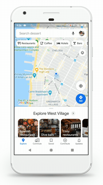
We’ve always fundamentally believed that a map is much more than masses of land and sea, that a city is more than a web of streets. After all, the things that make my hometown shine are the brunch spot with my favorite veggie scramble, the pet salon that keeps my dog happy while he gets a trim, and the pizza spot with the foosball table that keeps my kids entertained while we wait. A truly helpful map reflects all of those local insights and helps you find places and experiences that are right for you—so that’s been a big focus for us over the last few years.
Until recently, if you were looking to grab a slice of pizza, you’d get a list of 20 nearby pizza joints. (And way before that, you’d have to search in advance on a desktop to get the list, or if you were already out of the house you had to roam streets seeking the smell of melted cheese!) Now, we can help you find all of the pizza spots nearby, when they're open, how crowded they’ll be, and which one has the best toppings. Once you’ve decided where to go, you can easily make a reservation or call the restaurant.
Doing this well at scale requires a deep understanding of businesses and places—which is where our active community of users comes in. Every day, people contribute more than 20 million pieces of content to Google, like photos, reviews and ratings. These contributions continually make our map richer and more helpful for everyone. They also power features like popular dishes at restaurants, up-to-date road closures and wheelchair accessible routes. We’re also making it easy for you to get things done at these places within Google Maps—so you can go from finding a yoga studio to booking a class.
The technology propelling the future of Maps
The world is always changing—new roads are added, bus routes are changed and natural disasters alter accessible routes. That’s why a map needs to be updated, comprehensive and accurate. Major breakthroughs in AI have transformed our approach to mapmaking, helping us bring high-quality maps and local information to more parts of the world faster.
For instance, we worked with our data operations team to manually trace common building outlines, then trained our machine learning models to recognize building edges and shapes. Thanks to this technique, we’ve mapped as many buildings in the last year as we did in the previous 10. Elsewhere, machine learning helps us recognize handwritten building numbers that would be hard even for a passerby in a car to see. This is especially important when mapping areas where formal street signs and house numbers are uncommon. In Lagos, Nigeria alone, machine learning has helped us add 20,000 street names, 50,000 addresses, and 100,000 new businesses—lighting up the map with local places and businesses where there once was little detailed information.
The map of the next 15 years
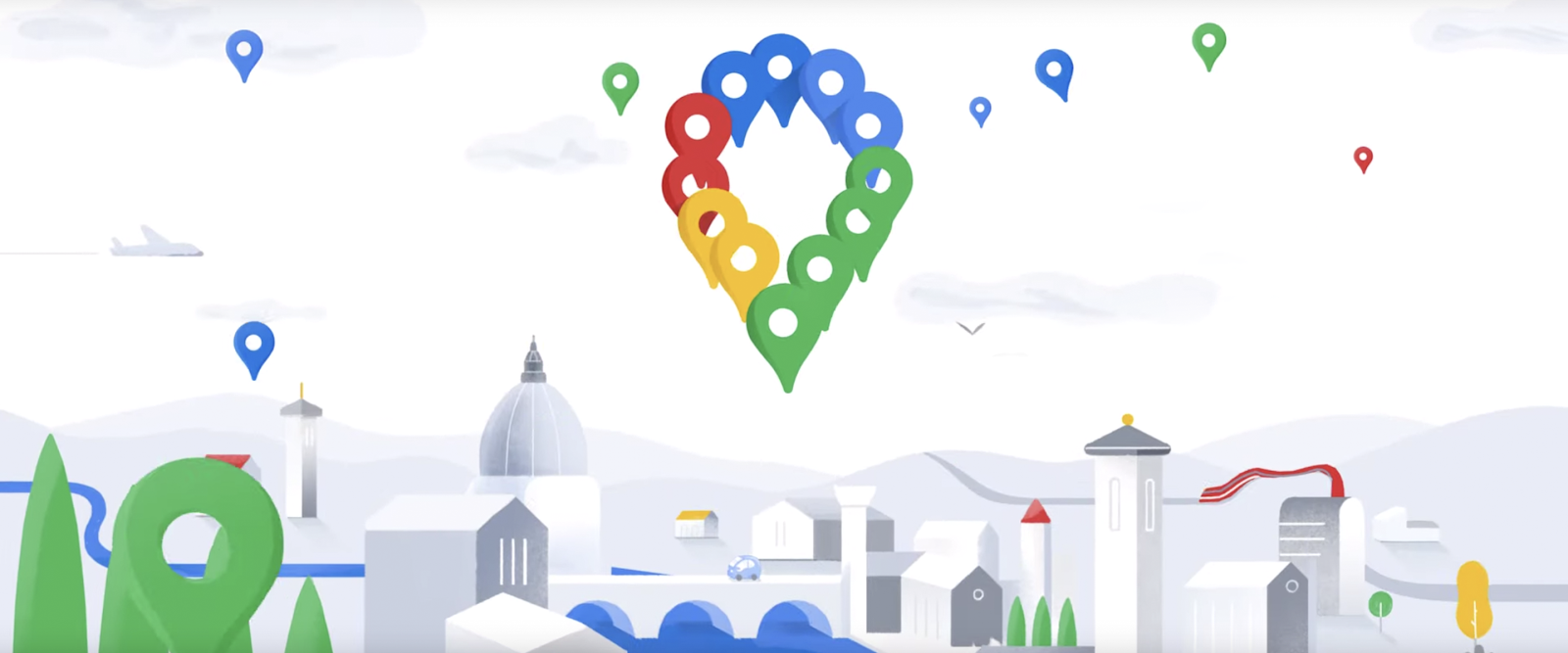
As we celebrate our birthday and look ahead to the next 15 years, we’re rolling out a few new updates, including a refreshed look for the app and more information about your transit rides. And we’ve updated our Google Maps icon to reflect our journey.
When we set out to map the world, we knew it would be a challenge. But 15 years in, I’m still in awe of what a gargantuan task it is. It requires building and curating an understanding of everything there is to know about the physical world, and then bringing that information to people in a way that helps you navigate, explore and get things done in your world. The real world is infinitely detailed and always changing, so our work of reflecting it back to you is never done.
Posted by Jen Fitzpatrick, Senior Vice President, Google Maps