Editor’s note: Today’s guest blogger is Chris Huff, Vice President of Mobile Development at The Weather Channel. Read how The Weather Channel uses Google Maps APIs to power their popular Android app. The Weather Channel is just one of many customers who shared their story as part of our cross-country road trip, Code the Road.
We know from experience that the combination of weather, mapping and community input can result in ideas that keep people safe and informed. Our Android app goes far beyond basic weather forecasting, which is why we chose Google Maps. We use Google Maps Android API, Google Maps JavaScript API and ImageOverlays to place geodata, such as weather alerts, hurricanes, and storm tracks, and weather tiles, such as radar maps and clouds, on top of Google Maps.
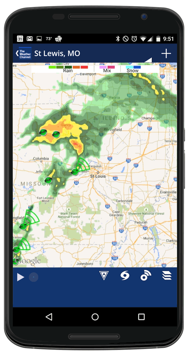
Radar maps are one of the app’s main features, and we work hard to get them right. We get radar imagery from multiple sources and produce raster images from them. Then we take hundreds of the images and animate them in a frame-based animation sequence. The Google Maps Android API gives us overlays to place the animation on top of maps, and also lets us add additional objects such as pins and polygons to visualize lightning strikes or a storm’s direction. You can see an example below.
The more local weather reporting is, the more accurate it is; a thunderstorm may skip one neighborhood but hit another. So to improve accuracy and to build a community around our app, we’ve been working to make it more social. People send us information about weather near them, and we use the Google Maps Android API to add a pin to the map for each user-created report. Anyone can tap a pin to see the detailed report. Here’s an example of social weather reporting.

With more than 68 million downloads, the app has been a tremendous success. We get 2 billion requests for radar maps every year. There’s an old saying that everyone talks about the weather but no one does anything about it. We beg to disagree. With the Google Maps APIs we’re giving people detailed, useful, live information about the weather, and we believe that’s doing quite a bit.
As part of the Code the Road series we hosted the 24-hour hackathon event, “Storm the Road: Hack for Safety with The Weather Channel and Google Maps”, on June 23. The event gave developers an opportunity to come together to create a new app or feature for mobile or web that helps keep the public safe and informed.