Street View imagery has been used for many purposes around the world, from town planning to artistic projects to disaster recovery. It can also be very valuable for scientists looking to better understand a place - even when that place is underwater.
Since the Catlin Seaview Survey first collected underwater imagery of the Great Barrier Reef, they’ve traveled to many other underwater spots around the world to collect a baseline photographic record of the marine environment. Now, they’re teaming up with the Sydney Institute of Marine Science to record and reveal the marine life along Sydney’s famous Harbour and coastline, from Manly to Bronte. The project uses Catlin Seaview Survey’s 360-degree panoramic SVII camera to gather the imagery, which will be published to Google Maps later this year.
Since the Catlin Seaview Survey first collected underwater imagery of the Great Barrier Reef, they’ve traveled to many other underwater spots around the world to collect a baseline photographic record of the marine environment. Now, they’re teaming up with the Sydney Institute of Marine Science to record and reveal the marine life along Sydney’s famous Harbour and coastline, from Manly to Bronte. The project uses Catlin Seaview Survey’s 360-degree panoramic SVII camera to gather the imagery, which will be published to Google Maps later this year.
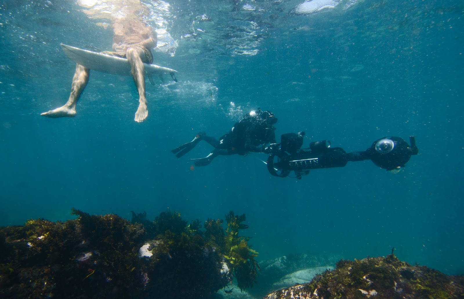
The SVII camera drives by a surfer at North Bondi Beach
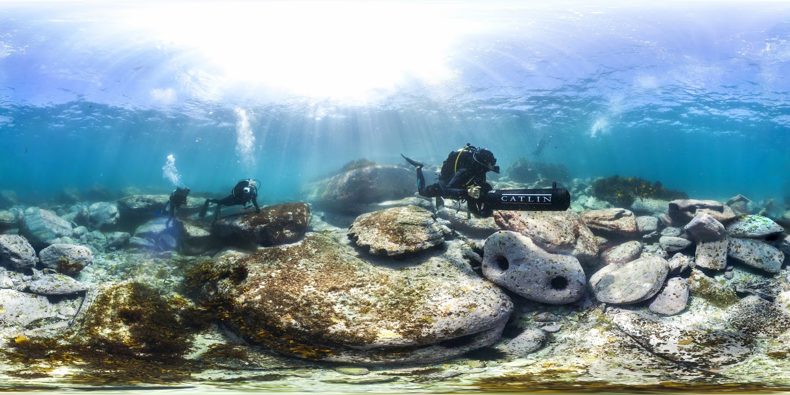
Catlin Seaview Survey team at work in the waters off (North Bondi)
We hope this new Street View imagery not only advances important scientific research, but also inspires people to learn more about the beautiful—and delicate—ecology of Sydney Harbour and our local beaches.
Nabil Naghdy, Product Manager for Google Maps, Australia and New Zealand