With dozens of public satellites in orbit and many more scheduled over the next decade, the size and complexity of geospatial imagery continues to grow. It has become increasingly difficult to manage this flood of data and use it to gain valuable insights. That's why we're excited to announce that we're bringing two of the most important collections of public, cost-free satellite imagery to Google Cloud: Landsat and Sentinel-2.
The Landsat mission, developed under a joint program of the USGS and NASA, is the longest continuous space-based record of Earth’s land in existence, dating back to 1972 with the Landsat 1 satellite. Landsat imagery sets the standard for Earth observation data due to the length of the mission and the rich data provided by its multispectral sensors. Landsat data has proven invaluable to agriculture, geology, forestry, regional planning, education, mapping, global change and disaster response. This collection includes the complete USGS archive of the Landsat 4, 5, 7 and 8 satellites, and the data is updated as new data arrives from Landsat 7 and 8. The collection is updated daily and contains a total of 4 million scenes and 1.3 petabytes of data covering 1984 to the present — over 35 years of imagery of our Earth ready for immediate analysis.
Sentinel-2, part of the European Union’s ambitious Copernicus Earth observation program, raised the bar for Earth observation data, with a Multi-Spectral Instrument (MSI) that produces images of the Earth with a resolution of up to 10 meters per pixel, far sharper than that of Landsat. Sentinel-2 data is especially useful for agriculture, forestry and other land management applications. For example, it can be used to study leaf area and chlorophyll and water content, to map forest cover and soils, and to monitor inland waterways and coastal areas. Images of natural disasters such as floods and volcanic eruptions can also be used for disaster mapping and humanitarian relief efforts. The collection currently contains 970,000 images and over 430 terabytes of data, updated daily.
 |
| Brisbane, Australia, as viewed by Sentinel-2 (ESA) |
One customer that has taken advantage of the powerful combination of Google Cloud and these datasets is Descartes Labs. Descartes Labs is focused on combining machine learning and geospatial data to forecast global crop production. “For an early stage technology startup, satellite imagery can be impossibly expensive,” said Descartes Labs CEO Mark Johnson. “To make accurate machine learning models of major crops, we needed decades of satellite imagery from the entire globe. Thanks to Google Earth Engine hosting the entire Landsat archive publicly on Google Cloud, we can focus on algorithms instead of worrying about collecting petabytes of data. Earth observation will continue to improve with every new satellite launch and so will our ability to forecast global food supply. We’re excited that Google sees the potential in hosting open geospatial data on Google Cloud, since it will enable companies like ours to better understand the planet we live on.”
 |
| Humboldt, Iowa (Landsat 8, USGS) |
 |
| Agricultural field edge boundaries and field segmentation from July 2016 of Humboldt, Iowa, generated using machine learning and Landsat data on Google Cloud. |
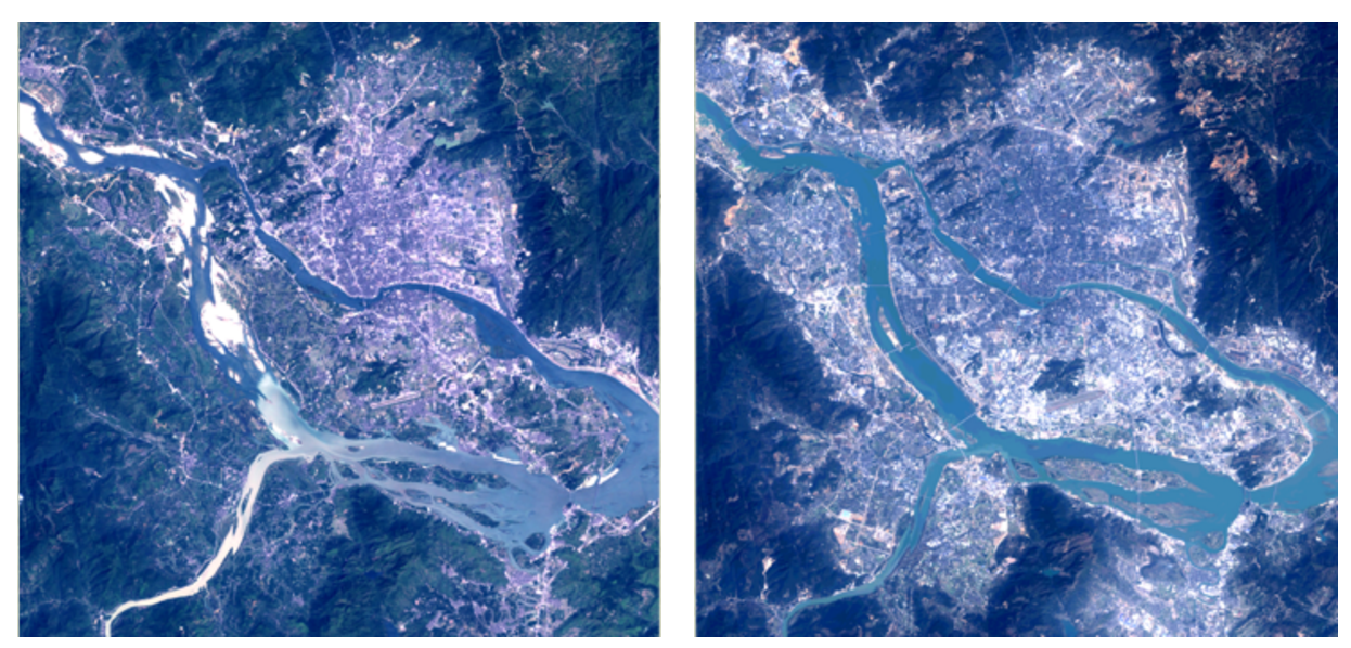 |
Fuzhou, China 2000 (Landsat 7, USGS) Fuzhou, China 2016 (Landsat 8, USGS)
|
Learn more about these new geo imagery datasets at http://cloud.google.com/storage/docs/public-datasets/ and about the full range of public datasets at http://cloud.google.com/public-datasets/.
