Google Maps is great for displaying data. Whether you’re using the Google Maps Javascript API’s Data Layer, Google Maps Engine, or My Maps, you’re able to display a pretty impressive amount of data on top of Google Maps. But don’t you always wish you could display a bit more?
I’ve been working on a way to use new web technology to make some really great, scalable and awesome tools to use with Maps. There’s one new technology that’s pretty good at displaying graphics on the web - WebGL. Using WebGL you can access a user’s graphics card and perform some speedy and big rendering operations. There are some open source libraries that are currently working to bring WebGL and maps closer together and I’ve made something that helps to bring WebGL and Google Maps closer together too.
Currently you can use CanvasLayer.js that Brendan Kenny developed to integrate WebGL and Maps. He showed that off last year at Google I/O but even with CanvasLayer, there’s a bit more work to do to help developers use WebGL with Maps.
That’s where WebGL Layer comes in. It’s an experimental extension I wrote for Google Maps that gives you simple and extensible access to WebGL on a map and it’s really easy to get started. Simply include WebGL Layer and its dependencies on your web page, make a Google Map like you normally would, and then you can add your WebGL Layer.
Just like you’d expect from a Maps Layer you can now load in data. WebGL Layer uses GeoJSON as a data source, but you can extend this as you wish. You can use GeoJSON from your application or GeoJSON from an external source.
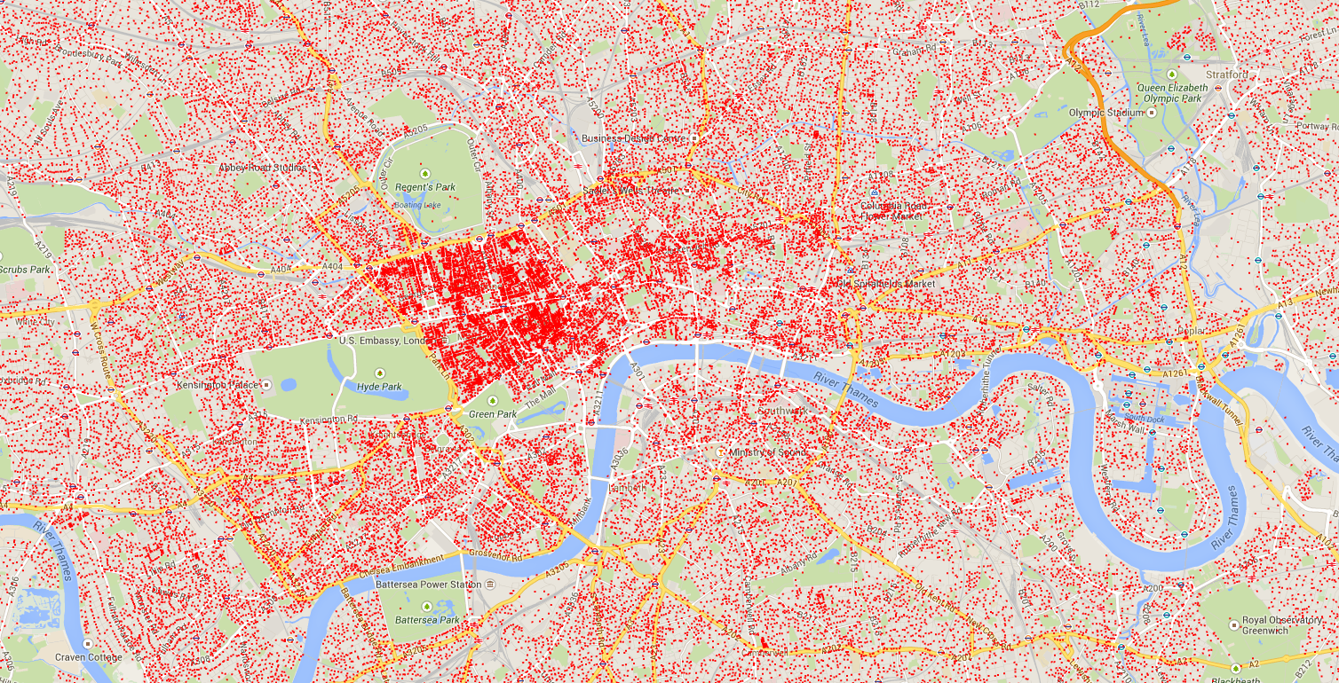
There’s also support for Vector Tile Servers. As WebGL Layer is designed to display huge amounts of data you’ll often run into problems with bandwidth and file size. A great way to get around this is to use Google’s Compute Engine to host your own tile server. One of the builds I liked is a PostGIS database with TileStache in front providing a UWSGI HTTP server for GeoJSON tiles. Once you have your tile server, adding it in is easy.
After you’ve added all your data in, you’re going to want to do something with it, right? WebGL Layer uses an onAddFeature callback that lets you grab a feature after it enters the layer and do some cool things with it.
Let’s say you want to build a robust frontend GIS (Geographic information system). You can integrate with JavaScript Topology Suite to let you do some spatial indexing and querying on your points. You can also use powerful libraries like Crossfilter to do speedy filtering and queries on your data or you can make your own data structure. Once you’ve got your data back you can use the index properties attached to the feature to change some of the internal features.
There are a lot more more examples on the Github repo. Feel free to play around and tinker with WebGL Layer to make your own awesome new maps projects. And as always, we’d love to hear about the new and exciting maps apps you’re building.