There’s a ninth-century Buddhist temple at the heart of an ancient city in Myanmar that’s constructed from red brick and adorned with exquisite plaster moldings softened by weather and age. When a 6.8-magnitude earthquake hit the area in 2016, its walls collapsed and the plaster crumbled. And this is just one temple amongst more than 3,000 pagodas, temples and monasteries in a vast archeological site that sprawls over 65 square kilometers, so assessing the scale of the damage — and how to repair it — was a huge and complex task.
Luckily, the team at CyArk, a Google Arts and Culture partner, were in a position to help. Six months before the earthquake, they had gathered a series of detailed 3D laser scans – or “digital twins” – of Bagan’s cultural sites for a UNESCO conservation project. By creating another set of “twins” in the earthquake’s aftermath, they could compare before and after in precise detail. For the engineers and conservators tasked with repairing Bagan, the data was invaluable.
According to John Ristevski, CEO and chairman of CyArk, the project was one dramatic example of “putting data to work to solve problems.” As the Bagan Lab Experiment shows, the data also served another purpose: bringing ancient heritage to life for new audiences around the world. Google Arts and Culture sat down with John to learn more about how this kind of 3D laser scanning technology, also known as LiDAR, can help preserve cultural heritage, tell captivating stories and make history more accessible.
John, tell us a bit more about LiDAR devices and how they work.
Ben Kacyra, who founded CyArk in 2003 to preserve and celebrate cultural heritage, developed the first mobile LiDAR devices in the mid-nineties. LiDAR stands for Light Detection and Ranging, and these devices use lasers to create incredibly detailed and accurate 3D representations of places that would be hard to describe using other means. Think of the inside of a submarine or an oil refinery, for instance – it would take forever to measure and map these places using traditional methods. A LiDAR device can gather many millions of data points per second.
So it’s safe to say that LiDAR beats a measuring tape and a pencil – but is it enough?
At Bagan, we also used aerial drone photography and photogrammetry, a technique that allows us to build 3D reconstructions that capture the colors and textures of the pagodas and temples in photo-realistic detail. Alongside these, we collected interviews, audio soundscapes and 360-degree video to evoke the atmosphere and history of Bagan.
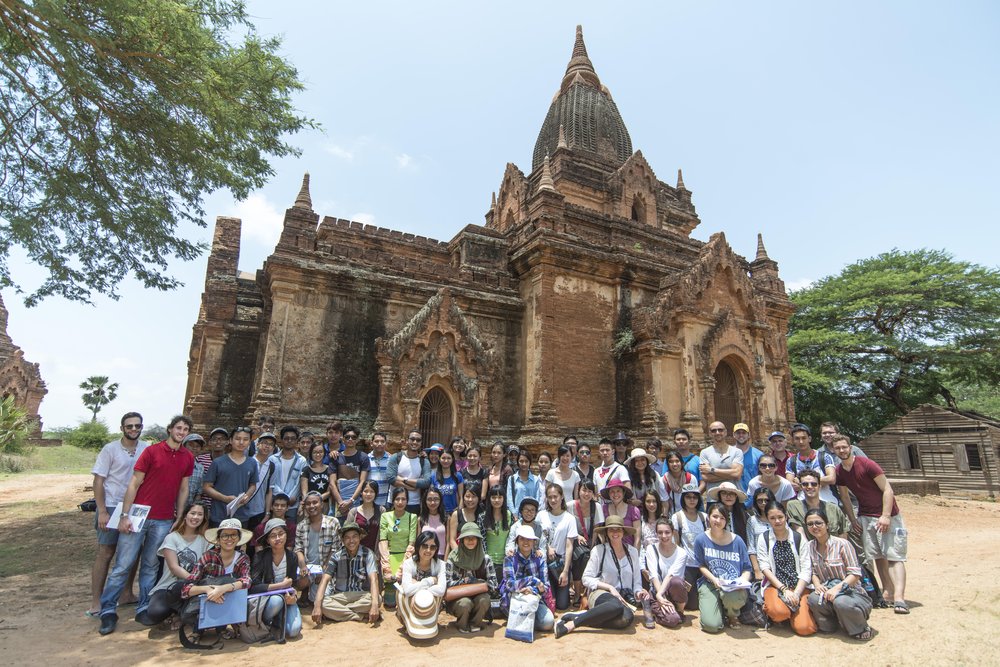
Members of CyArk, Myanmar's Department of Archaeology, Carleton University and Yangon Technological University during a 3D documentation workshop at Bagan, 2016.
Google Arts and Culture lends itself to pulling all these different pieces together to present coherent, interactive experiences, pushing the boundaries of how to tell these stories online. Open Heritage or Resilience of the Redwoods are two examples of that.
What threatens world heritage sites today and how can 3D models help?
The number one threat is climate change. Rising sea levels, desertification, rainfall events and so on are affecting sites and monuments that are not designed to withstand them. The Bagan earthquake was a dramatic, one-off event. But climate change is more insidious and it’s often harder to pin down its effects. By helping us understand how heritage sites are changing, 3D data can support efforts to preserve them which we’ve been doing with Heritage on the Edge.
What does the future hold for Bagan, and for LiDAR technology?
In 2019, Bagan was added to the UNESCO World Heritage list. Careful restoration work is ongoing to protect and preserve its statues, soaring temples and hand-painted frescoes, and it continues to be an active site of pilgrimage and worship.
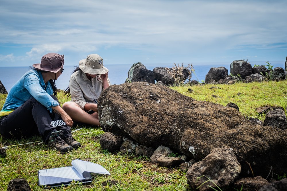
CyArk team members on a fieldwork trip to Rapa Nui, 2020.
Looking ahead, our hope for LiDAR technology is not just to document the world's cultural heritage ourselves, but to share these techniques and methods with others. A good example of this is our work in Rapa Nui, or Easter Island. Its unique moai stone statues are threatened by storms, rising sea levels and coastal erosion. Local people have now acquired their own LiDAR equipment to help preserve the island's cultural heritage for generations to come.