Gradient Polylines
In this release we’ve included gradient polylines which allow you to apply different colors to different segments of your polylines. This allows you to easily indicate changes along your polyline such as speed or elevation.There are two options:
- the first is to have the color gradually changing into another color (gradient polyline),
- the second is to use different blocks of color along your polyline.
The example below visualizes the elevation along a route using a gradient polyline.
.png)
Structured Reverse Geocoding
In the past, our reverse geocoder,GMSGeocoder, has responded to a latitude/longitude request with the address as a formatted string. In v1.7, GMSGeocoder can return the address as a GMSAddress object, enabling you to easily access the different parts of an address without needing to parse a string. For example if you’re only interested in the country, this is available as address.country. Check out the developer guide for further information about the properties available to you.URL Schemes & x-callback-url
The comgooglemaps URL scheme lets you launch Google Maps for iOS, displaying the map at a particular location and zoom level, showing the results of a search, or showing directions. In addition to driving, public transit and walking directions, we’ve now added biking directions to the URL scheme.There may be times, though, when you want to open Google Maps for iOS directly from within your app, but also want to provide the ability for users to easily return to your app via a back button when they are finished. X-callback-url, an open specification for inter-app communication and messaging between iOS apps, lets you do just that. We’ve documented how to use x-callback-url to launch Google Maps for iOS, and also how to help guide users back to your app when they are ready.
High fidelity 3D buildings
Finally, some of you may know that Google Maps for iOS now has some higher fidelity 3D buildings. If you’d like your app to have access to these 3D buildings, you’ll need to upgrade to v1.7 of the Google Maps SDK for iOS. Check out our favorite, the Eiffel Tower!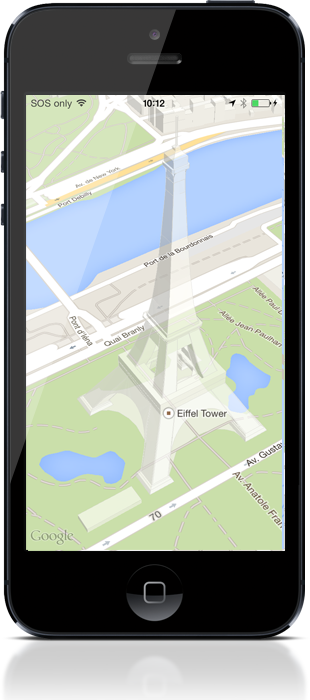
We’ve also included a few bug fixes which you can read about in the release notes.
We’re always interested to hear how you’re using the Maps APIs, so let us know if you’ve got something cool to show by tagging +Google Maps API on your posts (or comment right here). For technical questions that aren’t answered in the developer documentation, check out the Google Maps developer community on Stack Overflow. Don’t forget to tell us what you’d like to see in the next release using the Google Maps API issue tracker.
Posted by Megan Boundey, Product Manager, Google Maps Mobile APIs