Editor's note: Today’s guest blogger is Scott Hemmeter, CEO and founder of Arrowpointe, a company that creates applications for Salesforce customers. See how Arrowpointe and other developers are using the Google Maps APIs to bring maps and location content to their users.
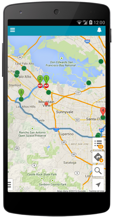
Maps and data go well together, and we’ve built our business on that premise. We developed an application called Geopointe to help companies map their Salesforce.com database to visualize location information, gain spatial insights and boost productivity—directly from within Salesforce. For example, a salesperson on the road can connect to the application on her mobile device and view, on a Google Map, all of her highly rated accounts in Salesforce that are within a 30-mile radius of where she’s standing. She can then get directions between these locations to plan her meetings and make most efficient use of her time.
Geopointe adds a map tab to Salesforce and uses Google Maps as the interface into Salesforce data. Our pages, both web and mobile, are HTML5 based, served by Salesforce’s Visualforce technology and heavily use client-side JavaScript to provide the user experience. The Google Maps JavaScript API is used to interact with the map.

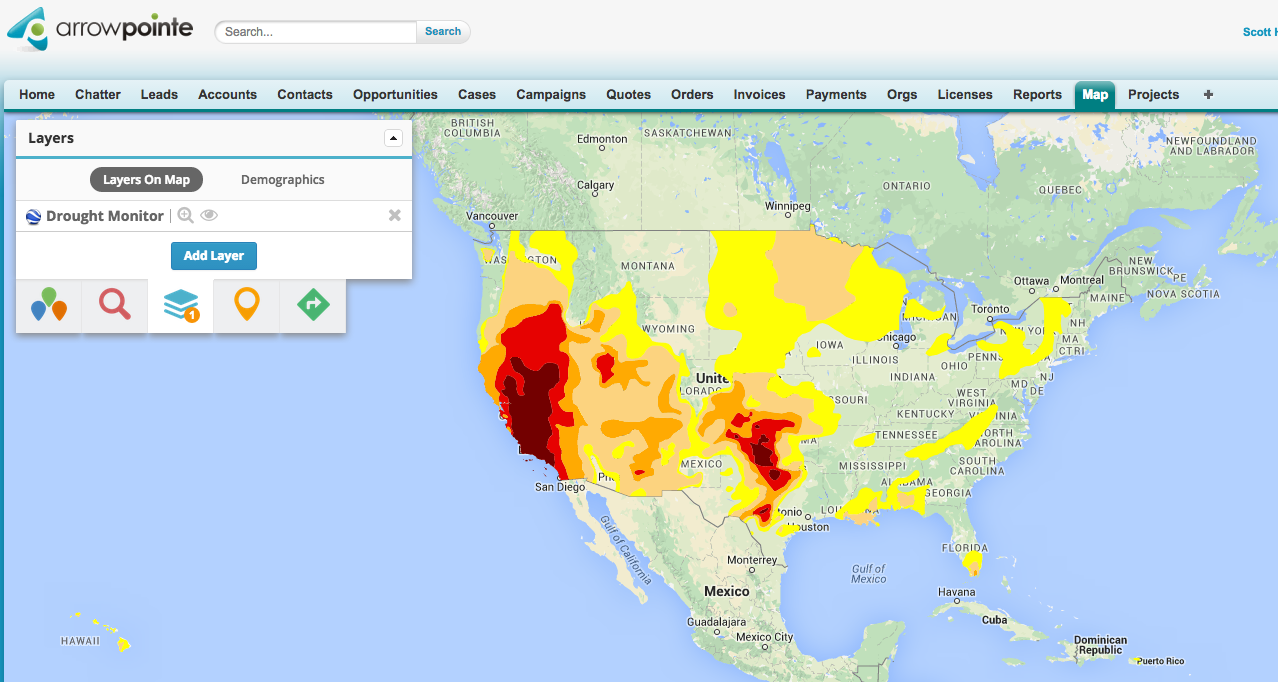
The flexibility of the Google Maps API enables our users to pull in data from other sources in the KML format and then layer it on the screen. For example, we have an agricultural customer who uses it to pull in drought information. If they’re working with farmers in Arizona, they can see the conditions in any location in the state.
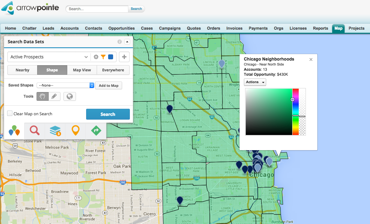
We also use the drawing tools in the Google Maps APIs to build a shape library that makes the app more useful within specific geographic areas. Users can define a space on their map, then pull information within the confines of that particular area. We collect data — like the boundaries of San Francisco neighborhoods — and host it ourselves in the GeoJSON format. We built an API to get GeoJSON data to Geopointe, which then uses the Google Maps APIs to put it on the map.
We chose Google Maps because business users rely on it. They want Google’s directions, Street View and Satellite View. Data is a valuable resource for Salesforce customers, and Google Maps is a great way to provide it. Google Maps lets our customers visualize data to make better use of it in their day to day operations. It’s one thing to see information in a list, report or sorting table, but once someone sees data pictured on a map, they say, “Now I know what I need to do.”