Editor’s note: Starting today, you can now explore the International Space Station in Street View in Google Maps. Thomas Pesquet, Astronaut at the European Space Agency (ESA), spent six months aboard the International Space Station (ISS) as a flight engineer. He returned to Earth in June 2017, and in this post he tells us about what it’s like to live on the ISS and his experience capturing Street View imagery in zero gravity.
In the six months that I spent on the International Space Station, it was difficult to find the words or take a picture that accurately describes the feeling of being in space. Working with Google on my latest mission, I captured Street View imagery to show what the ISS looks like from the inside, and share what it’s like to look down on Earth from outer space.
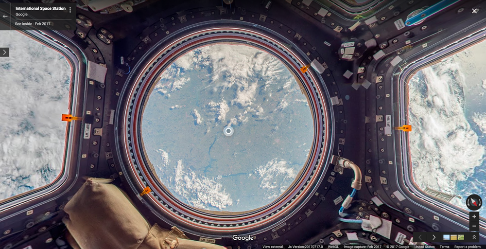
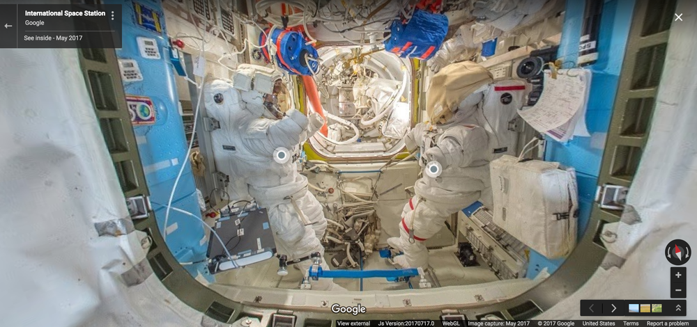
For 16 years, astronauts have been working and living on the ISS, a structure made up of 15 connected modules that floats 250 miles above Earth. The ISS acts as a base for space exploration—possible future missions to the Moon,Mars and asteroids—and gives us a unique perspective on Earth itself. We can collect data on the Earth’s oceans, atmosphere, and land surface. We can conduct experiments and studies that we wouldn’t be able to do from Earth, like monitoring how the human body reacts to microgravity, solving mysteries of the immune system, studying cyclones in order to alert populations and governments when a storm is approaching, or monitoring marine litter—the rapidly increasing amount of waste found in our oceans.
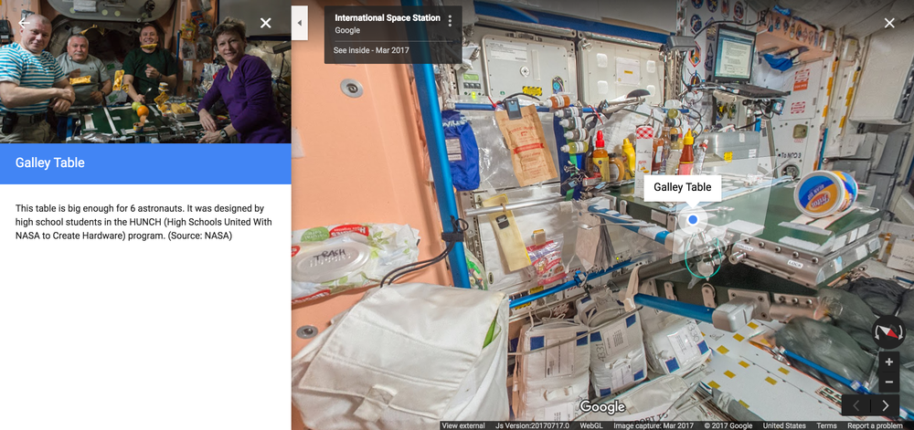
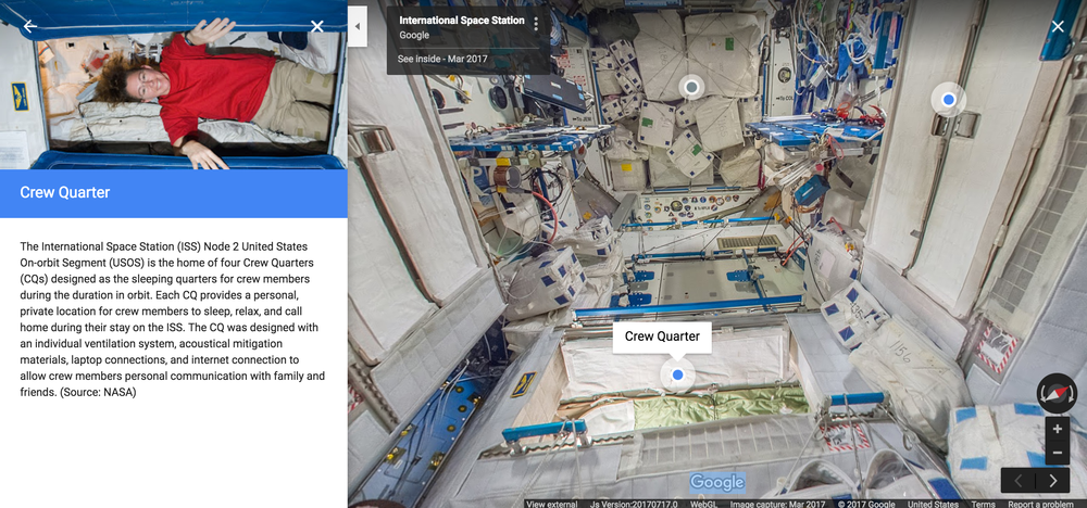
There were a few “firsts” on my mission. It was led by Peggy Whitson who, at age 56, became the oldest woman to fly into space and the first woman in history to command two expeditions. The mission was the first time Street View imagery was captured beyond planet Earth, and the first time annotations—helpful little notes that pop up as you explore the ISS—have been added to the imagery. They provide additional information or fun facts like where we work out to stay physically fit, what kind of food we eat, and where we conduct scientific experiments.
Because of the particular constraints of living and working in space, it wasn't possible to collect Street View using Google's usual methods. Instead, the Street View team worked with NASA at the Johnson Space Center in Houston, Texas and Marshall Space Flight Center in Huntsville, Alabama to design a gravity-free method of collecting the imagery using DSLR cameras and equipment already on the ISS. Then I collected still photos in space, that were sent down to Earth where they were stitched together to create panoramic 360 degree imagery of the ISS.
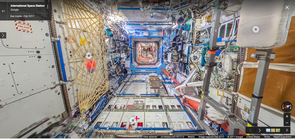
We did a lot of troubleshooting before collecting the final imagery that you see today in Street View. The ISS has technical equipment on all surfaces, with lots of cables and a complicated layout with modules shooting off in all directions—left, right, up, down. And it’s a busy place, with six crew members carrying out research and maintenance activities 12 hours a day. There are a lot of obstacles up there, and we had limited time to capture the imagery, so we had to be confident that our approach would work. Oh, and there’s that whole zero gravity thing.
None of this would have been possible without the work of the team on the ground, my colleagues (turned roommates) on the ISS, and the countries that came together to send us up to space. Looking at Earth from above made me think about my own world a little differently, and I hope that the ISS on Street View changes your view of the world too.
Click here to go behind the scenes with Thomas and the team.

