Map of the Week: Portsmouth History Photo Map
Why we like it: The Portsmouth History Photo Map is a great demonstration of combining old maps and photos with Google Maps.
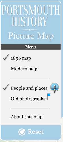
You start by viewing the 1896 map of Portsmouth on top of a Google Map. The old map is overlayed on top of the Google Map using an ImageMapType.

You can choose to look at standard Google Maps base map by clicking on Modern map, which reverts you to the road map.
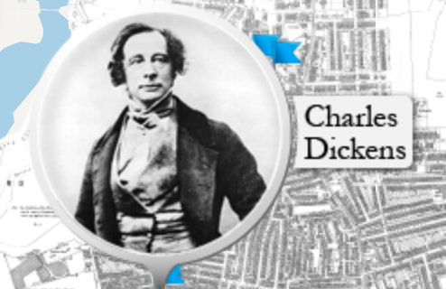
The featured markers, such as this one for Charles Dickens, are created using a standard Marker with a custom icon and size.
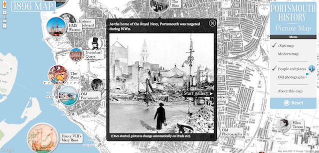
Instead of the standard InfoWindow, the developer created a Custom Overlay that allows for a more dynamic experience, allowing for a gallery of photos to be displayed in the overlay.
Finally, to control what’s showing on the map, the developer created a custom div that sits on top of the map and controls it with onclick events.
All in all a great custom implementation of our API.