Editor’s Note: Today’s blog is guest authored by Tara Rush, Kanien'kehá:ka from Akwesasne, Canadian Googler based at Google Kitchener-Waterloo
A seven year collaborative effort between Indigenous communities across Canada and Google Earth Outreach has lead to Indigenous Lands being added to Google Maps and Google Earth. This marks an essential step in accurately reflecting Canada to Canadians and to the world.
I’m Kanien'kehá:ka from Akwesasne (a territory that spans international and provincial borders, including Akwesasne 15, Akwesasne 59 and the St. Regis Mohawk Reservation) and I work at the Google Kitchener-Waterloo office. Since 2014, with the support of my colleagues, we have lead mapping workshops with various Indigenous communities across Canada. During that time, we’ve been asked why Indigenous Lands aren’t on Google Maps. So we set out to make that happen.
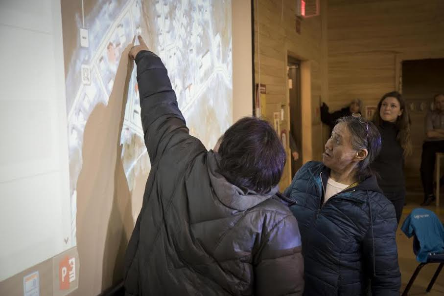
[Caption: Sanikiluaq, 2015, mapping activity with the Inuit community of Sanikiluaq. Raleigh Seamster, from the Google Outreach Team, is in the background.]
On our journey, we worked with various partners, including Steven DeRoy, an Anishinaabe cartographer and director of Firelight Research Inc, to bring these reserves and settlement lands to Google platforms. As Steve puts it, “Indigenous peoples are often underrepresented on Canadian base maps, and this was made apparent during our annual Indigenous Mapping Workshops. We are thrilled to see Google recognize Indigenous peoples by integrating Indigenous lands as an important fabric of Google's base maps."
Another team that worked on this project was Google Earth Outreach. The Google Earth Outreach program is proud to support Indigenous peoples using mapping technology for cultural preservation and land management. Together, we have supported Indigenous Mapping Workshops held in Victoria, Waterloo and Vancouver as well as a planned workshop in Winnipeg in October 2017. We hope to continue to build partnerships and use available technologies to better support and represent Indigenous interests in Canada and abroad.
Currently, over 3000 Indigenous Lands have been added to Google Maps and Google Earth. If Indigenous communities would like to add their lands to Google Maps, or want to update information about their lands such as roads, addresses, or businesses, their government can contribute the data they are comfortable sharing via the Base Map Partner Program and individual community members can also use the Send Feedback tool to add and edit essential information on Google Maps.
With the launch of recognized Indigenous Territories in Canada on Google Earth and Maps, the Google Earth Outreach program continues its work to support indigenous people using mapping technology. The goal is to enhance cultural preservation, digital awareness and land management. The hope is to use tools like Google Earth to preserve knowledge and to update Google Maps to reflect federally-recognized Canadian territories.
Canada has one of the world’s most diverse populations, with more than 1.4 million people self-identifying as First Nations, Métis or Inuit (NHS, 2011) , 600 bands living on 3100 reserves and in urban centres across Canada. We are working to better reflect these stories, histories and futures within our platforms.
Tara Rush, Kanien'kehá:ka from Akwesasne, Canadian Googler based at Google Kitchener-Waterloo