Since 2005, we’ve collaborated with transit authorities around the world to make a comprehensive resource for millions of riders to find out which bus, train, tram or ferry can take them to their next destination.
Starting today, commuters in New South Wales will be able to get real time bus, train and ferry information in Google Maps. Google has teamed up with Transport New South Wales to add real-time information about routes and schedules across the region on Google Maps – for the first time in Australia. Whether you are taking the train from Kings Cross to Killara, or boarding the ferries Fishburn or Friendship, you now have all the information you need to plan and adjust your journey at a glance, in one place.
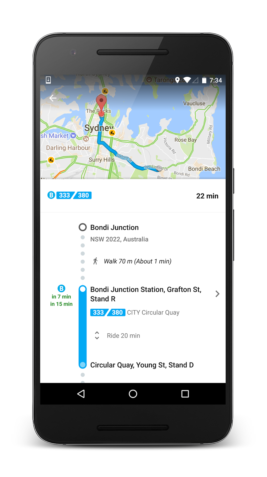
If you're planning a trip between, say Bondi Junction and Circular Quay, you can simply type the two locations into Google Maps to get the latest information about which bus, train or ferry to catch. In addition to bus routes, you’ll be able to see when the next bus is arriving at your stop and an estimation of how long your trip is going to take. If your bus is delayed, Google Transit will automatically update the times in line with the new conditions. Routes that have real-time information available are marked in Google Maps in green.
Know when your bus or train actually arrives with real time information in Google Maps


Google Transit is a feature of Google Maps designed to help you plan your public transport trips quickly and easily. Just search for where you want go and Google Maps will show you how to get there using public transport from your current location. Google Transit is available on Google Maps for Android and iPhone as well as the Web. If you’re using the latest version of Google Maps, you can also compare public transport options to work out when you need to leave to arrive at your destination on time.
Residents of New South Wales who would like to find out when the next bus, train or ferry is arriving or directions to somewhere using public transport using Google Maps should follow these three simple steps:
- Open Google Maps apps on your Android device or iPhone
- Enter your destination and click the "get directions" icon. If it’s not already selected, tap the "transit" icon (the little tram) to view times, bus/train numbers, routes and more
- You can change the destination by selecting a different end point at the top of the screen
Google Maps globally provides over one billion km worth of transit results every day and has schedules for more than three million public transit stops worldwide. Google Transit is now available for hundreds of cities across dozens of countries, with new partners joining all the time.
Posted by Cayden Meyer, Google Transit Product Lead