Malaysia’s most eastern state of Sabah sits just south of a typhoon belt. Seafarers used to call it the "Land Below The Wind," as it provided refuge from the raging storms of the north. From today you too can catch your breath, in awe, at the beauty of Sabah with the launch of new Street View imagery from 23 islands and nature reserves from the area.
Sabah is home to the highest mountain in Malaysia, so you can now scale the Mount Kinabalu peak from the couch. A UNESCO world heritage site, Mount Kinabalu sits in Kinabalu Park which teems with unique flora and fauna — including the gigantic Rafflesia plant and orangutans.
Or take a quiet cruise down the Kinabatangan River. The longest river in Sabah, Kinabatangan winds through a forest-covered floodplain which is home to Proboscis monkeys, Sumatran rhinos and Asian elephants. If you like wildlife, try and catch a glimpse of the orangutans at Sepilok Orang Utan Reserve:
Once you’ve explored the jungle, why not go island hopping and visit Mabul or Mataking? The clear turquoise waters of the Celebes Sea are teeming with sea life and gentle sloping reefs which makes them diving hotspots.
Sabah is home to incredibly unique natural diversity. We hope you enjoy scaling the peaks of Kinabalu, going deep into the jungle, or lazing around on the many island beaches with this new Street View collection.
Posted by Nhazlisham Hamdan, Street View Operations Lead Malaysia, Indonesia & Thailand
Sabah is home to the highest mountain in Malaysia, so you can now scale the Mount Kinabalu peak from the couch. A UNESCO world heritage site, Mount Kinabalu sits in Kinabalu Park which teems with unique flora and fauna — including the gigantic Rafflesia plant and orangutans.
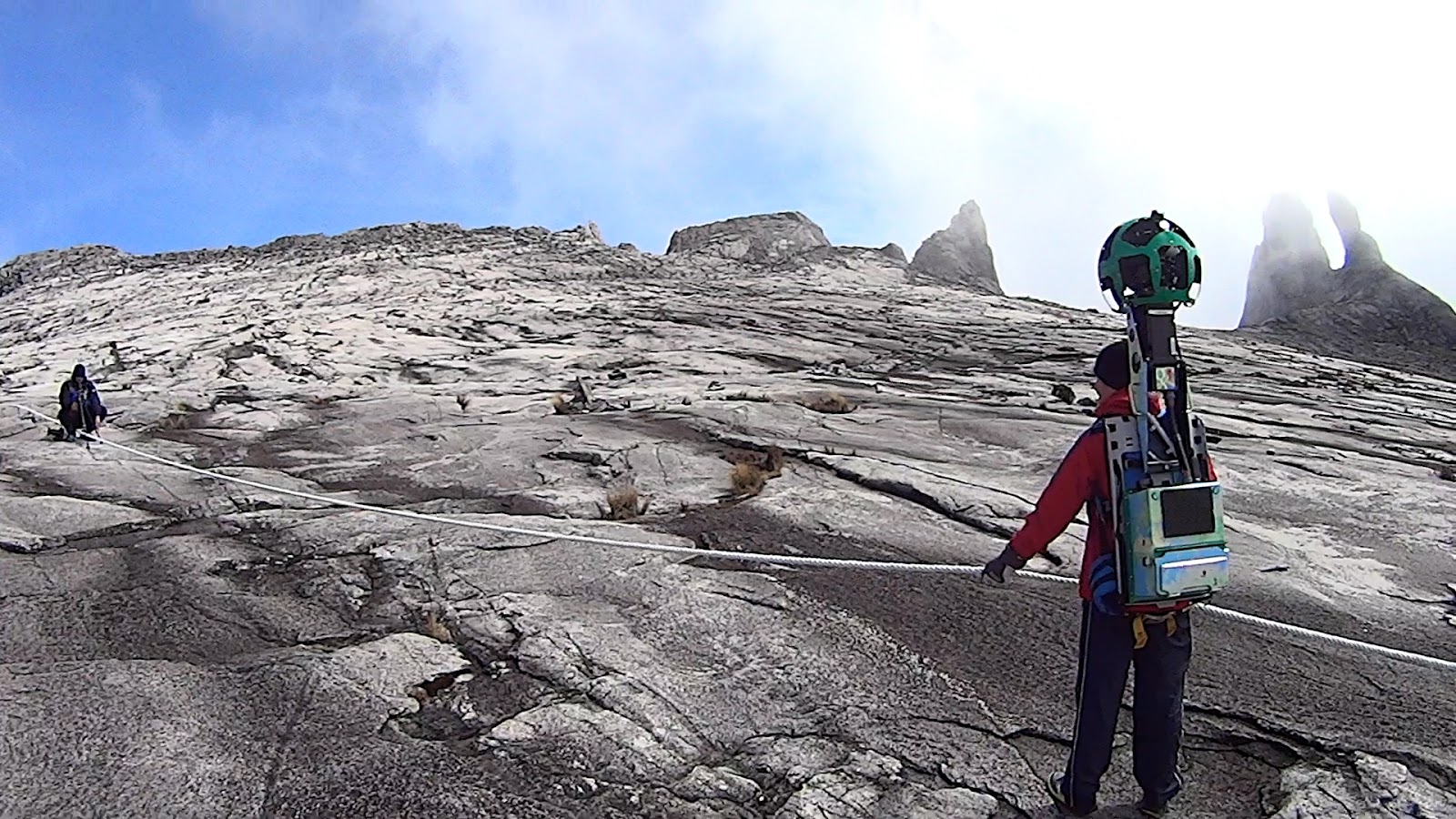 |
| Scaling the Mount Kinabalu peak is even tougher with an 18kg Trekker on your back |
Or take a quiet cruise down the Kinabatangan River. The longest river in Sabah, Kinabatangan winds through a forest-covered floodplain which is home to Proboscis monkeys, Sumatran rhinos and Asian elephants. If you like wildlife, try and catch a glimpse of the orangutans at Sepilok Orang Utan Reserve:
Two orangutans having a tête-à-tête at the Sepilok Orang Utan Reserve
Once you’ve explored the jungle, why not go island hopping and visit Mabul or Mataking? The clear turquoise waters of the Celebes Sea are teeming with sea life and gentle sloping reefs which makes them diving hotspots.
Take a virtual dip at Mabul Island
The tiny Mataking Island can be walked around in an hour. We bet you could go even faster with Street View.
Posted by Nhazlisham Hamdan, Street View Operations Lead Malaysia, Indonesia & Thailand

