Helping emergency services find you when you need it most
The new Emergency Location Service in Android sends your location to emergency services when you dial an emergency number.
To help address this issue, we created the Emergency Location Service in Android. This feature, when supported by your network, sends location from your phone to emergency services when you dial an emergency number. This uses the same location technologies available to apps on your phone, including Wi-Fi, GPS, and cell towers, to produce a more reliable emergency location both indoors and outdoors.
This feature is solely for the use of emergency service providers, and your precise location is never seen or handled by Google. It is sent from your handset to emergency services only when you explicitly place an emergency call, either directly or through your mobile network.
We look forward to making Android’s Emergency Location Service available internationally, and are actively engaging with more countries and operators to make this widely available. If you are a mobile network operator or emergency infrastructure provider interested in supporting better emergency location from Android devices, get in touch with us.
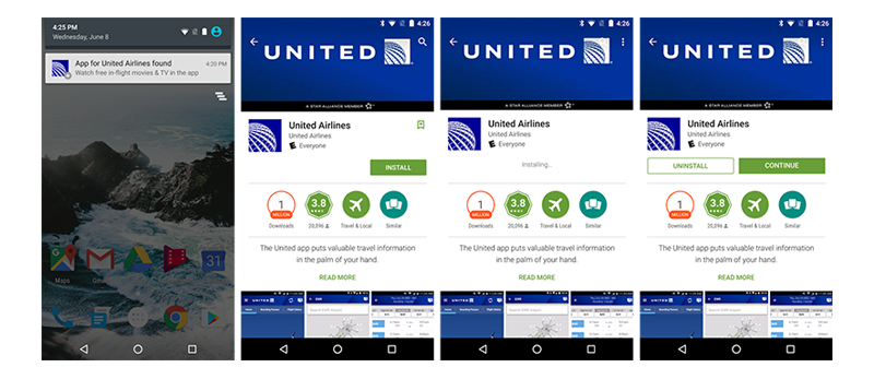
But, getting the right apps at the right time can be tough if you don’t already know about them. So, we’re introducing a new Android feature called Nearby, which notifies you of of things that can be helpful near you.
For example:
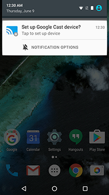
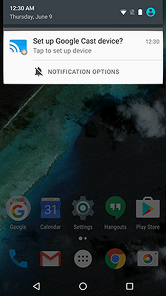
Select Google devices, including Google Cast and Android Wear watches, will also let you set them up simply by tapping a notification when you’re near them.
Earlier this year, we started experimenting with surfacing websites relevant to a place in Chrome through the Physical Web project. In addition to displaying relevant apps, Nearby will surface these websites directly from Android. To deploy your own beacons that work with Nearby, check out our developer blog post.

To use Nearby, just turn on Bluetooth and Location, and we’ll show you a notification if a nearby app or website is available. Once you’ve opted-in, tapping on a notification takes you straight into the intended experience. If you’re not interested, just swipe it away to give us a clear signal.
Nearby has started rolling out to users as part of the upcoming Google Play Services release and will work on Android 4.4 (KitKat) and above.

Earlier this year, we started experimenting with surfacing websites relevant to a place in Chrome through the Physical Web project. In addition to displaying relevant apps, Nearby will surface these websites directly from Android. To deploy your own beacons that work with Nearby, check out our developer blog post.

To use Nearby, just turn on Bluetooth and Location, and we'll show you a notification if a nearby app or website is available. Once you’ve opted-in, tapping on a notification takes you straight into the intended experience. If you're not interested, just swipe it away to give us a clear signal.
Nearby has started rolling out to users as part of the upcoming Google Play Services release and will work on Android 4.4 (KitKat) and above.